U.S. Route 52 in North Dakota
U.S. Highway 52 (US 52) is a 362-mile-long (583 km) United States Numbered Highway in the U.S. state of North Dakota, which travels from the Canada–United States border east to the Red River at Fargo. The highway connects the cities of Minot and Fargo and travels concurrent with Interstate 94 (I-94) between Jamestown and the Minnesota state line.
| ||||
|---|---|---|---|---|
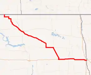
US 52 highlighted in red | ||||
| Route information | ||||
| Maintained by NDDOT | ||||
| Length | 362.031 mi[1] (582.632 km) | |||
| Existed | 1926–present | |||
| Major junctions | ||||
| West end | ||||
| East end | ||||
| Location | ||||
| Counties | Burke, Renville, Ward, McHenry, Pierce, Sheridan, Wells, Foster, Stutsman, Barnes, Cass | |||
| Highway system | ||||
| ||||

Route description
In North Dakota, US 52 continues from Saskatchewan Highway 39 from the Canada–United States border at North Portal, Saskatchewan and Portal, North Dakota to the Red River in Fargo, a distance of 361 miles (581 km). US 52 passes through Burke, Ward, Renville, McHenry, Pierce, Sheridan, Wells, Foster, Stutsman, Barnes, and Cass counties.
US 52 is a two-lane highway in most areas, except for four lane segments between the Burlington area and Minot, Jamestown and Buchanan, and Jamestown and Fargo. Some segments in Fargo are six lanes.
From a point halfway between Foxholm and Burlington, and the southeast edge of Minot, US 52 is co-signed with US 2. As US 2/US 52 passes through the south part of Minot, it intersects with the US 83 Bypass, and then US 83 itself. Further south, US 52 is also co-signed with US 281 for 44 miles (71 km) between Carrington and Jamestown. The route through Jamestown follows 5th St. NW, 1st Ave., and I-94 Business Loop (the signs previously followed the eastern half, but now follow the shorter western half). From Jamestown east to the Minnesota border at Fargo, the highway is co-signed with Interstate 94.
History
Major intersections
| County | Location | mi[1] | km | Destinations | Notes | |||
|---|---|---|---|---|---|---|---|---|
| Burke | Portal | 0.000 | 0.000 | US 52 northern terminus; continuation into Saskatchewan | ||||
| Canadian border at the Portal–North Portal Border Crossing | ||||||||
| | 7.416 | 11.935 | West end of ND 5 concurrency | |||||
| 20.361 | 32.768 | West end of ND 8 concurrency | ||||||
| Bowbells | 27.138 | 43.674 | East end of ND 8 concurrency | |||||
| Ward | | 36.847 | 59.299 | East end of ND 5 concurrency | ||||
| 53.831 | 86.633 | |||||||
| Renville |
No major junctions | |||||||
| Ward | Carpio | 67.910 | 109.291 | |||||
| | 82.696 | 133.086 | West end of US 2 concurrency | |||||
| Minot | 92.181 | 148.351 | ||||||
| 92.625 | 149.065 | |||||||
| 94.665 | 152.349 | |||||||
| 97.052 | 156.190 | East end of US 2 concurrency | ||||||
| McHenry | Velva | 116.858 | 188.065 | |||||
| | 120.210 | 193.459 | ||||||
| 137.723 | 221.644 | |||||||
| 141.411 | 227.579 | West end of ND 14 concurrency | ||||||
| Anamoose | 151.884 | 244.434 | East end of ND 14 concurrency | |||||
| Pierce |
No major junctions | |||||||
| Sheridan |
No major junctions | |||||||
| Wells | Harvey | 167.181 | 269.052 | |||||
| 167.711 | 269.905 | |||||||
| 167.952 | 270.293 | West end of ND 3 concurrency | ||||||
| | 169.979 | 273.555 | East end of ND 3 concurrency | |||||
| Fessenden | 185.548 | 298.611 | ||||||
| | 198.717 | 319.804 | West end of ND 200 concurrency | |||||
| 208.720 | 335.902 | |||||||
| Foster | Carrington | 222.719 | 358.431 | East end of ND 200 concurrency; west end of US 281 concurrency | ||||
| Foster–Stutsman county line | | 232.410 | 374.028 | |||||
| Stutsman | Pingree | 244.865 | 394.072 | |||||
| | 263.034 | 423.312 | Jamestown Truck Bypass | |||||
| Jamestown | 265.635 | 427.498 | ||||||
| 267.632 | 430.712 | Exit 258 on I-94; east end of US 281 concurrency; west end of I-94 concurrency | ||||||
| I-94 concurrency to the Minnesota state line | ||||||||
| Red River of the North | 362.031 | 582.632 | ||||||
1.000 mi = 1.609 km; 1.000 km = 0.621 mi
| ||||||||
See also
 U.S. Roads portal
References
- "Route and Mileage Map Insets" (PDF). North Dakota Department of Transportation. 2016. Retrieved January 5, 2018.