Union Township, Benton County, Indiana
Union Township is one of eleven townships in Benton County, Indiana. As of the 2010 census, its population was 255 and it contained 106 housing units.[3] The township was organized in June 1864 and named by John W. Nutt "because of the loyalty shown in furnishing soldiers for the Union army."[4]
Union Township | |
|---|---|
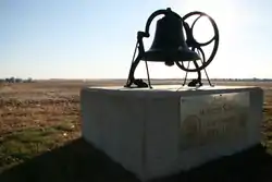 The school monument east of Wadena. | |
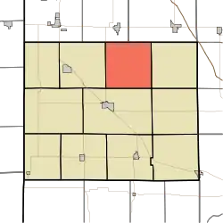 Location of Union Township in Benton County | |
| Coordinates: 40°41′28″N 87°15′50″W | |
| Country | United States |
| State | Indiana |
| County | Benton |
| Organized | June 1864 |
| Government | |
| • Type | Indiana township |
| Area | |
| • Total | 35.77 sq mi (92.6 km2) |
| • Land | 35.76 sq mi (92.6 km2) |
| • Water | 0.01 sq mi (0.03 km2) |
| Elevation | 791 ft (241 m) |
| Population (2010) | |
| • Total | 255 |
| • Density | 7.1/sq mi (2.7/km2) |
| Time zone | UTC-5 (EST) |
| • Summer (DST) | UTC-4 (EDT) |
| FIPS code | 18-77138[2] |
| GNIS feature ID | 453907 |
Geography
According to the 2010 census, the township has a total area of 35.77 square miles (92.6 km2), of which 35.76 square miles (92.6 km2) (or 99.97%) is land and 0.01 square miles (0.026 km2) (or 0.03%) is water.[3]
Adjacent townships
- Center (south)
- Gilboa (east)
- Pine (southeast)
- Richland (west)
- Carpenter Township, Jasper County (northeast)
- Grant Township, Newton County (northwest)
Major highways
References
- "US Board on Geographic Names". United States Geological Survey. 2007-10-25. Retrieved 2008-01-31.
- "U.S. Census website". United States Census Bureau. Retrieved 2008-01-31.
- "Population, Housing Units, Area, and Density: 2010 - County -- County Subdivision and Place -- 2010 Census Summary File 1". United States Census. Archived from the original on 2020-02-12. Retrieved 2013-05-10.
- Birch, Jesse Setlington (1942) [1928]. History of Benton County and Historic Oxford. Oxford, Indiana: Craw & Craw, Inc. p. 21.
External links
Municipalities and communities of Benton County, Indiana, United States | ||
|---|---|---|
| Towns | Map of Indiana highlighting Benton County | |
| Townships | ||
| Unincorporated communities | ||
| Ghost towns | ||
| Footnotes | ‡This populated place also has portions in an adjacent county or counties | |
| ||
This article is issued from Wikipedia. The text is licensed under Creative Commons - Attribution - Sharealike. Additional terms may apply for the media files.
