Indiana State Road 55
State Road 55 (SR 55) is a north–south road in Northern and Central Indiana. State Road 55 runs from the Crawfordsville area in the south to Gary in the north, a distance of approximately 110 miles (180 km).
| ||||
|---|---|---|---|---|
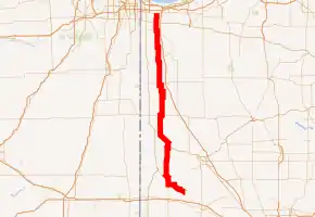
SR 55 highlighted in red | ||||
| Route information | ||||
| Maintained by INDOT | ||||
| Length | 109.682 mi[1] (176.516 km) | |||
| Existed | October 1, 1926[2]–present | |||
| Major junctions | ||||
| South end | ||||
| ||||
| North end | ||||
| Location | ||||
| Counties | Montgomery, Fountain, Warren, Benton, Newton, Lake | |||
| Highway system | ||||
| ||||

Route description
SR 55 southern terminus is at an intersection with State Road 25 (SR 25). SR 55 heads northwest towards Newtown where SR 55 has an intersection with State Road 341. SR 55 heads northwest out of Newtown towards U.S. Route 41 (US 41). SR 55 and US 41 are concurrent for 5.19 miles (8.35 km) through Attica. Northwest of Attica SR 55 leaves US 41 and heads north Oxford. North of Oxford, SR 55 has an intersection with U.S. Route 52 (US 52). US 52 and SR 55 are concurrent for 5.58 miles (8.98 km) until Fowler. In Fowler SR 55 leaves US 52 heading north towards Goodland. In Goodland SR 55 is concurrent with U.S. Route 24 (US 24). SR 55 heads north towards Crown Point passing through intersection with State Road 16, State Road 114, State Road 14, State Road 10, and State Road 2. In Crown Point SR 55 has an intersection with U.S. Route 231. SR 55 heads north after US 231 towards an intersection with Business US 6, the northern terminus of SR 55 is at this point.[3] Lake County has other names for Indiana 55. In Gary, it is called Cleveland Street. In Merrillville, it is Taft Street. In Crown Point, it is Main Street.
History
Between 1917 and 1926 SR 55 had a different route that follows the route that SR 2 takes today, from Hebron and Valparaiso. At this point the route that SR 55 takes today was of Old SR 8. In 1930, SR 55 and State Road 53 swapped routes in Lake County.[4] At some point, the southern terminus of SR 55 was at the intersection with U.S. Route 136, approximately two miles west of Crawfordsville.[5]
Major intersections
| County | Location | mi[1] | km | Destinations | Notes |
|---|---|---|---|---|---|
| Montgomery | Wingate | 0.000 | 0.000 | Southern terminus of SR 55 | |
| Fountain | Newtown | 4.576 | 7.364 | ||
| Shawnee Township | 10.869 | 17.492 | Southern end of US 41 concurrency | ||
| Attica | 12.171 | 19.587 | Eastern end of SR 28 concurrency | ||
| Warren | Warren Township | 16.062 | 25.849 | Northern end of US 41 concurrency; Western end of SR 28 concurrency | |
| Pine Village | 24.040 | 38.689 | Southern end of SR 26 concurrency | ||
| 24.277 | 39.070 | Northern end of SR 26 concurrency | |||
| Benton | Oxford | 31.261 | 50.310 | Western end of SR 352 concurrency | |
| 31.822 | 51.213 | Eastern end of SR 352 concurrency | |||
| Fowler | 34.787 | 55.984 | eastern end of US 52 concurrency | ||
| 39.126 | 62.967 | Eastern terminus of SR 18 concurrency | |||
| 40.346 | 64.931 | Western end of US 52 and SR 18 concurrences | |||
| Newton | Goodland | 50.594 | 81.423 | Western end of US 24 concurrency | |
| 51.092 | 82.225 | Eastern end of US 24 concurrency | |||
| Iroquois Township | 58.496 | 94.140 | |||
| Jackson Township | 64.242 | 103.387 | |||
| Colfax Township | 71.238 | 114.646 | |||
| Lincoln Township | 80.310 | 129.246 | |||
| Lake | Cedar Creek Township | 90.864 | 146.231 | Eastern end of SR 2 concurrency | |
| 91.370 | 147.046 | Western end of SR 2 concurrency | |||
| Crown Point | 100.021 | 160.968 | Eastern end of US 231 concurrency | ||
| 100.618 | 161.929 | Western end of US 231 concurrency | |||
| Merrillville | 104.581 | 168.307 | |||
| Gary | 109.682 | 176.516 | Northern terminus of SR 55 | ||
1.000 mi = 1.609 km; 1.000 km = 0.621 mi
| |||||
References
- Indiana Department of Transportation (July 2016). Reference Post Book (PDF). Indianapolis: Indiana Department of Transportation. SR 55. Retrieved February 26, 2018.
- "Road Numbers to Be Changed". The Hancock-Democrat. The Indianapolis News. September 30, 1926. Retrieved June 9, 2016 – via Newspapers.com.

- Google (2011-03-04). "overview map of SR55" (Map). Google Maps. Google. Retrieved 2011-03-04.
- "Indiana Highway Ends - SR 55". Archived from the original on 2011-07-11. Retrieved 2009-06-17.
- [Indiana (Standard Oil Division American Oil Company)map,copyright 1964 by Rand McNally & Co.]