Upper Gwynedd Township, Montgomery County, Pennsylvania
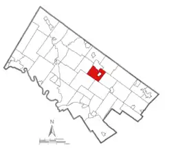
Upper Gwynedd Township ( /ˈɡwɪnɛd/)[3] is a township in Montgomery County, Pennsylvania, United States. The population was 15,552 at the 2010 census. North Wales Borough is surrounded by Upper Gwynedd Township on all sides, and many homes and businesses with North Wales addresses are actually in Upper Gwynedd. Many properties with Lansdale addresses are in Upper Gwynedd as well. It is part of the North Penn Valley region that is centered around the borough of Lansdale.
Upper Gwynedd Township | |
|---|---|
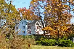
 Knipe-Moore-Rupp Farmhouse, built 1808 | |
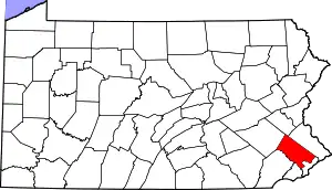
 Location of Pennsylvania in the United States | |
| Coordinates: 40°13′05″N 75°17′28″W | |
| Country | United States |
| State | Pennsylvania |
| County | Montgomery |
| Founded | 1891 |
| Area | |
| • Total | 8.13 sq mi (21.1 km2) |
| • Land | 8.12 sq mi (21.0 km2) |
| • Water | 0.00 sq mi (0.0 km2) |
| Elevation | 335 ft (102 m) |
| Population (2010) | |
| • Total | 15,552 |
| • Estimate (2016)[2] | 15,975 |
| • Density | 1,900/sq mi (740/km2) |
| Time zone | UTC-5 (EST) |
| • Summer (DST) | UTC-4 (EDT) |
| Area code(s) | 215, 267 and 445 |
| FIPS code | 42-091-79056 |
| Website | www |
Station Square, one of the first new transit oriented developments in the Philadelphia Suburbs, is located in Upper Gwynedd on the border with Lansdale. It is across the street from Pennbrook Station with SEPTA rail service to Philadelphia.
Geography
According to the United States Census Bureau, the township has a total area of 8.1 square miles (21.1 km2), all of it land. It is in the Schuylkill watershed and is drained by the Towamencin and Wissahickon Creeks. Its villages include Gwynedd Heights, Gwynedd Square, and West Point.
Neighboring municipalities
- Lansdale (north)
- Montgomery Township (east)
- Lower Gwynedd Township (southeast)
- Whitpain Township (south)
- Worcester Township (west)
- Towamencin Township (northwest)
Upper Gwynedd Township surrounds the borough of North Wales.
Demographics
| Historical population | |||
|---|---|---|---|
| Census | Pop. | %± | |
| 1930 | 1,478 | — | |
| 1940 | 1,183 | −20.0% | |
| 1950 | 2,164 | 82.9% | |
| 1960 | 4,661 | 115.4% | |
| 1970 | 6,856 | 47.1% | |
| 1980 | 9,487 | 38.4% | |
| 1990 | 12,197 | 28.6% | |
| 2000 | 14,243 | 16.8% | |
| 2010 | 15,552 | 9.2% | |
| 2016 (est.) | 15,975 | [2] | 2.7% |
| [4] | |||
As of the 2010 census, the township was 81.1% White, 4.2% Black or African American, 12.3% Asian, and 1.5% were two or more races. 2.2% of the population were of Hispanic or Latino ancestry.[5]
As of the census[6] of 2000, there were 14,243 people, 5,341 households, and 4,005 families residing in the township. The population density was 1,750.4 people per square mile (675.6/km2). There were 5,496 housing units at an average density of 675.4/sq mi (260.7/km2). The racial makeup of the township was 86.77% White, 3.97% African American, 0.08% Native American, 7.84% Asian, 0.41% from other races, and 0.94% from two or more races. Hispanic or Latino of any race were 1.45% of the population.
There were 5,341 households, out of which 33.7% had children under the age of 18 living with them, 65.3% were married couples living together, 7.6% had a female householder with no husband present, and 25.0% were non-families. 21.2% of all households were made up of individuals, and 7.2% had someone living alone who was 65 years of age or older. The average household size was 2.63 and the average family size was 3.08.
In the township the population was spread out, with 23.8% under the age of 18, 6.2% from 18 to 24, 29.2% from 25 to 44, 28.0% from 45 to 64, and 12.8% who were 65 years of age or older. The median age was 40 years. For every 100 females there were 92.0 males. For every 100 females age 18 and over, there were 88.3 males.
The median income for a household in the township was $71,078, and the median income for a family was $81,371. Males had a median income of $52,430 versus $37,729 for females. The per capita income for the township was $32,806. About 1.4% of families and 1.9% of the population were below the poverty line, including 1.7% of those under age 18 and 2.7% of those age 65 or over.
Government and politics
| Year | Republican | Democratic |
|---|---|---|
| 2012 | 47.4% 4,165 | 51.4% 4,522 |
| 2008 | 45.4% 3,991 | 53.6% 4,709 |
| 2004 | 50.5% 4,116 | 48.9% 3,982 |
| 2000 | 52.3% 3,568 | 45.1% 3,076 |
| 1996 | 46.6% 2,811 | 42.6% 2,569 |
| 1992 | 43.7% 1,921 | 36.4% 1,599 |
Commissioners
Upper Gwynedd Township elects five at-large commissioners to four-year terms.
- Liz McNaney, President
- Denise Hull, Vice-President
- Katherine Carter
- Martha Simelaro
- Ruth Damsker
Legislators
- State Senator Maria Collett, 12th district, Democrat
- State Representative Liz Hanbidge, 61st district, Democrat
- US Representative Madeleine Dean, 4th district, Democrat
History
_p104_FRIENDS'_MEETING_HOUSE_AT_GWYNEDD%252C_BUILT_1823.jpg.webp)
Gwynedd was founded in 1698 by Welsh Quakers. The township was then split into Lower Gwynedd and Upper Gwynedd in 1891. The name Gwynedd means "Fair Land" in Welsh.
The township is so named because it was originally settled largely by migrants from Gwynedd and other parts of North Wales in the 17th and 18th centuries. For several generations the main language used in the township was Welsh.
The Keefe-Mumbower Mill, Knipe-Johnson Farm, Knipe-Moore-Rupp Farm, and Isaac Kulp Farm are listed on the National Register of Historic Places.[7]
References
- "2016 U.S. Gazetteer Files". United States Census Bureau. Retrieved Aug 14, 2017.
- "Population and Housing Unit Estimates". Retrieved June 9, 2017.
- Not *[ˈɡʊɨnɛð] like its Welsh namesake.
- http://www.dvrpc.org/data/databull/rdb/db82/appedixa.xls
- https://www.usatoday.com/news/nation/census/profile/PA
- "U.S. Census website". United States Census Bureau. Retrieved 2008-01-31.
- "National Register Information System". National Register of Historic Places. National Park Service. July 9, 2010.
External links
| Wikimedia Commons has media related to Upper Gwynedd Township, Montgomery County, Pennsylvania. |
