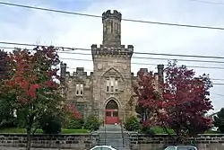
Norristown, Pennsylvania
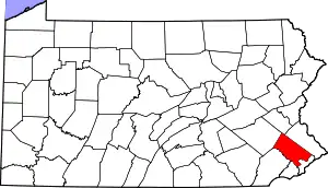
Norristown is a municipality (with home rule status) and the county seat of Montgomery County, Pennsylvania in the Philadelphia metropolitan area.[3] Located along the Schuylkill River approximately 6 miles (9.7 km) from the Philadelphia city limits, Norristown has a population of 34,324 as of the 2010 U.S. Census. It is the fourth most populous municipality in the county and second most populous borough in Pennsylvania.[4]
Norristown
"The Borough" | |
|---|---|
| Municipality of Norristown | |
 | |
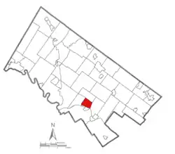 Location of Norristown in Montgomery County, Pennsylvania. | |
 Norristown Location of Norristown in Pennsylvania  Norristown Norristown (the United States) | |
| Coordinates: 40°07′12″N 75°20′30″W | |
| Country | |
| State | |
| County | |
| Settled | 1682 |
| Borough | 1812 |
| Municipality | 1986 |
| Government | |
| • Type | Council-manager |
| Area | |
| • Total | 3.60 sq mi (9.33 km2) |
| • Land | 3.52 sq mi (9.10 km2) |
| • Water | 0.09 sq mi (0.23 km2) |
| Elevation | 135 ft (41 m) |
| Population (2010) | |
| • Total | 34,324 |
| • Estimate (2019)[2] | 34,341 |
| • Density | 9,769.84/sq mi (3,771.90/km2) |
| Time zone | UTC-5 (EST) |
| • Summer (DST) | UTC-4 (EDT) |
| ZIP Codes | 19401, 19403-19409, 19487-19489 |
| Area code(s) | 610 and 484 |
| FIPS code | 42-54656 |
| Website | www |
History
The area where Norristown sits was originally owned by the family of Isaac Norris. Along with William Trent, Norris purchased the land on October 7, 1704 for 50¢ per acre. In 1712, Norris acquired Trent's share and established a gristmill at the foot of present-day Water Street.[5]
Named the county seat in 1784 when Montgomery County was formed, Norristown was incorporated as a borough in 1812 and subsequently enlarged in 1853. About 500 people lived there at the time of its incorporation. Growing rapidly after the Civil War, it swelled to 22,265 people by 1900. By 1940 it was home to 38,181 Norristonians, making it the most populous borough in Pennsylvania before declining in the decades after World War II, and in fact it was described in that year as "the most populous independent borough in the United States."[5]
At its height, Norristown was an industrial, retail, banking, and government center. Breweries, cigar factories, textile mills, icehouses, foundries, rolling mills, and lumber yards provided ample employment for skilled laborers and artisans.[6] The downtown featured two department stores, several theaters, and enough goods and services that residents never had to leave town to find anything they needed.[7] Although primarily settled by the English and a handful of Germans, Scots, Dutch, and Swedes, in the mid-1800s the Irish began arriving in large numbers, followed by waves of Italians at the turn of the century.[8]
With the opening of new malls in nearby King of Prussia and Plymouth Meeting, the downtown declined in the decades after World War II. Industry soon followed, as many companies closed or relocated into new industrial parks throughout Montgomery County.[9] Efforts to revitalize and reshape itself as a 21st-century community have produced minimal results.
Geography
Norristown is located in southeastern Pennsylvania, approximately 6 mi (10 km) northwest of Philadelphia, although direct driving distance from downtown Norristown to Center City, Philadelphia, is about 17 miles. Totaling 3.519 square miles in land area, the municipality sits along the Schuylkill River. Two major tributaries, the Stony Creek and the Saw Mill Run, bisect the town into thirds and empty directly into the Schuylkill. The town's terrain is generally hilly, especially in the areas closest to downtown, which itself sits on a plateau surrounded by all three major waterways.
Norristown has four distinct neighborhoods: the West End, the East End, the North End, and the downtown.
It is bounded by West Norriton, East Norriton, and Plymouth townships, as well as the borough of Bridgeport.
The borough has a hot-summer humid continental climate (Dfa) bordering closely upon a humid subtropical climate (Cfa). The hardiness zone is 7a. Average monthly temperatures downtown range from 31.8 °F in January to 76.5 °F in July.
Demographics
| Historical population | |||
|---|---|---|---|
| Census | Pop. | %± | |
| 1820 | 827 | — | |
| 1830 | 1,089 | 31.7% | |
| 1840 | 2,937 | 169.7% | |
| 1850 | 6,024 | 105.1% | |
| 1860 | 8,848 | 46.9% | |
| 1870 | 10,753 | 21.5% | |
| 1880 | 13,063 | 21.5% | |
| 1890 | 19,791 | 51.5% | |
| 1900 | 22,265 | 12.5% | |
| 1910 | 27,875 | 25.2% | |
| 1920 | 32,319 | 15.9% | |
| 1930 | 35,853 | 10.9% | |
| 1940 | 38,181 | 6.5% | |
| 1950 | 38,126 | −0.1% | |
| 1960 | 38,925 | 2.1% | |
| 1970 | 38,169 | −1.9% | |
| 1980 | 34,684 | −9.1% | |
| 1990 | 30,749 | −11.3% | |
| 2000 | 31,282 | 1.7% | |
| 2010 | 34,324 | 9.7% | |
| 2019 (est.) | 34,341 | [2] | 0.0% |
| Sources:[10][11][12][13] | |||
As of the 2010 census, Norristown's population is 34,324, which represents a 9.7% increase since 2000. The municipality's population is 37.6% black or African American, 29.3 white (non-Hispanic), 14.5% Hispanic and two or more races 3.35%. Almost triple the Hispanic population in 2000.[14]
There were 11,963 households and 7,498 families residing in the municipality.[15] The population density was 9,753.9 people per square mile. There were 13,420 housing units at an average density of 3,813.5 per square mile.[16]
Of the 11,963 households, 62.7% (7,498) were family households and 37.3% were non-family households. Of the 7,498 families, 58.2% had their own and related children under the age of 18 living with them; 51.0% were married couples living together, and 36.6% had a female householder with no husband present. The average household size was 2.79 and the average family size was 3.41.[17]
The median age of all residents is 31.2 years, with an age distribution of 26.2% under the age of 18, 43.5% between ages 18 and 44, 21.2% between ages 45 and 64, and 9.1% ages 65 and above.[18]
According to the U.S. Census Bureau's 2012 American Community Survey, the median household income was $42,764. Males had a median income of $34,214 versus $34,086 for females. The per capita income was $21,204. About 17.3% of families and 19.3% of the population were below the poverty line, including 28.3% of those under the age of 18 and 11.8% of those 65 and older.[17]
Approximately 76.0% of all persons 25 and older have a high school diploma or higher, while 16.7% have a college degree (Bachelor's or higher).[19]
Economy
Norristown’s economy is based largely on institutions in the government, healthcare, legal, and social services sectors. The Montgomery County government is the municipality’s largest employer.[20] Other major Norristown employers with a considerable presence are the Pennsylvania Department of Environmental Protection (DEP), the Montgomery County Intermediate Unit, USM (formerly U.S. Maintenance), U.S. Roofing Corporation, BartonPartners Architects+Planners, Chandler Bats, and the Norristown Area School District. Norristown is home to the corporate headquarters of both USM and U.S. Roofing.
In addition to major employers, there are numerous small professional, manufacturing, technology, and distribution firms operating in the municipality, as well as law offices and local realty companies.
Politics and government
| Year | Republican | Democratic |
|---|---|---|
| 2020 | 17.8% 2,099 | 81.4% 9,600 |
| 2016 | 17.1% 1,891 | 79.7% 8,826 |
| 2012 | 16.0% 1,749 | 83.0% 9,053 |
| 2008 | 17.0% 2,042 | 82.3% 9,911 |
| 2004 | 24.2% 2,611 | 75.3% 8,147 |
| 2000 | 24.6% 2,066 | 73.0% 6,124 |
Norristown has been a home rule municipality since 1986 when voters adopted a charter with a manager/council form of government and a seven-member municipal council. The office of mayor was abolished in July 2004 after a public referendum amended the municipal charter. Executive and administrative authority is now delegated to a council appointed Municipal Manager.
The municipality is part of the Fourth Congressional District (represented by Rep. Madeleine Dean), the 70th State House Districts (represented by Rep. Matt Bradford) and the 17th State Senate District (represented by Sen. Amanda Cappelletti).
Infrastructure
Transportation
Norristown sits at the junction of several major roads in the Philadelphia region. Main Street (also known as Ridge Pike outside of the municipality) and Airy Street run east–west through the downtown, eventually leading to interchanges for I-476 (the Blue Route) and the Pennsylvania Turnpike (I-276), respectively, in Plymouth Meeting. U.S. 202 is the major north–south route through the town, connecting it with other nearby county seats such as Doylestown and West Chester. U.S. 202 is split into a one-way pair through the municipality, as DeKalb St. is designated “U.S. 202 North” while Markley St. is signed “U.S. 202 South.”[22][23]
Norristown is the largest multi-modal transportation hub in Montgomery County. Numerous rail lines, bus routes, multi-use trails, and parking areas converge at the Norristown Transportation Center (NTC). SEPTA operates eight Suburban Division bus routes (90, 91, 93, 96, 97, 98, 99, and 131), one interurban rapid transit route (the Norristown High Speed Line to 69th Street Transportation Center), and a Regional Rail line (the Manayunk/Norristown Line to Center City Philadelphia) out of the NTC complex.
The regional rail station at the Norristown Transportation Center is one of three on the Manayunk/Norristown Line in Norristown. The other two are Main Street and Elm Street, the latter of which serves as the terminus of the line.
The NTC contains a 522-space SEPTA commuter parking garage that also contains an intercity bus terminal that was formerly used by Bieber Transportation Group, Greyhound Lines, and Martz Trailways.[24] Several taxi companies and private bus shuttles have a presence at the Transportation Center. The Schuylkill River Trail, which connects Philadelphia to Pottstown and runs through downtown Norristown, also passes through the NTC complex. The Chester Valley Trail will also connect to the Transportation Center by the end of the 2010s.
Utilities
Electricity and natural gas in Norristown is provided by PECO Energy Company, a subsidiary of Exelon.[25][26][27] Water is provided by Pennsylvania American Water, a subsidiary of American Water.[28] The Norristown Municipal Waste Authority provides sewer service, operating collection sewers and a wastewater treatment plant.[29] Trash and recycling collection is provided under contract by J.P. Mascaro.[30]
Media
The Times Herald is the borough's daily newspaper, printing seven days a week and serving most of Montgomery County. Founded on June 15, 1799, it is currently owned by 21st Century Media.[31] The paper's staff offices are located within the municipality.
Culture
Despite the loss of its historic movie and vaudeville theaters, Norristown is home to two performing arts centers (the Montgomery County Cultural Center and Centre Theatre) and one professional theater company, Theatre Horizon. All are part of The Theatre Alliance of Greater Philadelphia and the Greater Philadelphia Cultural Alliance.
These theaters form the nucleus for Norristown Arts Hill, a collection of theaters, art galleries, and professional firms on the 300-500 blocks of DeKalb Street in downtown.
Styles of ethnic food available on Norristown's Main Street include Korean/Japanese, Chinese, Mexican, Ethiopian, Vietnamese, and Italian.
Revitalization
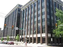
Norristown has seen several new office buildings constructed or rehabbed over the last several decades. One Montgomery Plaza, the municipality's iconic downtown 10-story office building, was built in the early 1970s, and is now owned by Montgomery County.
Two newer mid-rise downtown office buildings, the Montgomery County Intermediate Unit Building and the Department of Environmental Protection Building, were built in the 1990s and early 2000s. In 2009, the historic former Bell Telephone building was completely renovated for offices, and that same year the U.S. Roofing Corporation rehabbed the former Conte Luna pasta factory on East Main Street to house their operations. The former Sears building at the Studio Centre shopping center in the North End was renovated as a modern office center.
Since the early 2000s, the Regatta Apartments, the Rittenhouse condominium building, and dozens of new townhouses have contributed to a residential boom in the East End.
Two new downtown parking garages were built in the late 2000s, one at Main and Cherry Streets for visitors and another at SEPTA’s Norristown Transportation Center on Lafayette Street. Several large downtown and neighborhood streetscape projects were completed by the municipal government to install new street lighting, trees, curbing, and sidewalks along Main Street, DeKalb Street, and Powell Street.
The Lafayette Street Extension Project, a $60 million effort now underway by Montgomery County, PennDOT, and the Federal Highway Administration (FHWA), will improve highway access and mobility into downtown Norristown by widening Lafayette Street and extending it eastward toward Ridge Pike and Conshohocken, with eventual connections to the Pennsylvania Turnpike (I-276) and the US 202 Dannehower Bridge.[32]
Education
Norristown Area School District is the local school district.
St. Francis of Assisi School is located in Norristown proper.[33]
Other area Catholic schools include Visitation B.V.M. School in West Norriton Township,[34] near the Trooper census-designated place and near Norristown;[35] Holy Rosary Regional Catholic School in Plymouth Meeting and Plymouth Township; and Mother Teresa Regional Catholic School in King of Prussia. Holy Rosary was formed in 2012 by the merger of St. Titus School in East Norriton, Epiphany of Our Lord School in Plymouth Meeting, and Our Lady of Victory in East Norriton. Mother Teresa formed in 2012 by the merger of St. Teresa of Avila in West Norriton and Mother of Divine Providence in King of Prussia.[34][36] Both St. Titus and St. Teresa had Norristown, Pennsylvania postal addresses but were not in the city proper.[37]
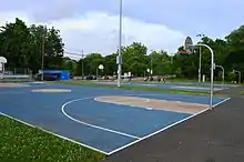
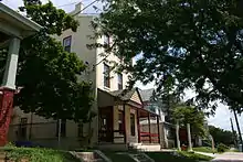
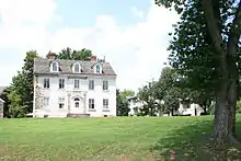
Notable locations
Notable people
- Nia Ali, track & field olympian
- Geno Auriemma, Hall of Fame women's basketball coach at UConn
- Maria Bello, actress (ER, A History of Violence)
- Steve Bono, former NFL quarterback
- Peter Boyle, actor (Everybody Loves Raymond, Young Frankenstein)
- Harry Roberts Carson, Episcopal Bishop of Haiti
- Josh Culbreath, athlete (1957 400 m hurdles world record), actor ("Tail-wind Turner", The Cosby Show)
- Richard Derr, actor
- David C. Dolby, Medal of Honor
- Werner Erhard, founder of Erhard Seminars Training (EST)
- Jules Fisher, lighting designer
- Joseph Fornance, U.S. Congressman and Norristown Borough council president.
- Larry Glueck, football player for Villanova and 1963 NFL champion Chicago Bears, head coach for Fordham University
- Marques Green, basketball player
- Winfield Scott Hancock, field commander at Gettysburg, presidential candidate
- John F. Hartranft, Governor of Pennsylvania 1873–1879
- Soh Jaipil, first Korean to become a naturalized citizen of the United States
- Gertrude I. Johnson (1876—1961), co-founder of Johnson & Wales University, born and died in Norristown[38]
- Maud Coan Josaphare (1886-1935), arts educator and writer
- Tommy Lasorda, manager of Los Angeles Dodgers, Baseball Hall of Famer
- Drew Lewis, CEO Union Pacific, U.S. Secretary of Transportation
- Thaddeus Lowe, Civil War-era aeronaut, scientist, and inventor
- Bobby Mitchell, professional baseball player
- William Moore, U.S. Congressman representing New Jersey 1869–1871
- Timothy L. O'Brien, journalist
- Jaco Pastorius, musician
- John Pergine, NFL linebacker
- Mike Piazza, professional baseball player, Baseball Hall of Famer
- George Bryan Porter, Territorial Governor of Pennsylvania[39]
- David Rittenhouse Porter, Governor of Pennsylvania 1839–1845
- Jack Posobiec, political activist[40]
- Catherine Pugh, 50th Mayor of Baltimore[41]
- Martha Settle Putney, educator and historian
- Brothers Quay (Stephen and Timothy), stop-motion animators
- Lisa Raymond, WTA tennis player
- Cam Reddish, Former Duke basketball player, current NBA player for the Atlanta Hawks
- Bill Schonely, broadcaster
- Richard Schweiker, U.S. Senator from Pennsylvania 1969–1981 and Secretary of Health and Human Services under President Ronald Reagan from 1981 to 1983
- Jimmy Smith, jazz musician
- Art Spiegelman, cartoonist, Maus
- Jerry Spinelli, author
- Kellee Stewart, actress
- Ralph B. Strassburger, newspaper publisher, thoroughbred racehorse owner
- John F. Street, Mayor of Philadelphia 2000–2008
- Roy Thomas, Philadelphia Phillies outfielder 1899-1908 and University of Pennsylvania head baseball coach
- Bobby Wine, professional baseball player, coach, manager and scout
- Khalif Wyatt (born 1991), basketball player for Hapoel Holon of the Israeli Basketball Premier League[42]
In popular culture
- Maniac Magee, author Jerry Spinelli based the fictional town of Two Mills on Norristown, where he was born.[43]
- The X-Files, Season 4, Episode 10 ("Paper Hearts"), although the "Norristown" in this episode was obviously somewhere in suburban Vancouver, Canada.
- The Lovely Bones
- The Devil in the White City
.jpg.webp)
See also
References
- "2019 U.S. Gazetteer Files". United States Census Bureau. Retrieved July 28, 2020.
- "Population and Housing Unit Estimates". United States Census Bureau. May 24, 2020. Retrieved May 27, 2020.
- "Find a County". National Association of Counties. Retrieved 2011-06-07.
- Demographic and Information Packet, Montgomery County Planning Commission (MCPC), http://webapp.montcopa.org/planning/dataportal/pdfs/2012demogentiredocument.pdf, page 8.
- Federal Writers' Project (1940). Pennsylvania: A Guide to the Keystone State (1st ed.). New York: Oxford University Press. p. 427.
- Montgomery County Federation of Historical Societies, Montgomery County: The Second Hundred Years; Toll, Jean Barth and Michael J. Schwager, ed.;1983, pg. 464
- Barth and Schwager, pg.463
- Barth and Schwager, pg. 469
- Barth and Schwager, pg. 465
- "Number of Inhabitants: Pennsylvania" (PDF). 18th Census of the United States. U.S. Census Bureau. Retrieved 22 November 2013.
- "Pennsylvania: Population and Housing Unit Counts" (PDF). U.S. Census Bureau. Retrieved 22 November 2013.
- "U.S. Census website". United States Census Bureau. Retrieved 2008-01-31.
- "Incorporated Places and Minor Civil Divisions Datasets: Subcounty Population Estimates: April 1, 2010 to July 1, 2012". U.S. Census Bureau. Archived from the original on 11 June 2013. Retrieved 25 November 2013.
- "Demographic and Information Packet, Montgomery County Planning Commission (MCPC), page 11" (PDF).
- MCPC, pg. 15
- MCPC, pg. 14
- Bureau, U. S. Census. "U.S. Census website". United States Census Bureau. Retrieved 2019-04-02.
- MCPC, pg. 10
- MCPC, pg. 16
- PA Department of Labor and Industry, "Archived copy". Archived from the original on 2015-03-16. Retrieved 2015-07-07.CS1 maint: archived copy as title (link).
- "Montgomery County Election Results". Montgomery County, Pennsylvania. Retrieved January 16, 2017.
- Montgomery County, Pennsylvania (Map) (18th ed.). 1"=2000'. ADC Map. 2006. ISBN 0-87530-775-2.
- Google (September 22, 2014). "overview of Norristown, Pennsylvania" (Map). Google Maps. Google. Retrieved September 22, 2014.
- "Philadelphia Schedule Update". Martz Group. May 29, 2018. Retrieved September 11, 2019.
- "PECO: Company Information". PECO Energy Company. Retrieved January 29, 2017.
- "Electric Service Tariff" (PDF). PECO Energy Company. July 17, 2017. p. 4. Retrieved October 10, 2017.
- "Gas Service Tariff" (PDF). PECO Energy Company. August 30, 2017. p. 2. Retrieved October 10, 2017.
- "Rates, Rules and Regulations Governing the Distribution and Sale of Water Service" (PDF). Pennsylvania American Water. August 8, 2018. p. 11. Retrieved September 9, 2018.
- "News & Events / About Us". Norristown Municipal Waste Authority. Retrieved September 9, 2018.
- "Public Works". Municipality of Norristown. Retrieved September 9, 2018.
- 21st Century Media list of brands and products, "Archived copy". Archived from the original on 2014-09-20. Retrieved 2014-09-20.CS1 maint: archived copy as title (link)
- Montgomery County Planning Commission, Lafayette Street Extension Project website, http://www.lafayettestreetproject.com.
- "Home". St. Francis of Assisi School. Retrieved 2020-05-02.
- "Zoning Map". West Norriton Township. Retrieved 2020-05-02. - Church and school locations for St. Teresa of Avila and Visitation BVM indicated on the map
- "Home". West Norriton Township, Montgomery County, Pennsylvania: Visitation BVM School. Retrieved 2020-05-03.
Visitation BVM School - 190 N. Trooper Road, Trooper, PA 19403
- The archdiocese states the address as: "190 North Trooper Rd. Norristown PA, 19403" - The school is both outside of the Trooper CDP limits and outside of the Norristown city limits. - "2012 Catholic grade school consolidations/closings". Catholicphilly.com. 2012-07-15. Retrieved 2020-04-22.
- "St. Titus". Roman Catholic Archdiocese of Philadelphia. 1998-01-13. Archived from the original on 1998-01-13. Retrieved 2020-05-02.
3006 Keenwood Rd. 19403
- Compare with the East Norriton zoning map for proof of location: "Zoning Map" (PDF). East Norriton Township. Retrieved 2020-05-02. - DeSimone, Russell (2015). "Gertrude I. Johnson". Rhode Island Heritage Hall of Fame. Rhode Island Heritage Hall of Fame. Retrieved 1 January 2018.
- "George Bryan Porter". 2010 by the Litchfield Historical Society. Retrieved 9 June 2014.
- https://web.archive.org/web/20170620121939/https://www.vice.com/en_uk/article/how-this-game-of-thrones-blogger-made-his-way-into-the-white-house
- "Who is Catherine Pugh?". WMAR. 6 December 2016.
- Long Bostrom, Kathleen (June 2003). Winning Authors: Profiles of the Newbery Medalists. Libraries Unlimited. pp. 247–251. ISBN 1-56308-877-0.
Further reading
- Kerkstra, Patrick (25 November 2003). "Mexican immigrants boost a growing Latino population". The Philadelphia Inquirer. Archived from the original on 2003-12-05. Retrieved 2019-12-16.
- O'Toole, Stephen (30 December 2002). "Norristown ready to recognize Mexican IDs". The Times Herald (Norristown, Pennsylvania).
- Heysham, Theodore (1913). Norristown, 1812-1912. Norristown.
External links
| Wikimedia Commons has media related to Norristown, Pennsylvania. |
| Wikivoyage has a travel guide for Norristown. |

| Counties |  | |
|---|---|---|
| Major cities | ||
| Cities and towns 50k-99k | ||
| Cities and towns 30k-50k | ||
| Authority control |
|---|