Uru Uru Lake
Uru Uru Lake is a lake in the Oruro Department in Bolivia. It is fed by the Desaguadero River and the Jach'a Jawira. It is situated at an elevation of 3,686 m, its surface area is 214 km².
| Uru Uru Lake | |
|---|---|
 | |
 Uru Uru Lake | |
| Location | Oruro Department |
| Coordinates | 18°5′40″S 67°5′46″W |
| Primary inflows | Río Desaguadero |
| Primary outflows | Río Desaguadero, Laq'a Jawira |
| Basin countries | Bolivia |
| Surface area | 214 km2 (83 sq mi) |
| Max. depth | 1.5 m (4 ft 11 in) |
| Surface elevation | 3,686 m (12,093 ft) |
| Settlements | Oruro, Machacamarca |
| Official name | Lagos Poopó y Uru Uru |
| Designated | 11 July 2002 |
| Reference no. | 1181[1] |
The lake is formed by the flow of the Desaguadero River at its mouth into Lake Poopó, over the extensive sedimentation known as "Santo Tomás" from the small hermitage found there that was completely inundated. The formation dates to 1962. The river connects Lake Titicaca and Lake Poopó.
The lake is a tourist attraction for boating and fishing, as it contains a large number of fish.
Oruro is located very near the shore, and is an industrial mining center.
During a long drought in 2016, the lake lost almost all of its water. This was described by local media and experts as an environmental catastrophe caused by several factors, including climate change and the use of water for mining.[2]
See also
References
| Wikimedia Commons has media related to Lake Uru Uru. |
- "Lagos Poopó y Uru Uru". Ramsar Sites Information Service. Retrieved 25 April 2018.
- (in Spanish) Marcelo Tedesqui, El lago Uru Uru desaparece y se lleva vida y esperanza, La Patria (reprint from El Deber), 25 November 2016
Capital: Oruro | ||
| Provinces | 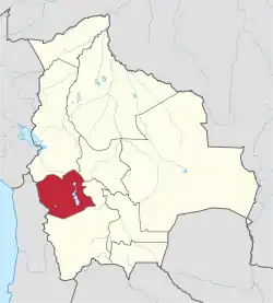 | |
| Municipalities (and seats) |
| |