Vasco da Gama Bridge
The Vasco da Gama Bridge (Portuguese: Ponte Vasco da Gama; pronounced [ˈpõt(ɨ) ˈvaʃku dɐ ˈɡɐmɐ]) is a cable-stayed bridge flanked by viaducts that spans the Tagus River in Parque das Nações in Lisbon, the capital of Portugal.
Vasco da Gama Bridge | |
|---|---|
 Aerial view of the bridge | |
| Coordinates | 38°45′44″N 9°02′36″W |
| Carries | Six road lanes of IP 1 |
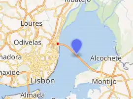
| Crosses | Tagus River |
| Locale | Sacavém, north of Lisbon (right/north bank) Alcochete and Montijo (left/south bank) |
| Official name | Ponte Vasco da Gama |
| Owner | Portuguese Republic |
| Maintained by | Lusoponte (1994–2030)[1][2] |
| Characteristics | |
| Design | cable-stayed, viaducts |
| Total length | 12.345 kilometres (7.671 mi)[3][4] |
| Width | 30 metres (98 ft) |
| Height | 148 metres (486 ft)[5] (pylon) |
| Longest span | 420 m (1,378 ft) |
| History | |
| Designer | Armando Rito |
| Construction start | February 1995[4] |
| Construction end | March 1998[4] |
| Opened | 29 March 1998 |
| Statistics | |
| Toll | Northbound: €2.85–€12.20[6] Southbound: toll free |
| Location | |
| |
It is the longest bridge in the European Union, and the second longest in all of Europe after the Crimean Bridge[7] with a total length of 12.3 kilometres (7.6 mi), including 0.8 kilometres (0.50 mi) for the main bridge and 11.5 kilometres (7.1 mi) in viaducts.[3] The bridge is served by 4.8 kilometres (3.0 mi) of dedicated access roads.[3] It was built to alleviate the congestion on Lisbon's 25 de Abril Bridge, and eliminate the need for traffic between the country's northern and southern regions to pass through the capital city.[8]
Construction began in February 1995; the bridge was opened to traffic on 29 March 1998, just in time for Expo 98, the World's Fair that celebrated the 500th anniversary of the discovery by Vasco da Gama of the sea route from Europe to India.
Description
.jpg.webp)
The bridge carries six road lanes, with a speed limit of 120 km/h (75 mph), the same as that on motorways, except on one section which is limited to 100 km/h (60 mph). On windy, rainy, and foggy days, the speed limit is reduced to 90 km/h (56 mph). The number of road lanes will be enlarged to eight when traffic reaches a daily average of 52,000.
- Bridge and access road sections
- North access roads: 945 m (3,100 ft)
- North viaduct: 488 m (1,601 ft)
- Expo viaduct: 672 m (2,205 ft); 12 sections
- Main bridge: main span: 420 m (1,378 ft); side spans: 203 m (666 ft) each (total length: 829 m or 2,720 ft); cement pillars: 150 m (492 ft)-high; free height for navigation in high tides: 45 m (148 ft);
- Central viaduct: 6.351 km (3.95 mi); 80 pre-fabricated sections 78 m (256 ft)-long; 81 pillars up to 95 m (312 ft)-deep; height from 14 m (46 ft) to 30 m (98 ft)
- South viaduct: 3.825 km (2.38 mi); 45 m (148 ft) sections; 84 sections; 85 pillars
- South access roads: 3.895 km (2.42 mi); includes the toll plaza (18 gates) and two service areas
Construction and cost
The $1.1 billion project was split in four parts, each built by a different company, and supervised by an independent consortium. There were up to 3,300 workers simultaneously on the project, which took 18 months of preparation and 18 months of construction. The financing is via a build-operate-transfer system by Lusoponte, a private consortium which receive the first 40 years of tolls of both Lisbon bridges. Lusoponte's capital is 50.4% from Portuguese companies, 24.8% French and 24.8% British.
The bridge has a life expectancy of 120 years, having been designed to withstand wind speeds of 250 km/h (155 mph) and hold up to an earthquake 4.5 times stronger than the historical 1755 Lisbon earthquake (estimated at 8.5–9.0 on the moment magnitude scale). The deepest foundation piles, up to 2.2 m (7.2 ft) in diameter, were driven down to 95 m (312 ft) under mean sea level. Environmental pressure throughout the project resulted in the left-bank viaducts being extended inland to preserve the marshes underneath, as well as the lamp posts throughout the bridge being tilted inwards so as not to cast light on the river below.
Toll
Northbound traffic (to Lisbon) is charged a toll, while traveling southbound is free. Tolls are collected through a toll plaza located in the south bank of Tagus, near Montijo. As of 2020, taxes range from €2.85 (passenger cars) to €12.20 (trucks).[6]

References
- "Vasco da Gama Bridge – Funding". Lusoponte. Archived from the original on 11 February 2016. Retrieved 30 November 2016.
- "Infraestruturas Rodoviárias > Rede Rodoviária > Concessões" [Road infrastructures > Road network > Concessions] (in Portuguese). Instituto da Mobilidade e dos Transportes. Archived from the original on 30 November 2016. Retrieved 30 November 2016.
- "Vasco da Gama Bridge – Construction Statistics". Lusoponte. Archived from the original on 10 May 2017. Retrieved 30 November 2016.
- Vasco da Gama Bridge at Structurae
- "Main features". Lusoponte. Retrieved 30 December 2019.
- "Vasco da Gama Bridge – Tariffs". Lusoponte. Archived from the original on 13 April 2016. Retrieved 30 November 2016.
- Hodge, Nathan. "Russia's bridge to Crimea: A metaphor for the Putin era". CNN. Retrieved 18 June 2018.
- "Vasco da Gama Bridge – Background". Lusoponte. Archived from the original on 10 May 2017. Retrieved 30 November 2016.
Sources
- (in Portuguese) www.civilium.net
External links
| Wikimedia Commons has media related to Ponte Vasco da Gama. |
- Vasco da Gama Bridge on bridge-info.org
- Portal das Nações Discover the Ponte Vasco da Gama
- BBC news story of bridge opening
- Flickr photos of bridge
| Records | ||
|---|---|---|
| Preceded by Öland Bridge |
Europe’s longest bridge 1998 – 2018 |
Succeeded by Crimean Bridge |
| Authority control |
|
|---|