Montijo, Portugal
Montijo (Portuguese pronunciation: [mõˈtiʒu] (![]() listen)) is a municipality in Setúbal District in Portugal. Its name was Aldeia Galega do Ribatejo or simply Aldeia Galega until 1930. The population in 2011 was 51,222,[1] in an area of 348.62 km2.[2] The town of Montijo proper had a population of 25,719 in 2001.[3]
listen)) is a municipality in Setúbal District in Portugal. Its name was Aldeia Galega do Ribatejo or simply Aldeia Galega until 1930. The population in 2011 was 51,222,[1] in an area of 348.62 km2.[2] The town of Montijo proper had a population of 25,719 in 2001.[3]
Montijo | |
|---|---|
_(cropped).jpg.webp) .jpg.webp) .jpg.webp) .jpg.webp)  .jpg.webp) .jpg.webp) | |
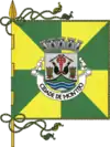 Flag 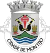 Coat of arms | |
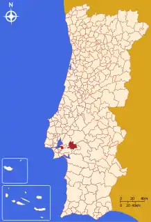 | |
| Coordinates: 38°41′N 08°54′W | |
| Country | |
| Region | Lisboa |
| Metropolitan area | Lisbon |
| District | Setúbal |
| Parishes | 5 |
| Government | |
| • President | Nuno Canta (PS) |
| Area | |
| • Total | 348.62 km2 (134.60 sq mi) |
| Population (2011) | |
| • Total | 51,222 |
| • Density | 150/km2 (380/sq mi) |
| Time zone | UTC±00:00 (WET) |
| • Summer (DST) | UTC+01:00 (WEST) |
| Local holiday | Saint Peter June 29 |
| Website | http://www.mun-montijo.pt |
It is one of the few municipalities in Portugal without territorial continuity; that is, its component parts are not conjoined. It is located in the Lisbon metropolitan area.
History
Montijo was known as Aldeia Galega until July 6, 1930, in spite of the fact that it was a small town and no longer a village. It was elevated to city status on August 14, 1985.
Paleolithic vestiges of human settlement suggest that the region was occupied into the pre-history.[4] Yet, the first historical references date to the 12th century, in 1186, with the donations of religious and hereditary lands to Paio Peres, that initiated formal occupation.[4]
Initially, the settlement was a constituted of poor hovels, that were villages for fishermen and farmers, but by the 14th century, the area had developed into a sizeable centre, with its own church, dedicated to São Sebastião.
During the reigns of Afonso IV, Pedro and Fernando, Montijo was awarded various privileges that John I later confirmed in 1385.[4] For a long time, the place formed one ecclesiastical parish with neighboring Alcochete, whose seat was in the village of Santa Maria de Sabonha, in the parish of São Francisco.[4] On 15 September 1514, Manual I conceded a foral (charter), which was quickly renewed on 17 January 1515, with Alcochete.[4]
In 1539, the centres separated resulting in administrative autonomy.[4] The grand postmaster, Luís Afonso, established his seat in the south in 1533, due to its geographic conditions and close proximity to Spain and southern Portugal. A year earlier, John III had registered the title to the village of Aldea Galega.[4]
Over the years, many monarch passed through Montijo, such as the future John IV of Portugal, who arrived on 5 December 1640, to enthusiastic cheers from the nobles, clerics and people of the village.[4]
In 1808 Montijo suffered the roaming attacks and pillage of French forces.[4]
Twenty one years later, a carriage post between Montijo and Badajoz/Madrid, which was of short duration and lasted until 1831.[4] In 1843, during an official visit, Queen Maria II of Portugal necessitated the carriage, allowing a 26-hour trip from Montijo to Badajoz. But, the service was suspended in 1864.[4]
Aldeia Galega was one of the first centres to celebrate the implantation of the 5 October 1910 revolution, before Lisbon and other major centres.[4]
Climate
| Climate data for Montijo (Base Aérea), 1971-2000 normals and extremes | |||||||||||||
|---|---|---|---|---|---|---|---|---|---|---|---|---|---|
| Month | Jan | Feb | Mar | Apr | May | Jun | Jul | Aug | Sep | Oct | Nov | Dec | Year |
| Record high °C (°F) | 21.0 (69.8) |
25.0 (77.0) |
28.6 (83.5) |
29.8 (85.6) |
37.5 (99.5) |
39.5 (103.1) |
43.2 (109.8) |
39.0 (102.2) |
39.0 (102.2) |
33.2 (91.8) |
27.4 (81.3) |
23.8 (74.8) |
43.2 (109.8) |
| Average high °C (°F) | 14.7 (58.5) |
16.2 (61.2) |
18.6 (65.5) |
19.7 (67.5) |
22.2 (72.0) |
25.8 (78.4) |
28.5 (83.3) |
28.7 (83.7) |
26.8 (80.2) |
22.5 (72.5) |
18.3 (64.9) |
15.5 (59.9) |
21.5 (70.6) |
| Daily mean °C (°F) | 10.1 (50.2) |
11.6 (52.9) |
13.7 (56.7) |
15.0 (59.0) |
17.4 (63.3) |
20.4 (68.7) |
22.6 (72.7) |
22.8 (73.0) |
21.2 (70.2) |
17.7 (63.9) |
14.0 (57.2) |
11.4 (52.5) |
16.5 (61.7) |
| Average low °C (°F) | 5.8 (42.4) |
7.2 (45.0) |
8.6 (47.5) |
10.2 (50.4) |
12.4 (54.3) |
14.9 (58.8) |
16.6 (61.9) |
16.8 (62.2) |
15.6 (60.1) |
12.7 (54.9) |
9.4 (48.9) |
7.3 (45.1) |
11.5 (52.6) |
| Record low °C (°F) | −4.0 (24.8) |
−2.0 (28.4) |
−0.4 (31.3) |
3.4 (38.1) |
4.8 (40.6) |
8.0 (46.4) |
10.8 (51.4) |
11.0 (51.8) |
8.5 (47.3) |
1.6 (34.9) |
−0.5 (31.1) |
−2.0 (28.4) |
−4.0 (24.8) |
| Average rainfall mm (inches) | 71.0 (2.80) |
55.0 (2.17) |
35.8 (1.41) |
51.8 (2.04) |
44.3 (1.74) |
15.2 (0.60) |
3.2 (0.13) |
3.8 (0.15) |
24.6 (0.97) |
57.3 (2.26) |
81.6 (3.21) |
97.1 (3.82) |
540.7 (21.3) |
| Average precipitation days (≥ 0.1 mm) | 11.8 | 10.6 | 8.3 | 11.9 | 9.2 | 4.8 | 1.7 | 2.0 | 5.4 | 9.3 | 12.1 | 13.3 | 100.4 |
| Mean monthly sunshine hours | 150.4 | 159.9 | 217.2 | 236.7 | 279.5 | 304.2 | 341.8 | 338.4 | 255.5 | 216.8 | 160.1 | 128.4 | 2,788.9 |
| Source: Instituto de Meteorologia[5] | |||||||||||||
| Climate data for Pegões, Montijo, 1971-2000 normals and extremes | |||||||||||||
|---|---|---|---|---|---|---|---|---|---|---|---|---|---|
| Month | Jan | Feb | Mar | Apr | May | Jun | Jul | Aug | Sep | Oct | Nov | Dec | Year |
| Record high °C (°F) | 22.5 (72.5) |
28.0 (82.4) |
30.0 (86.0) |
32.2 (90.0) |
35.6 (96.1) |
43.3 (109.9) |
44.0 (111.2) |
41.1 (106.0) |
40.6 (105.1) |
34.9 (94.8) |
28.5 (83.3) |
24.5 (76.1) |
44.0 (111.2) |
| Average high °C (°F) | 15.1 (59.2) |
16.4 (61.5) |
19.1 (66.4) |
20.0 (68.0) |
22.6 (72.7) |
26.8 (80.2) |
30.2 (86.4) |
30.7 (87.3) |
28.3 (82.9) |
23.4 (74.1) |
18.9 (66.0) |
15.9 (60.6) |
22.3 (72.1) |
| Daily mean °C (°F) | 10.0 (50.0) |
11.3 (52.3) |
13.1 (55.6) |
14.3 (57.7) |
16.6 (61.9) |
20.0 (68.0) |
22.5 (72.5) |
22.8 (73.0) |
21.2 (70.2) |
17.6 (63.7) |
13.7 (56.7) |
11.2 (52.2) |
16.2 (61.2) |
| Average low °C (°F) | 4.9 (40.8) |
6.2 (43.2) |
7.1 (44.8) |
8.5 (47.3) |
10.6 (51.1) |
13.1 (55.6) |
14.9 (58.8) |
14.9 (58.8) |
14.1 (57.4) |
11.7 (53.1) |
8.6 (47.5) |
6.5 (43.7) |
10.1 (50.2) |
| Record low °C (°F) | −4.8 (23.4) |
−3.2 (26.2) |
−4.0 (24.8) |
0.0 (32.0) |
2.5 (36.5) |
5.5 (41.9) |
8.0 (46.4) |
8.1 (46.6) |
5.0 (41.0) |
−0.5 (31.1) |
−2.0 (28.4) |
−4.0 (24.8) |
−4.8 (23.4) |
| Average rainfall mm (inches) | 94.7 (3.73) |
74.0 (2.91) |
41.6 (1.64) |
59.7 (2.35) |
54.9 (2.16) |
21.0 (0.83) |
7.8 (0.31) |
6.5 (0.26) |
26.4 (1.04) |
77.3 (3.04) |
94.0 (3.70) |
115.7 (4.56) |
673.6 (26.53) |
| Average precipitation days (≥ 0.1 mm) | 11.2 | 10.2 | 7.8 | 9.9 | 7.6 | 3.3 | 1.1 | 1.4 | 4.1 | 8.7 | 9.3 | 11.6 | 86.2 |
| Source: Instituto de Meteorologia[6] | |||||||||||||
Transport
The Vasco da Gama Bridge, inaugurated in 1998, connects Montijo with the capital city of Lisbon. Numerous roads, including the IC13, provide access to the south, east and west of Portugal.
Although the train service via the Ramal do Montijo rail line was discontinued, Montijo maintains a network of public transportation that connects it to other nearby major cities and villages by bus and by a river service connecting it with Lisbon.
Parishes
Administratively, the municipality is divided into 5 civil parishes (freguesias):[7]
- Atalaia e Alto Estanqueiro-Jardia
- Canha
- Montijo e Afonsoeiro
- Pegões
- Sarilhos Grandes
Panorama
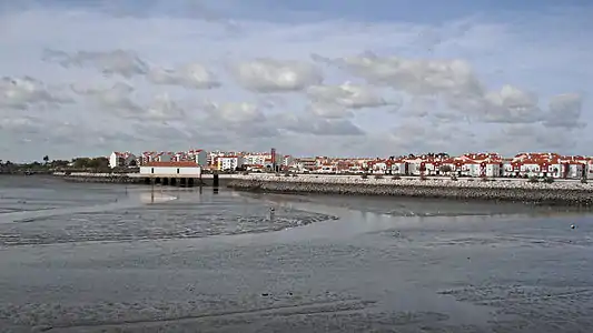
International Relations
Montijo has international cooperation protocols with:[8][9]
 Água Grande, São Tomé and Príncipe, since 2013
 Luís Eduardo Magalhães, Brazil, since 2006
 Santa Catarina, Cape Verde, since 2010
 São Filipe, Cape Verde, since 1997
 Svogue, Bulgaria, since 2010
 Tarrafal, Cape Verde, since 2010
References
- Instituto Nacional de Estatística
- "Áreas das freguesias, concelhos, distritos e país". Archived from the original on 2018-11-05. Retrieved 2018-11-05.
- "UMA POPULAÇÃO QUE SE URBANIZA, Uma avaliação recente - Cidades, 2004". Nuno Pires Soares. Instituto Geográfico Português (Geographic Institute of Portugal).
- Balderico, Joaquim (2012). Câmara Municipal (ed.). "Resenha Histórica". Montijo, Portugal: Câmara Municipal de Montijo. Archived from the original on 29 September 2012. Retrieved 27 August 2013.
- "Monthly Averages for Montijo (1971–2000)" (PDF). Instituto de Meteorologia.
- "Monthly Averages for Pegões, Montijo (1971–2000)" (PDF). Instituto de Meteorologia.
- Diário da República. "Law nr. 11-A/2013, page 552 78" (pdf) (in Portuguese). Retrieved 28 July 2014.
- "Geminações de Montijo". Associação Nacional de Municípios Portugueses. Retrieved 2020-07-22.
- "Archived copy" (PDF). Archived from the original (PDF) on 2015-05-25. Retrieved 2015-05-25.CS1 maint: archived copy as title (link)