Vilnius District Municipality
Vilnius District Municipality (Lithuanian: Vilniaus rajono savivaldybė) is one of 60 municipalities in Lithuania. It surrounds the capital city of Vilnius on 3 sides, while the rest borders the Trakai District Municipality.
Vilnius District Municipality
Vilniaus rajono savivaldybė Samorząd rejonu wileńskiego | |
|---|---|
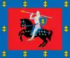
 Coat of arms | |
 Location of Vilnius district municipality | |
| Country | |
| Ethnographic region | Dzūkija/Aukštaitija |
| County | |
| Capital | Vilnius |
| Elderships | |
| Government | |
| • Mayor | Marija Rekst (Electoral Action of Poles in Lithuania) |
| Area | |
| • Total | 2,129 km2 (822 sq mi) |
| Population (2021) | |
| • Total | 106,957 |
| • Density | 50/km2 (130/sq mi) |
| Time zone | UTC+2 (EET) |
| • Summer (DST) | UTC+3 (EEST) |
| Website | www |
At the 2011 Census, Poles amounted to 52.07% out of 95,348 inhabitants. 32.47% were Lithuanians, 8.01% Russians, 4.17% Belarusians, 0.65% Ukrainians and 0.11% Jews.[1] Population grew to 106,957 in January 2021[2] because of migration of Vilnius citizens to the suburbs.
History
Vilnius district municipality is situated in the territory what was once Baltic East Lithuanian Barrow Culture (c. 3/4th–11/12th century AD) and numerous archaeological sites from this period are situated within its borders. During the formation of the Grand Duchy of Lithuania, major part of what is now Vilnius district municipality was the nucleus of Lietuva Duchy (the land – Lietuva), while the territory to the North of Maišiagala belonged to Neris land. There are some evidences, that Bukiškis just North of Vilnius, which historic name was Gedvydžiai could be associated with Duke Gedvydas and through this link – with Mindaugas.[3] According to Jan Długosz, the pagan ruler of Lithuania Algirdas was cremated in Kukaveitis sacred forest near Maišiagala, after his death in Maišiagala castle in 1377.[4] Nemenčinė (1338), Maišiagala (1254, 1365), Medininkai (1387) known from written sources from the 13th-14th centuries, were among the oldest settlements in Lithuania. These were trade and defense centers with castles as well as religious centers – after the Christianization of Lithuania, early churches were built here. As Vilnius was the capital of the Grand Duchy of Lithuania, the territory around the city was forming the very center of the state, so called Lithuania proper. It was the major part of a much larger Vilnius Duchy and later – Vilnius Voivodeship. After the partitions of the Polish-Lithuanian Commonwealth, Vilna Governorate was formed and Vilensky Uyezd occupied all of what is now Vilnius district municipality. When Vilnius and its suburbs in 1923 were incorporated into Interwar Poland, what is now Vilnius district municipality was the core of Powiat wileńsko-trocki. After the World War II, Vilnius district municipality was formed. Initially small Vilnius district (938 km²) was soon significantly enlarged, absorbing Naujoji Vilnia district (in 1959) and Nemenčinė district (in 1962), parts of Ukmergė district, but transferring some smaller administrative territories to Molėtai district and Švenčionys district, including Pabradė (in 1962). After 1962 (then 2313 km²), there were only minor administrative reforms, attaching some territories from Vilnius district municipality (now 2129 km²) to Vilnius city. In March 1987 Pašilaičiai, Fabijoniškės, Kelmija, Raisteliai villages and parts of Pavilionys, Baltoji Vokė, Prašiškės, Bajorai, Buivydiškės, Grigaičiai, Vanaginė villages were attached to Vilnius city.[5] Almost all of the municipality belongs to Vilnius urban belt, forming suburban environs of the capital city.
Elderships
The municipality is divided into 23 elderships:
| # | Eldership | Coat of Arms | Administrative
center |
Area in km²[6] | Population (2019)[7] |
|---|---|---|---|---|---|
| 1 | Avižieniai Eldership | - | Avižieniai | 52.08 | 11,598 |
| 2 | Bezdonys Eldership | - | Bezdonys | 121.42 | 2,886 |
| 3 | Buivydžiai Eldership |  |
Buivydžiai | 98.03 | 908 |
| 4 | Dūkštos Eldership | - | Dūkštos | 89.66 | 1,930 |
| 5 | Juodšiliai Eldership | - | Juodšiliai | 23.63 | 4,671 |
| 6 | Kalveliai Eldership | - | Kalveliai | 119.91 | 4,170 |
| 7 | Lavoriškės Eldership | - | Lavoriškės | 121.62 | 2,277 |
| 8 | Maišiagala Eldership |  |
Maišiagala | 99.9 | 2,872 |
| 9 | Marijampolis Eldership | - | Marijampolis | 121.88 | 3,553 |
| 10 | Medininkai Eldership |  |
Medininkai | 64.24 | 1,068 |
| 11 | Mickūnai Eldership |  |
Mickūnai | 93.56 | 5,583 |
| 12 | Nemenčinė Eldership | - | Nemenčinė | 147.23 | 3,728 |
| 13 | Nemenčinė City Eldership |  |
Nemenčinė | 3.98 | 4,886 |
| 14 | Nemėžis Eldership |  |
Nemėžis | 39.76 | 9,062 |
| 15 | Paberžė Eldership |  |
Paberžė | 208.81 | 3,407 |
| 16 | Pagiriai Eldership | - | Pagiriai | 89.39 | 7,202 |
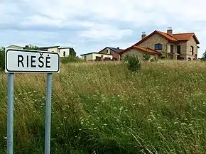
| 17 | Riešė Eldership |  |
Didžioji Riešė | 103.76 | 6,498 |
| 18 | Rudamina Eldership |  |
Rudamina | 52.49 | 5,886 |
| 19 | Rukainiai Eldership | - | Rukainiai | 141.21 | 2,648 |
| 20 | Sudervė Eldership | - | Sudervė | 71.29 | 2,871 |
| 21 | Sužionys Eldership | - | Sužionys | 164.42 | 1,791 |
| 22 | Šatrininkai Eldership | - | Vėliučionys | 35.40 | 2,966 |
| 23 | Zujūnai Eldership | - | Zujūnai | 65.44 | 7,467 |
Structure

District structure.[8]
- 1 city – Nemenčinė;
- 4 towns – Bezdonys, Maišiagala, Mickūnai, Šumskas
- 1091 villages.
Largest residential areas by population (2011[9]):
- Nemenčinė – 5,054
- Skaidiškės – 4,133
- Rudamina (Vilnius) – 3,981
- Pagiriai (Vilnius) – 3,451
- Didžioji Riešė – 2,520
- Nemėžis – 2,498
- Avižieniai – 2,125
- Valčiūnai – 1,874
- Juodšiliai – 1,744
- Zujūnai – 1,660
- Maišiagala – 1,636
- Kalveliai – 1,592
- Galgiai – 1,426
- Mickūnai – 1,389
- Grigaičiai – 1,325
- Buivydiškės – 1,314
- Vaidotai – 1,287
- Riešė – 1,234
- Gineitiškės – 1,093
- Kalviškės – 974
- Bukiškis – 922
- Paberžė – 919
- Šumskas – 919
- Marijampolis – 870
- Rukainiai – 770
- Bendoriai – 764
- Bezdonys – 743
- Didžiosios Kabiškės – 716
- Mostiškės – 631
- Lavoriškės – 621
- Anavilis – 574
- Rastinėnai – 556
- Glitiškės – 549
- Sudervė – 523
- Vėliučionys – 516
- Medininkai – 493
- Keturiasdešimt Totorių – 451
International relations
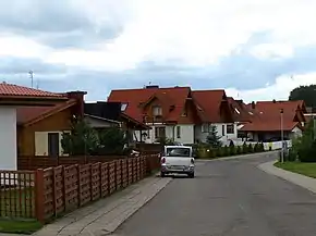
Gallery

 Sacred Daubos Oak in Neris Regional Park
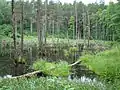 Swamp near Šilėnai
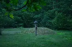
_hillfort_2011_(1).jpg.webp) Buivydai hillfort
Buivydai hillfort Ilgutis lake near Keturiasdešimt Totorių
 Stones "Three Brothers" near Sudervė
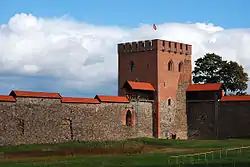

 Wooden Old Believers church in Žemaitėliai
 Wooden mosque in Keturiasdešimt Totorių
 Tower chapel in Sudervė
 Road near Marijampolis
 Stone sculptures in Vilnoja lake near Sudervė
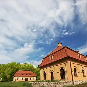
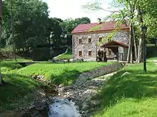 Liubavas mill-museum
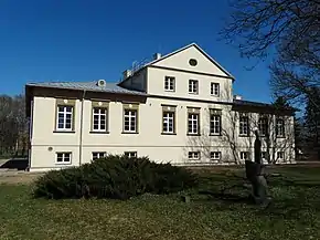
 Museum of Władysław Syrokomla in Bareikiškės
 Road near Lavoriškės
References
- "Lithuania 2011 Census". Lietuvos statistikos departamentas. 2011. Archived from the original on 2012-01-11. Retrieved 2013-03-24.
- 2021 01 04 Gyventoju skaičius pagal savivaldybes
- „Būtovės slėpiniai: Kernavė ar Vilnius?“
- Semaška, Algimantas (2006). Kelionių vadovas po Lietuvą: 1000 lankytinų vietovių norintiems geriau pažinti gimtąjį kraštą (in Lithuanian) (4th ed.). Vilnius: Algimantas. pp. 363–364. ISBN 9986-509-90-4.
- Visuotinio 1989 m. gyventojų surašymo duomenys, Vilnius, 1993
- "Atviri duomenys | VĮ Registrų centras". www.registrucentras.lt. Retrieved 2021-01-07.
- "Naujas detalus gyventojų žemėlapis". osp.stat.gov.lt (in Lithuanian). Retrieved 2021-01-07.
- Główny Geodeta Kraju (2012). "Robocza wersja wykazu polskich nazw geograficznych świata (Glossary of geographical names)" (PDF file, direct download 261 KB). Litwa; ofic. Republika Litewska; Lietuva; ofic. Lietuvos Respublika. Komisja Standaryzacji Nazw Geograficznych (Commission for Standardization of Placenames). p. 27. Retrieved December 31, 2012.
- Lietuvos statistikos departamentas. http://web.stat.gov.lt/uploads/docs/Gyventojai_gyvenamosiose_vietovese.xls
- "Radom - Miasta partnerskie" [Radom - Partnership cities]. Miasto Radom [City of Radom] (in Polish). Archived from the original on 2013-04-03. Retrieved 2013-08-07.