Wattle Downs
Wattle Downs is a suburb of South Auckland, New Zealand.
Wattle Downs | |
|---|---|
Suburb | |
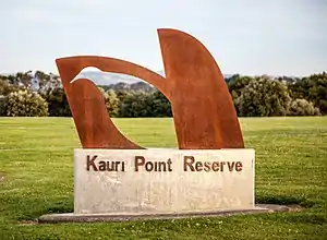 Kauri Point Reserve | |

| |
| Country | New Zealand |
| Local authority | Auckland Council |
| Electoral ward | Manurewa-Papakura Ward |
| Local board | Manurewa Local Board |
| Population (2018) | |
| • Total | 8,496 |
| Postcode(s) | 2103 |
| Clendon Park | Manurewa | Manurewa East |
| Weymouth |
|
(Pahurehure Inlet) Conifer Grove |
| (Pahurehure Inlet) Kingseat |
(Pahurehure Inlet) Karaka |
(Pahurehure Inlet) Takanini |
The suburb is located on the Mahia Park peninsula on the Manukau Harbour. It includes the area of Wattle Cove.
It is 25 kilometres south of the Auckland CBD and 10 kilometres south of Manukau town centre.
Development
Originally the Mahia Park peninsula was farmland (belonging to Ian Ross) but has been developed in a number of phases. The area is almost exclusively residential, with only a few shops and schools.
Wattle Cove, a large development by Fletcher Building was a $300 million subdivision that built 900 houses on the Wattle Downs peninsula.[1]
Wattle Park, a recent development that started construction in 2019 is a 112 home subdivision.[2]
Demographics
| Year | Pop. | ±% p.a. |
|---|---|---|
| 2006 | 6,813 | — |
| 2013 | 7,458 | +1.30% |
| 2018 | 8,496 | +2.64% |
| Source: [3] | ||
Wattle Downs, comprising the statistical areas of Wattle Downs West, Wattle Downs North and Wattle Downs East, had a population of 8,496 at the 2018 New Zealand census, an increase of 1,038 people (13.9%) since the 2013 census, and an increase of 1,683 people (24.7%) since the 2006 census. There were 2,589 households. There were 4,095 males and 4,401 females, giving a sex ratio of 0.93 males per female, with 2,004 people (23.6%) aged under 15 years, 1,638 (19.3%) aged 15 to 29, 3,606 (42.4%) aged 30 to 64, and 1,245 (14.7%) aged 65 or older.
Ethnicities were 53.1% European/Pākehā, 25.0% Māori, 22.8% Pacific peoples, 16.6% Asian, and 2.6% other ethnicities (totals add to more than 100% since people could identify with multiple ethnicities).
The proportion of people born overseas was 29.7%, compared with 27.1% nationally.
Although some people objected to giving their religion, 38.6% had no religion, 43.8% were Christian, 4.2% were Hindu, 1.4% were Muslim, 0.8% were Buddhist and 4.8% had other religions.
Of those at least 15 years old, 1,161 (17.9%) people had a bachelor or higher degree, and 1,290 (19.9%) people had no formal qualifications. The employment status of those at least 15 was that 3,489 (53.7%) people were employed full-time, 657 (10.1%) were part-time, and 237 (3.7%) were unemployed.[3]
Education
Clayton Park School and Reremoana Primary School are coeducational full primary schools (years 1–8) with rolls of 321 and 432 students, respectively.[4][5] Clayton Park opened in 1979.[6] Reremoana opened on 7 February 2006. It has been built to cater for the rapidly growing population in the local area.[7]
Rolls are as of March 2020.[8]
Recreation
Wattle Downs Golf Course, a 9-hole golf course, is nestled between areas of housing.
Wattle Downs North & South Path, are shared paths that link several reserves in the area and includes views over Waimaha Creek & Pahurehure Inlet
References
- Gibson, ANNE GIBSON, Anne (11 January 2005). "Fletchers in $425m buy-up". NZ Herald. ISSN 1170-0777. Retrieved 10 June 2020.
- "Wattle Park - Property Development & Investment in Wattle Downs, Auckland". www.neighbourly.co.nz. Retrieved 10 June 2020.
- "Statistical area 1 dataset for 2018 Census". Statistics New Zealand. March 2020. Wattle Downs West (161100), Wattle Downs North (161200) and Wattle Downs East (161500). 2018 Census place summary: Wattle Downs West 2018 Census place summary: Wattle Downs North 2018 Census place summary: Wattle Downs East
- Education Counts: Clayton Park School
- Education Counts: Reremoana Primary School
- "Welcome to Clayton Park School". Clayton Park School. Retrieved 19 September 2020.
- "About Us". Reremoana School. Retrieved 19 September 2020.
- "New Zealand Schools Directory". New Zealand Ministry of Education. Retrieved 26 April 2020.
