Waubun, Minnesota
Waubun is a city in Mahnomen County, Minnesota, United States. The population was 400 at the 2010 census.[6]
Waubun | |
|---|---|
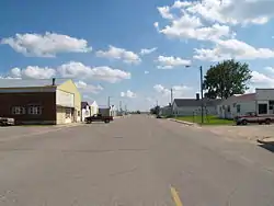 Downtown Waubun | |
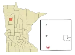 Location of Waubun, Minnesota | |
| Coordinates: 47°11′3″N 95°56′29″W | |
| Country | United States |
| State | Minnesota |
| County | Mahnomen |
| Area | |
| • Total | 0.51 sq mi (1.33 km2) |
| • Land | 0.51 sq mi (1.33 km2) |
| • Water | 0.00 sq mi (0.00 km2) |
| Elevation | 1,240 ft (378 m) |
| Population | |
| • Total | 400 |
| • Estimate (2019)[3] | 405 |
| • Density | 787.94/sq mi (304.04/km2) |
| Time zone | UTC-6 (Central (CST)) |
| • Summer (DST) | UTC-5 (CDT) |
| Area code(s) | 218 |
| FIPS code | 27-68674[4] |
| GNIS feature ID | 0653849[5] |
U.S. Route 59 and Minnesota State Highway 113 are two of the main routes in the community.
History
The city was incorporated as a village on December 18, 1907. When the Soo Line built through the county in 1903–4, the general manager, Pennington, and his chief engineer, Thomas Green, named the stations as they moved the line north; all towns on the reservation had to have Native American names. The post office for this community was established in 1905 as Bement, changing to Waubun in 1906.[7] The name Waubun comes from the Ojibwe word which means "the east," "the morning," "the twilight of dawn",[7] and "dawn of day."[8]
Geography
According to the United States Census Bureau, the city has a total area of 0.51 square miles (1.32 km2), all of it land.[9]
Demographics
| Historical population | |||
|---|---|---|---|
| Census | Pop. | %± | |
| 1910 | 230 | — | |
| 1920 | 346 | 50.4% | |
| 1930 | 337 | −2.6% | |
| 1940 | 438 | 30.0% | |
| 1950 | 426 | −2.7% | |
| 1960 | 350 | −17.8% | |
| 1970 | 345 | −1.4% | |
| 1980 | 390 | 13.0% | |
| 1990 | 330 | −15.4% | |
| 2000 | 403 | 22.1% | |
| 2010 | 400 | −0.7% | |
| 2019 (est.) | 405 | [3] | 1.3% |
| U.S. Decennial Census[10] | |||
2010 census
As of the census[2] of 2010, there were 400 people, 160 households, and 108 families residing in the city. The population density was 784.3 inhabitants per square mile (302.8/km2). There were 182 housing units at an average density of 356.9 per square mile (137.8/km2). The racial makeup of the city was 46.0% White, 0.3% African American, 33.3% Native American, 0.3% Asian, and 20.3% from two or more races. Hispanic or Latino of any race were 2.0% of the population.
There were 160 households, of which 36.3% had children under the age of 18 living with them, 36.9% were married couples living together, 23.1% had a female householder with no husband present, 7.5% had a male householder with no wife present, and 32.5% were non-families. 28.1% of all households were made up of individuals, and 17.5% had someone living alone who was 65 years of age or older. The average household size was 2.50 and the average family size was 2.96.
The median age in the city was 33.7 years. 31.7% of residents were under the age of 18; 8.2% were between the ages of 18 and 24; 21.2% were from 25 to 44; 21.6% were from 45 to 64; and 17.8% were 65 years of age or older. The gender makeup of the city was 43.0% male and 57.0% female.
2000 census
As of the census[4] of 2000, there were 403 people, 179 households, and 100 families residing in the city. The population density was 788.2 people per square mile (305.1/km2). There were 183 housing units at an average density of 357.9 per square mile (138.5/km2). The racial makeup of the city was 66.75% White, 17.12% Native American, and 16.13% from two or more races. Hispanic or Latino of any race were 0.25% of the population (1 person).
There were 179 households, out of which 26.3% had children under the age of 18 living with them, 39.7% were married couples living together, 14.5% had a female householder with no husband present, and 44.1% were non-families. 38.5% of all households were made up of individuals, and 25.7% had someone living alone who was 65 years of age or older. The average household size was 2.25 and the average family size was 3.00.
In the city, the population was spread out, with 26.6% under the age of 18, 5.7% from 18 to 24, 20.3% from 25 to 44, 25.8% from 45 to 64, and 21.6% who were 65 years of age or older. The median age was 42 years. For every 100 females, there were 93.8 males. For every 100 females age 18 and over, there were 88.5 males.
The median income for a household in the city was $31,042, and the median income for a family was $35,625. Males had a median income of $23,906 versus $22,292 for females. The per capita income for the city was $14,968. About 2.8% of families and 11.4% of the population were below the poverty line, including 7.0% of those under age 18 and 23.7% of those age 65 or over.
References
- "2019 U.S. Gazetteer Files". United States Census Bureau. Retrieved July 26, 2020.
- "U.S. Census website". United States Census Bureau. Retrieved 2012-11-13.
- "Population and Housing Unit Estimates". United States Census Bureau. May 24, 2020. Retrieved May 27, 2020.
- "U.S. Census website". United States Census Bureau. Retrieved 2008-01-31.
- "US Board on Geographic Names". United States Geological Survey. 2007-10-25. Retrieved 2008-01-31.
- "2010 Census Redistricting Data (Public Law 94-171) Summary File". American FactFinder. U.S. Census Bureau, 2010 Census. Retrieved 23 April 2011.
- Upham, Warren. "History, Mahnomen County, Minnesota". Mahnomen County History. Retrieved 2019-06-29.
- Upham, Warren (1920). Minnesota Geographic Names: Their Origin and Historic Significance. Minnesota Historical Society. p. 324.
- "US Gazetteer files 2010". United States Census Bureau. Retrieved 2012-11-13.
- "Census of Population and Housing". Census.gov. Retrieved June 4, 2015.
Municipalities and communities of Mahnomen County, Minnesota, United States | ||
|---|---|---|
| Cities | 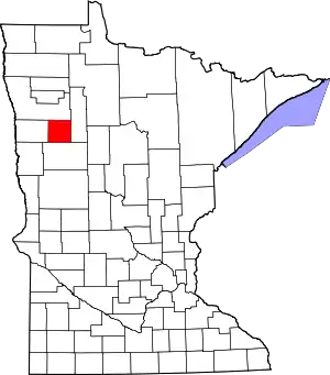 Map of Minnesota highlighting Mahnomen County | |
| Townships | ||
| CDPs | ||
| Unincorporated community | ||
| Indian reservations | ||
| Footnotes | ‡This populated place also has portions in an adjacent county or counties | |
| ||