Wearmouth Bridge
Wearmouth Bridge is a through arch bridge across the River Wear in Sunderland. It is the final bridge over the river before its mouth with the North Sea.
Wearmouth Bridge | |
|---|---|
 Looking across the current Wearmouth Bridge, constructed in 1929. | |
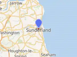
| Coordinates | 54°54′36″N 1°22′58″W |
| OS grid reference | NZ396574 |
| Carries | |
| Crosses | River Wear |
| Locale | Wearside |
| Official name | Wearmouth Bridge |
| Maintained by | Sunderland City Council |
| Heritage status | Grade II listed building |
| Next upstream | Monkwearmouth Railway Bridge |
| Characteristics | |
| Design | Through arch bridge |
| Material | Iron |
| Total length | 375 ft (114 m) |
| Width | 48 ft (15 m) |
| Longest span | 240 ft (73 m) |
| Clearance below | 105 ft (32 m) |
| No. of lanes |
|
| History | |
| Designer | Mott, Hay and Anderson |
| Constructed by | Sir William Arrol & Co. |
| Construction start | 1927 |
| Construction end | 1929 |
| Construction cost | £231,943 |
| Opened | 1929 |
| Inaugurated | 31 October 1929 |
| Replaces | Wearmouth Bridge |
| Location | |
| |
Original bridge
The original Wearmouth Bridge was designed by Thomas Paine and opened in 1796. In 1805 the bridge was repaired, and between 1857-1859 it was reconstructed by Robert Stephenson.
History

To accommodate the growing volume of traffic, construction began on the current bridge in 1927. It was designed by Mott, Hay and Anderson and fabricated by the famous bridge building firm of Sir William Arrol & Co. at their Dalmarnock Ironworks in Glasgow (they also built the famous Forth Rail Bridge and the steel structure of Tower Bridge in London).[1] The new bridge was built around the old one to allow the road to remain open.[2] It was opened on 31 October 1929 by the Duke of York (who would later become King George VI).[3]
The cost of the bridge amounted to £231,943 of which £12,000 was spent on dismantling the old bridge.[3]
The adjoining Monkwearmouth Railway Bridge was built in 1879, and extended the railway south from Monkwearmouth to the centre of Sunderland.[4]
The bridge carries the A183 road between Chester-le-Street and South Shields and the A1018 which was the old route of the A19 until the bypass was built leading to the Tyne Tunnel. It is a Grade II listed building.[5]
References
- 'The Sir William Arrol Collection', Royal Commission on the Ancient and Historical Monuments of Scotland contains many pictures of Wearside Bridge under Construction
- "LOCAL STUDIES CENTRE FACT SHEET NUMBER 7: The Wearmouth Bridge". Local Studies Centre collection, Sunderland Public Library Service. Archived from the original on 7 August 2011. Retrieved 30 January 2011.
- Vickers, Alex. "The second Wearmouth Bridge". National Grid for Learning. Retrieved 24 September 2006.
- "Historic Structures: Wearmouth Bridge". Sunderland City Council. Archived from the original on 8 May 2005. Retrieved 24 September 2006.
- Historic England. "WEARMOUTH BRIDGE (1279911)". National Heritage List for England. Retrieved 19 June 2015.
External links
| Wikimedia Commons has media related to Wearmouth Bridge. |
| Next bridge upstream | River Wear | Next bridge downstream |
| Monkwearmouth Bridge Durham Coast Line & Tyne and Wear Metro |
Wearmouth Bridge Grid reference NZ396574 |
None North Sea |