Wells, Minnesota
Wells is a city in Faribault County, Minnesota, United States. The population was 2,343 at the 2010 census.[6]
Wells | |
|---|---|
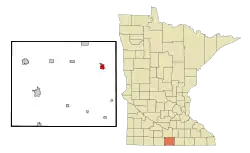 Location of Wells, Minnesota | |
| Coordinates: 43°44′33″N 93°43′40″W | |
| Country | United States |
| State | Minnesota |
| County | Faribault |
| Government | |
| • Type | Mayor – Council |
| • Mayor | David Braun |
| Area | |
| • Total | 1.96 sq mi (5.06 km2) |
| • Land | 1.96 sq mi (5.06 km2) |
| • Water | 0.00 sq mi (0.00 km2) |
| Elevation | 1,158 ft (353 m) |
| Population | |
| • Total | 2,343 |
| • Estimate (2019)[3] | 2,169 |
| • Density | 1,109.46/sq mi (428.38/km2) |
| Time zone | UTC-6 (Central (CST)) |
| • Summer (DST) | UTC-5 (CDT) |
| ZIP code | 56097 |
| Area code(s) | 507 |
| FIPS code | 27-69106[4] |
| GNIS feature ID | 0653904[5] |
| Website | www.CityOfWells.net |
History
Wells was laid out in 1869.[7] The city was named for J.W. Wells, father in law of Clark W. Thompson.[8]
The city contains a property listed on the National Register of Historic Places: the former Chicago, Milwaukee, St. Paul and Pacific Depot and Lunchroom.
Geography
According to the United States Census Bureau, the city has a total area of 1.99 square miles (5.15 km2), all of it land.[9]
Minnesota State Highways 22 and 109 are two of the main routes in the city. Interstate 90 is located 6 miles south of Wells on Highway 22.
Demographics
| Historical population | |||
|---|---|---|---|
| Census | Pop. | %± | |
| 1880 | 661 | — | |
| 1890 | 1,208 | 82.8% | |
| 1900 | 2,017 | 67.0% | |
| 1910 | 1,755 | −13.0% | |
| 1920 | 1,894 | 7.9% | |
| 1930 | 1,795 | −5.2% | |
| 1940 | 2,127 | 18.5% | |
| 1950 | 2,475 | 16.4% | |
| 1960 | 2,897 | 17.1% | |
| 1970 | 2,791 | −3.7% | |
| 1980 | 2,777 | −0.5% | |
| 1990 | 2,465 | −11.2% | |
| 2000 | 2,494 | 1.2% | |
| 2010 | 2,343 | −6.1% | |
| 2019 (est.) | 2,169 | [3] | −7.4% |
| U.S. Decennial Census | |||
2010 census
As of the census[2] of 2010, there were 2,343 people, 1,013 households, and 635 families living in the city. The population density was 1,177.4 inhabitants per square mile (454.6/km2). There were 1,133 housing units at an average density of 569.3 per square mile (219.8/km2). The racial makeup of the city was 96.9% White, 0.2% African American, 0.2% Native American, 0.8% Asian, 0.9% from other races, and 1.1% from two or more races. Hispanic or Latino of any race were 7.3% of the population.
There were 1,013 households, of which 27.3% had children under the age of 18 living with them, 48.7% were married couples living together, 10.0% had a female householder with no husband present, 4.0% had a male householder with no wife present, and 37.3% were non-families. 33.9% of all households were made up of individuals, and 18.7% had someone living alone who was 65 years of age or older. The average household size was 2.26 and the average family size was 2.87.
The median age in the city was 45.3 years. 22.6% of residents were under the age of 18; 6.2% were between the ages of 18 and 24; 20.8% were from 25 to 44; 27.6% were from 45 to 64; and 22.6% were 65 years of age or older. The gender makeup of the city was 47.9% male and 52.1% female.
2000 census
As of the census[4] of 2000, there were 2,494 people, 1,032 households, and 665 families living in the city. The population density was 1,846.5 people per square mile (713.3/km2). There were 1,097 housing units at an average density of 812.2 per square mile (313.7/km2). The racial makeup of the city was 96.31% White, 0.04% African American, 0.16% Native American, 0.68% Asian, 0.00% Pacific Islander, 2.17% from other races, and 0.64% from two or more races. 4.73% of the population were Hispanic or Latino of any race.
There were 1,032 households, out of which 28.3% had children under the age of 18 living with them, 53.1% were married couples living together, 7.8% had a female householder with no husband present, and 35.5% were non-families. 32.2% of all households were made up of individuals, and 19.7% had someone living alone who was 65 years of age or older. The average household size was 2.33 and the average family size was 2.94.
In the city, the population was spread out, with 23.3% under the age of 18, 7.3% from 18 to 24, 22.1% from 25 to 44, 21.3% from 45 to 64, and 26.0% who were 65 years of age or older. The median age was 43 years. For every 100 females, there were 87.5 males. For every 100 females age 18 and over, there were 82.6 males.
The median income for a household in the city was $26,463, and the median income for a family was $38,523. Males had a median income of $27,969 versus $19,873 for females. The per capita income for the city was $15,614. 9.8% of the population and 5.9% of families were below the poverty line. 7.4% of those under the age of 18 and 15.1% of those 65 and older were living below the poverty line.
Transportation
Land was purchased in 1964 to build an airport. The Wells Municipal Airport opened in August 1966.[10]
Notable people
- Larry Buendorf, US Secret Service agent who subdued Squeaky Fromme. On the morning of September 5, 1975, Fromme went to Sacramento's Capitol Park (reportedly to plead with President Gerald Ford about the plight of the California redwoods) dressed in a nun-like red robe and armed with a Colt M1911 .45 semi-automatic pistol that she pointed at Ford. The pistol's magazine was loaded with four rounds, but there was no bullet in the firing chamber. She was immediately restrained by Buendorf.
- Gerald Dean Schultz, US Air Force Staff Sergeant 1948–1952. "Jerry" was a rawinsonde operator involved in Operation Ranger and witnessed five atomic tests. All the bombs were dropped by B-50D bombers and exploded in the open air over Frenchman Flat (Area 5) Nevada. He was commended on his duty and then sent on to Eniwetok Atoll for Operation Greenhouse and further testing of the atomic bomb.
- Carl W. Riddick, member of the U.S. House of Representatives from the Second District of Montana[11]
- Frederic Warde, printer, type and book designer.
References
- "2019 U.S. Gazetteer Files". United States Census Bureau. Retrieved July 26, 2020.
- "U.S. Census website". United States Census Bureau. Retrieved 2012-11-13.
- "Population and Housing Unit Estimates". United States Census Bureau. May 24, 2020. Retrieved May 27, 2020.
- "U.S. Census website". United States Census Bureau. Retrieved 2008-01-31.
- "US Board on Geographic Names". United States Geological Survey. 2007-10-25. Retrieved 2008-01-31.
- "2010 Census Redistricting Data (Public Law 94-171) Summary File". American FactFinder. United States Census Bureau. Retrieved 27 April 2011.
- Upham, Warren (1920). Minnesota Geographic Names: Their Origin and Historic Significance. Minnesota Historical Society. p. 188.
- "Profile for Wells, Minnesota". ePodunk. Retrieved 2010-05-29.
- "US Gazetteer files 2010". United States Census Bureau. Retrieved 2012-11-13.
- Foster, Tom (July 2013). "Airport of the Month". Minnesota Flyer.
- "RIDDICK, Carl Wood, (1872 - 1960)". Biographical Directory of the United States Congress. Retrieved October 14, 2012.
External links
Municipalities and communities of Faribault County, Minnesota, United States | ||
|---|---|---|
| Cities | 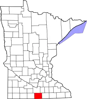 Map of Minnesota highlighting Faribault County | |
| Townships | ||
| Unincorporated communities | ||
| Ghost towns | ||
| Footnotes | ‡This populated place also has portions in an adjacent county or counties | |
| ||