Faribault County, Minnesota
Faribault County (/ˈfeɪrɪboʊ/) is a county in the U.S. state of Minnesota. As of the 2010 United States Census, the population was 14,553.[1] Its county seat is Blue Earth.[2]
Faribault County | |
|---|---|
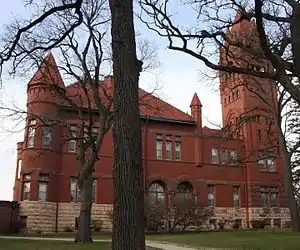 Faribault County Courthouse in Blue Earth | |
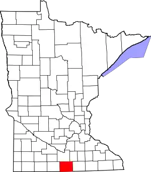 Location within the U.S. state of Minnesota | |
 Minnesota's location within the U.S. | |
| Coordinates: 43°41′N 93°57′W | |
| Country | |
| State | |
| Founded | February 20, 1855 |
| Named for | Jean Baptiste Faribault |
| Seat | Blue Earth |
| Largest city | Blue Earth |
| Area | |
| • Total | 722 sq mi (1,870 km2) |
| • Land | 712 sq mi (1,840 km2) |
| • Water | 9.4 sq mi (24 km2) 1.3%% |
| Population (2010) | |
| • Total | 14,553 |
| • Estimate (2019) | 13,653 |
| • Density | 19.4/sq mi (7.5/km2) |
| Time zone | UTC−6 (Central) |
| • Summer (DST) | UTC−5 (CDT) |
| Congressional district | 1st |
| Website | www |
History
The county was founded in 1855.[3] It was named for Jean-Baptiste Faribault, a settler and French fur trader among the Sioux Indians.[4]
Geography
Faribault County lies on the south side of Minnesota. Its southern border abuts the north border of the state of Iowa. The Blue Earth River flows northerly through the west-central part of the county; it enters from Iowa as two branches, West Branch and Middle Branch, merging at 5 miles (8 km) into the county. It is joined by East Branch near the city of Blue Earth, thence flows northward into Blue Earth County. The Maple River flows west-northwestward through the upper central part of the county, entering from Freeborn County and exiting to Blue Earth County. The Cobb River also flows through the NE part of the county, from Freeborn to Blue Earth county.[5]
The county terrain consists of semi-arid rolling hills, devoted to agriculture. The SE portion is a glacial moraine near Kiester, and is known as the Kiester Moraine.[6] The county has an area of 722 square miles (1,870 km2), of which 712 square miles (1,840 km2) is land and 9.4 square miles (24 km2) (1.3%) is water.[7]
Lakes[5]
- Bass Lake
- Hart Lake
- Minnesota Lake
- Rice Lake (Delavan Twp)
- Rice Lake (Foster Twp)
- South Walnut Lake
- Walnut Lake
Major highways
 Interstate 90
.svg.png.webp) U.S. Highway 169
U.S. Highway 169 Minnesota State Highway 22
 Minnesota State Highway 109
Adjacent counties
- Blue Earth County - north
- Waseca County - northeast
- Freeborn County - east
- Winnebago County, Iowa - southeast
- Kossuth County, Iowa - southwest
- Martin County - west
Protected areas[5]
- Walnut Lake State Wildlife Management Area
Demographics
| Historical population | |||
|---|---|---|---|
| Census | Pop. | %± | |
| 1860 | 1,335 | — | |
| 1870 | 9,940 | 644.6% | |
| 1880 | 13,016 | 30.9% | |
| 1890 | 16,708 | 28.4% | |
| 1900 | 22,055 | 32.0% | |
| 1910 | 19,949 | −9.5% | |
| 1920 | 20,998 | 5.3% | |
| 1930 | 21,642 | 3.1% | |
| 1940 | 23,941 | 10.6% | |
| 1950 | 23,879 | −0.3% | |
| 1960 | 23,685 | −0.8% | |
| 1970 | 20,896 | −11.8% | |
| 1980 | 19,714 | −5.7% | |
| 1990 | 16,937 | −14.1% | |
| 2000 | 16,181 | −4.5% | |
| 2010 | 14,553 | −10.1% | |
| 2019 (est.) | 13,653 | [9] | −6.2% |
| US Decennial Census[10] 1790-1960[11] 1900-1990[12] 1990-2000[13] 2010-2019[1] | |||

2000 census
As of the 2000 United States Census,[14] there were 16,181 people, 6,652 households, and 4,476 families in the county. The population density was 22.7/sqmi (8.77/km2). There were 7,247 housing units at an average density of 10.2/sqmi (3.93/km2). The racial makeup of the county was 97.11% White, 0.24% Black or African American, 0.19% Native American, 0.36% Asian, 0.04% Pacific Islander, 1.36% from other races, and 0.69% from two or more races. 3.50% of the population were Hispanic or Latino of any race. 45.5% were of German, 21.2% Norwegian and 5.1% Irish ancestry.
There were 6,652 households, out of which 28.50% had children under the age of 18 living with them, 57.80% were married couples living together, 6.10% had a female householder with no husband present, and 32.70% were non-families. 29.70% of all households were made up of individuals, and 16.80% had someone living alone who was 65 years of age or older. The average household size was 2.36 and the average family size was 2.93.
The county population contained 24.40% under the age of 18, 6.70% from 18 to 24, 23.20% from 25 to 44, 23.50% from 45 to 64, and 22.20% who were 65 years of age or older. The median age was 42 years. For every 100 females there were 97.20 males. For every 100 females age 18 and over, there were 92.50 males.
The median income for a household in the county was $34,440, and the median income for a family was $41,793. Males had a median income of $28,990 versus $20,224 for females. The per capita income for the county was $17,193. About 5.50% of families and 8.60% of the population were below the poverty line, including 9.40% of those under age 18 and 10.20% of those age 65 or over.
Communities
Cities
- Blue Earth (County seat)
- Bricelyn
- Delavan
- Easton
- Elmore
- Frost
- Kiester
- Minnesota Lake (Partly in Blue Earth County)
- Walters
- Wells
- Winnebago
Unincorporated communities
- Baroda
- Brush Creek
- Clayton (Ghost Town)
- Dell
- Guckeen
- Homedahl (Ghost Town)
- Huntley
- Marna
- Pilot Grove
Townships
- Barber Township
- Blue Earth City Township
- Brush Creek Township
- Clark Township
- Delavan Township
- Dunbar Township
- Elmore Township
- Emerald Township
- Foster Township
- Jo Daviess Township
- Kiester Township
- Lura Township
- Minnesota Lake Township
- Pilot Grove Township
- Prescott Township
- Rome Township
- Seely Township
- Verona Township
- Walnut Lake Township
- Winnebago City Township
Government and Politics
Faribault County has primarily supported Republican Party candidates in presidential elections throughout its history. Only six times since 1892 has a Republican candidate failed to win the county in a presidential election, most recently Bob Dole in 1996.
| Year | Republican | Democratic | Third parties |
|---|---|---|---|
| 2016 | 62.9% 4,659 | 29.1% 2,153 | 8.1% 600 |
| 2012 | 53.2% 4,104 | 44.2% 3,407 | 2.6% 202 |
| 2008 | 51.5% 4,196 | 45.8% 3,736 | 2.7% 220 |
| 2004 | 55.2% 4,794 | 43.4% 3,767 | 1.4% 120 |
| 2000 | 51.5% 4,336 | 43.0% 3,624 | 5.5% 464 |
| 1996 | 39.6% 3,272 | 46.2% 3,817 | 14.2% 1,173 |
| 1992 | 37.6% 3,439 | 36.5% 3,339 | 25.9% 2,368 |
| 1988 | 55.1% 4,846 | 44.1% 3,879 | 0.9% 75 |
| 1984 | 58.4% 5,690 | 41.0% 3,993 | 0.5% 53 |
| 1980 | 59.2% 6,206 | 34.5% 3,620 | 6.3% 655 |
| 1976 | 51.5% 5,577 | 46.6% 5,049 | 1.9% 207 |
| 1972 | 64.1% 6,503 | 34.7% 3,519 | 1.3% 131 |
| 1968 | 54.5% 5,662 | 41.8% 4,335 | 3.7% 387 |
| 1964 | 44.7% 4,817 | 55.2% 5,946 | 0.1% 12 |
| 1960 | 61.8% 6,975 | 38.1% 4,301 | 0.1% 11 |
| 1956 | 65.8% 6,886 | 34.0% 3,554 | 0.2% 25 |
| 1952 | 71.0% 7,763 | 28.6% 3,120 | 0.4% 47 |
| 1948 | 46.1% 4,619 | 52.5% 5,261 | 1.3% 134 |
| 1944 | 61.4% 5,822 | 38.4% 3,640 | 0.3% 25 |
| 1940 | 62.1% 6,816 | 37.4% 4,099 | 0.5% 56 |
| 1936 | 38.3% 3,773 | 56.9% 5,603 | 4.8% 471 |
| 1932 | 46.7% 4,148 | 51.6% 4,590 | 1.7% 154 |
| 1928 | 69.2% 5,885 | 29.9% 2,545 | 0.9% 76 |
| 1924 | 58.1% 4,682 | 7.2% 578 | 34.7% 2,797 |
| 1920 | 86.0% 6,687 | 11.2% 869 | 2.8% 219 |
| 1916 | 61.7% 2,184 | 31.7% 1,123 | 6.6% 232 |
| 1912 | 11.7% 393 | 27.4% 919 | 60.9% 2,045 |
| 1908 | 61.8% 2,305 | 27.9% 1,039 | 10.3% 385 |
| 1904 | 77.7% 2,792 | 17.0% 611 | 5.3% 191 |
| 1900 | 70.6% 2,910 | 22.7% 936 | 6.7% 275 |
| 1896 | 71.4% 3,116 | 25.4% 1,107 | 3.3% 143 |
| 1892 | 58.0% 1,992 | 31.2% 1,070 | 10.8% 372 |
| Position | Name | District | Next Election | |
|---|---|---|---|---|
| Commissioner and Vice Chair | John Roper | District 1 | 2020 | |
| Commissioner | Greg Young | District 2 | 2022 | |
| Commissioner | Bill Groskreutz | District 3 | 2020 | |
| Commissioner | Tom Loveall | District 4 | 2022 | |
| Commissioner and Chairperson | Tom Warmka | District 5 | 2020 | |
| Position | Name | Affiliation | District | |
|---|---|---|---|---|
| Senate | Julie Rosen[17] | Republican | District 23 | |
| Senate | Dan Sparks[18] | Democrat | District 27 | |
| House of Representatives | Bob Gunther[19] | Republican | District 23A | |
| House of Representatives | Peggy Bennett[20] | Republican | District 27A | |
| Position | Name | Affiliation | District | |
|---|---|---|---|---|
| House of Representatives | Jim Hagedorn[21] | Republican | 1st | |
| Senate | Amy Klobuchar[22] | Democrat | N/A | |
| Senate | Tina Smith[23] | Democrat | N/A | |
References
- "State & County QuickFacts". United States Census Bureau. Archived from the original on June 7, 2011. Retrieved August 31, 2013.
- "Find a County". National Association of Counties. Archived from the original on May 31, 2011. Retrieved June 7, 2011.
- Upton, Warren. Minnesota Geographic Names: Their Origin and Historic Significance (1920) Published by Minnesota Historical Society. p.182 (accessed 8 March 2019)
- Gannett, Henry (1905). The Origin of Certain Place Names in the United States. Govt. Print. Off. p. 123.
- Faribault County MN Google Maps (accessed 8 March 2019)
- Upton, Warren. Minnesota Geographic Names: Their Origin and Historic Significance (1920) p. 188 (accessed 8 March 2019)
- "2010 Census Gazetteer Files". US Census Bureau. August 22, 2012. Archived from the original on October 6, 2014. Retrieved October 15, 2014.
- Nelson, Steven (2011). Savanna Soils of Minnesota. Minnesota: Self. pp. 65-67. ISBN 978-0-615-50320-2.
- "Population and Housing Unit Estimates". Retrieved March 26, 2020.
- "US Decennial Census". US Census Bureau. Retrieved October 15, 2014.
- "Historical Census Browser". University of Virginia Library. Retrieved October 15, 2014.
- "Population of Counties by Decennial Census: 1900 to 1990". US Census Bureau. Retrieved October 15, 2014.
- "Census 2000 PHC-T-4. Ranking Tables for Counties: 1990 and 2000" (PDF). US Census Bureau. Retrieved October 15, 2014.
- "U.S. Census website". US Census Bureau. Retrieved January 31, 2008.
- Leip, David. "Atlas of US Presidential Elections". uselectionatlas.org. Retrieved September 18, 2018.
- "Board of Commissioners | Faribault County MN". www.co.faribault.mn.us. Retrieved June 25, 2020.
- "MN State Senate". www.senate.mn. Retrieved June 25, 2020.
- "MN State Senate". www.senate.mn. Retrieved June 25, 2020.
- "Rep. Bob Gunther (23A) - Minnesota House of Representatives". www.house.leg.state.mn.us. Retrieved June 25, 2020.
- "Rep. Peggy Bennett (27A) - Minnesota House of Representatives". www.house.leg.state.mn.us. Retrieved June 25, 2020.
- "Representative Jim Hagedorn". Representative Jim Hagedorn. Retrieved June 25, 2020.
- "U.S. Senator Amy Klobuchar". www.klobuchar.senate.gov. Retrieved June 24, 2020.
- "Home". Senator Tina Smith. Retrieved June 24, 2020.
External links
Places adjacent to Faribault County, Minnesota | ||||||||||
|---|---|---|---|---|---|---|---|---|---|---|
| ||||||||||
Municipalities and communities of Faribault County, Minnesota, United States | ||
|---|---|---|
| Cities | Map of Minnesota highlighting Faribault County | |
| Townships | ||
| Unincorporated communities | ||
| Ghost towns | ||
| Footnotes | ‡This populated place also has portions in an adjacent county or counties | |
| ||

| Authority control |
|---|