West Adams, Los Angeles
West Adams is a historic neighborhood in the South Los Angeles region of Los Angeles, California. The area is known for its large number of historic buildings, structures and notable houses and mansions throughout Los Angeles. It is a youthful, densely populated area with a high percentage of African American and Latino residents. The neighborhood has several public and private schools.


West Adams | |
|---|---|
 | |
| Country | |
| State | |
| County | |
| City | |
| Time zone | Pacific |
| Area code(s) | 323 |
History
West Adams is one of the oldest neighborhoods in the city of Los Angeles, with most of its buildings erected between 1880 and 1925, including the William Andrews Clark Memorial Library. West Adams was developed by railroad magnate Henry E. Huntington and wealthy industrialist Hulett C. Merritt of Pasadena. It was once the wealthiest district in the city, with its Victorian mansions and sturdy Craftsman bungalows, and a home to Downtown businessmen and professors and academicians at USC. Several historic areas of West Adams, namely, Harvard Heights, Lafayette Square, Pico-Union, and West Adams Terrace, were designated as Historic Preservation Overlay Zones by the city of Los Angeles, in recognition of their outstanding architectural heritage. Menlo Avenue-West Twenty-ninth Street Historic District, North University Park Historic District, Twentieth Street Historic District, Van Buren Place Historic District and St. James Park Historic District, all with houses of architectural significance, are located in West Adams.
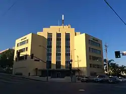
The development of the West Side, Beverly Hills and Hollywood, beginning in the 1910s, siphoned away much of West Adams' upper-class white population; upper-class blacks began to move in around this time, although the district was off limits to all but the very wealthiest African-Americans. One symbol of the area's emergence as a center of black wealth at this time is the landmark 1949 headquarters building of the Golden State Mutual Life Insurance Company, a late-period Moderne structure at Adams and Western designed by renowned black architect Paul Williams. It housed what was once one of the nation's largest black-owned insurers (currently, along with an adjacent new building, it is now a campus for a large non-profit). West Adams' transformation into an affluent black area was sped by the Supreme Court's 1948 invalidation of segregationist covenants on property ownership.[1] The area was a favorite among black celebrities in the 1940s and 1950s; notable residents included Hattie McDaniel, Tim Moore, Eddie Anderson, Joe Louis, Sweet Daddy Grace, Little Richard, Lionel Hampton and Ray Charles.
Singer Ray Charles's business headquarters, including his RPM studio, is located at 2107 Washington Boulevard. The intersection of Washington Boulevard and Westmoreland Boulevard, at the studio, is named "Ray Charles Square" in his honor.
Starting in 1961, construction of the ten-lane Santa Monica Freeway (Interstate 10) tore through West Adams' core, with the freeway routed east to west just north of Adams Boulevard. Its construction resulted in the taking by eminent domain, and demolition, of numerous West Adams homes, including a number of mansions owned by African Americans.[2] The construction resulted in substantial displacement of West Adams residents, including the relocation of much of the area's affluent Black families.[3] As the Los Angeles Sentinel reported:
"The road could have been built without cutting through the so-called Sugar Hill section. However, in order to miss Sugar Hill, it was ‘said’ that the route would have to cut through fraternity and sorority row area around USC. Sorority and fraternity row still stands and Sugar Hill doesn’t, so you know who won out!”[4]
As in many other American cities during the heyday of Interstate Highway Act construction, interstate highway rights of way were disproportionately routed through predominantly African American communities, causing substantial displacement of residents and steep declines in neighborhood viability.
In the past, many African-American gays had moved into the neighborhood, and it became the center of black gay life in Los Angeles, even earning the nickname of "the black West Hollywood" or "the black Silver Lake"[5]
Many of the neighborhoods, including West Adams, are experiencing a renaissance of sorts with their historic houses being restored to their previous elegance.[1]
The area is undergoing severe gentrification,[6] with young professionals, restaurants, new businesses moving into the area. Many professionals are being attracted to the area, due to the proximity of job hubs in Silicon Beach, Culver City, and El Segundo.[7][8]
Demographics
According to the Mapping L.A. project of the Los Angeles Times, a total of 21,764 people lived in West Adams's 1.48 square miles, according to the 2000 U.S. census—averaging 14,686 people per square mile, among the highest population densities in the city as a whole. Population was estimated at 22,857 in 2008. The median age was 28, considered young when compared to the city as a whole. The percentages of residents aged birth to 18 were among the county's highest.[9]
Latinos made up 56.2% of the population, with black people at 37.6%, white people 2.4%, Asian 1.7%, and other 2%. Mexico and El Salvador were the most common places of birth for the 36.9% of the residents who were born abroad, an average percentage of foreign-born when compared with the city or county as a whole.[9]
The $38,209 median household income in 2008 dollars was considered low for the city and county. The percentage of households earning $20,000 or less was high, compared to the county at large. The average household size of 3.1 people was about average for the city. Renters occupied 62.8% of the housing units, and homeowners occupied the rest.[9]
In 2000, there were 1,078 families headed by single parents, or 21.8%, a rate that was high for the county and the city. The percentages of never-married women (39.5) and divorced women (5.7) were among the county's highest.[9]
Geography
Description
According to the "Mapping L.A." project of the Los Angeles Times, West Adams is flanked by Mid-City to the north—across the Santa Monica Freeway—Jefferson Park to the east, Baldwin Hills/Crenshaw to the south and Palms to the west.[10] The neighborhood's street boundaries are the Santa Monica Freeway on the north, Crenshaw Boulevard on the east, Exposition and Jefferson Boulevards on the south and the Culver City line on the west (Ballona Creek and Fairfax Avenue).[9]
Project leader Doug Smith reported that, in response by the public to advance posting of the proposed maps, "Among the bitter rifts we encountered were the competing claims to the name West Adams."[11]
Historical purists would reserve the designation West Adams for the once-upper-crust district of Victorian mansions now falling in the shadow of USC. But residents farther west have appropriated the name for that hard-to-define area between the 10 Freeway and Baldwin Hills. To bolster their case, the area's Neighborhood Empowerment Zone bears that name. The discussion has taken on powerful emotional content in recent years as part of a larger debate over gentrification and changing demographics in that part of the city. We resolved the argument as best we could, using the West Adams label for the region west of Crenshaw Boulevard and including the old mansions east of Vermont Avenue as part of University Park.[11]
West Adams Heritage Association
The West Adams Heritage Association states that West Adams stretches "roughly from Figueroa Street on the east to West Boulevard on the west, and from Pico Boulevard on the north to Jefferson Boulevard on the south."[12]
Automobile Club
The Automobile Club of Southern California delineates no boundaries for the area, but centers it on the West Adams Alternative School, between Seventh and Fourth avenues (west and east) and Adams Boulevard and 25th Street (north and south).[13]
Tracts and districts
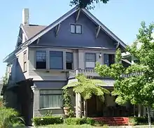
West Adams is home to one of the largest collections of historic houses and small mansions west of the Mississippi River. The West Adams neighborhood was developed between 1880 and 1925 and contains many diverse architectural styles of the era, including the Queen Anne, Shingle, Gothic Revival, Transitional Arts and Crafts, American Craftsman/Ultimate Bungalow, Craftsman Bungalow, Colonial Revival, Renaissance Revival, Mediterranean Revival, Spanish Colonial Revival, Mission Revival, Egyptian Revival, Beaux-Arts and Neoclassical styles. West Adams boasts the only existing Greene and Greene house left in the entire city of Los Angeles.
More than 70 sites in West Adams have received recognition as a Los Angeles Historic-Cultural Monument, a California Historical Landmark, or listing on the National Register of Historic Places.
Kinney Heights
Kinney Heights was developed around 1900 by developer Abbot Kinney, for whom it is named. It was a suburban tract of large wealthy Craftsman style houses at what was then the western edge of Los Angeles. The houses featured amenities like "beveled-glass china cabinets, marble fireplaces and mahogany floors".[14] It was accessible to downtown via streetcar and attracted upper-class families.[15]
Many of the hundred-year-old structures are still standing and have been renovated and upgraded. The neighborhood is part of the West Adams Terrace Historic Preservation Overlay Zone (HPOZ).[16]
Twentieth Street Historic District
The Twentieth Street Historic District consists of a row of bungalows and Craftsman-style houses in the 900 block on the south side of 20th Street.
Education
Just 7.8% of residents aged 25 and older had a four-year degree, a percentage considered low for the city and the county; the percentage with less than a high school diploma (not stated) was considered high.[9]
The schools within the West Adams neighborhood are as follows:[17][18]
- Stella Middle Charter Academy, LAUSD, 2636 Mansfield Avenue
- Marvin Elementary School, LAUSD, public, 2411 Marvin Avenue
- Cienega Elementary School, LAUSD, 2611 South Orange Drive
- Cleophas Oliver Learning Academy, private elementary, 4449 West Adams Boulevard
- Virginia Road Elementary School, LAUSD, public, 2925 Virginia Road
- Full Circle Learning Academy, LAUSD charter, 1850 West 96th Street
- Crown Preparatory Academy, 2055 W. 24th St.
Recreation and parks
Transportation
The Metro E Line from Downtown Los Angeles to Santa Monica includes three stations in West Adams: La Cienega/Jefferson, Expo/La Brea and Farmdale.[21]
Government
Fire service in West Adams is provided by the Los Angeles Fire Department. LACoFD operates Station 26.[22]
Notable places
- Olympic Village 1932 Summer Olympics (near intersection of Adams and Hoover)
- Forthmann House – At 1102 W. 28th Street, a Victorian home built in 1880. This home is known as the Forthmann House and was built for the founders of the Los Angeles Soap Co. It is characterized by its mansard-roofed tower.
- John B. Kane Residence (Bonsallo Avenue, located near 23rd St)
Notable people
- Hattie McDaniel, actress, known for Gone with the Wind starring Clark Gable[23]
- Tim Moore, vaudeville comedian; star of CBS-TV's situation comedy, Amos 'n' Andy.
- Joe Louis, pugilist
- Sweet Daddy Grace
- Clementina D. Griffin, school principal, aviator
- Little Richard, singer
- Lionel Hampton, musician
- Ray Charles, singer
- Leila Holterhoff, singer, linguist, psychoanalyst
- Marvin Gaye, singer
In popular culture
Its historic homes are frequently used as locations for movie films and TV shows including CBS's CSI, Six Feet Under, The Shield, Monk, Confessions of a Dangerous Mind, and Of Mice and Men.
See also
- List of Registered Historic Places in Los Angeles
- List of Los Angeles Historic-Cultural Monuments in South Los Angeles
- South Los Angeles
References
- Khouri, Andrew (April 30, 2014) "Soaring home prices spur a resurgence near USC " Los Angeles Times
- Ibid.
- West Adams on the Down Low : Curbed LA
- Flores, Jessica (2019-09-12). "Is a bike tour through West Adams a sign of gentrification?". Curbed LA. Retrieved 2020-08-12.
- Madams, Hannah (June 14, 2019) "Businesses Flock to West Adams" Los Angeles Business Journal
- Barragan, Bianca (2018-03-22). "Gaze upon these first visuals for 30-story Cumulus tower in West Adams". Curbed LA. Retrieved 2020-08-12.
- "West Adams," Mapping L.A., Los Angeles Times
- "South L.A.," Mapping L.A., Los Angeles Times
- Doug Smith, "MappingL.A. Project Is Revised in Nearly 100 Ways," Los Angeles Times, June 3, 2009
- "About West Adams," West Adams Heritage Association
- Map, "Los Angeles Central & Western Area," Automobile Club of Southern California, 2002–2013
- Mithers, Carol (April 17, 2005). "Vanishing: The history of one house in L.A." Los Angeles Times. Retrieved 28 July 2013.
- Oliver, Marilyn Tower (October 1, 1995). "In Touch with the Past: Craftsman-style homes in three neighborhoods recall gracious days of yore. Today they rate among L.A.'s best buys". Los Angeles Times. Retrieved 28 July 2013.
- "Historic West Adams Tour". PreserveLA.com. October 9, 2005. Retrieved 28 July 2013.
- The Thomas Guide, 2006, pages 633 and 673
- "West Adams Schools," Mapping L.A., Los Angeles Times
- Los Angeles Department of Recreation and Parks
- Los Angeles Department of Recreation and Parks
- Phase 1 Construction
- Station 26 LA City Fire: Fire Station 26
- Time magazine, "Victory on Sugar Hill", Monday, December 17, 1945.
External links
| Wikimedia Commons has media related to West Adams, Los Angeles. |
- WAHA—West Adams Heritage Association
- Los Angeles Times: Saving Harvard Heights
- Van Buren Place Community Restoration Association
- West Adams Heights/Sugar Hill Neighborhood Association
- United Neighborhoods Council
| Wikimedia Commons has media related to West Adams, Los Angeles. |


