Westfield Township, Bureau County, Illinois
Westfield Township is one of twenty-five townships in Bureau County, Illinois, USA. As of the 2010 census, its population was 941 and it contained 425 housing units.[2]
Westfield Township | |
|---|---|
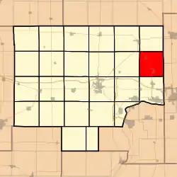 Location in Bureau County | |
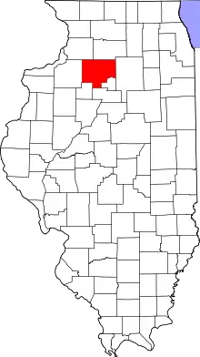 Bureau County's location in Illinois | |
| Coordinates: 41°27′34″N 89°13′20″W | |
| Country | United States |
| State | Illinois |
| County | Bureau |
| Established | November 6, 1849 |
| Area | |
| • Total | 34.74 sq mi (90.0 km2) |
| • Land | 34.73 sq mi (90.0 km2) |
| • Water | 0.01 sq mi (0.03 km2) 0.03% |
| Elevation | 699 ft (213 m) |
| Population (2010) | |
| • Total | 941 |
| • Estimate (2016)[1] | 901 |
| • Density | 27.1/sq mi (10.5/km2) |
| Time zone | UTC-6 (CST) |
| • Summer (DST) | UTC-5 (CDT) |
| ZIP codes | 61312, 61317, 61330 |
| FIPS code | 17-011-80268 |
Geography
According to the 2010 census, the township has a total area of 34.74 square miles (90.0 km2), of which 34.73 square miles (90.0 km2) (or 99.97%) is land and 0.01 square miles (0.026 km2) (or 0.03%) is water.[2]
Cemeteries
- Arlington
- Bereans
- Calvery Catholic
- Cherry Miner's
- Lost Grove
Major highways
Airports and landing strips
- Funfsinn Airport
- Gerald H Hamer Airport
- Hahn Airport
School districts
- La Moille Community Unit School District 303
- Mendota Elementary School District 289
- Mendota High School District 280
Political districts
- Illinois's 11th congressional district
- State House District 76
- State Senate District 38
References
- "Westfield Township, Bureau County, Illinois". Geographic Names Information System. United States Geological Survey. Retrieved 4 January 2010.
- US Census Bureau 2007 TIGER/Line Shapefiles
- US National Atlas
- "Population and Housing Unit Estimates". Retrieved June 9, 2017.
- "Population, Housing Units, Area, and Density: 2010 - County". US Census Bureau. Archived from the original on 12 February 2020. Retrieved 28 May 2013.
- "Census of Population and Housing". Census.gov. Retrieved June 4, 2016.
External links
Places adjacent to Westfield Township, Bureau County, Illinois | |
|---|---|
Municipalities and communities of Bureau County, Illinois, United States | ||
|---|---|---|
| Cities | Map of Illinois highlighting Bureau County | |
| Villages | ||
| Townships | ||
| Unincorporated communities | ||
| Ghost town | ||
| Footnotes | ‡This populated place also has portions in an adjacent county or counties | |
| ||
This article is issued from Wikipedia. The text is licensed under Creative Commons - Attribution - Sharealike. Additional terms may apply for the media files.