Wexham
Wexham is a civil parish in the county of Buckinghamshire in southern England. It is on the boundary of the unitary authority of Slough, its post town. Wexham Park Hospital is a large hospital on the parish border and Burnham Beeches, a forest takes in small parts of its northern land.
| Wexham | |
|---|---|
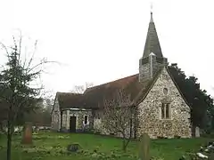 St Mary's parish church | |
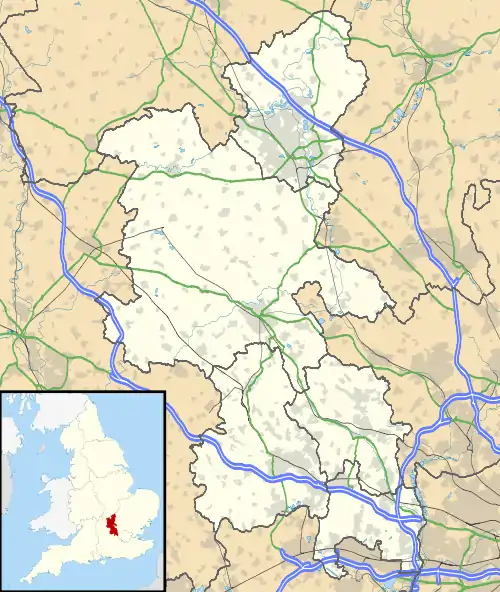 Wexham Location within Buckinghamshire | |
| Area | 11.19 km2 (4.32 sq mi) |
| Population | 2,378 (2011 census)[1] |
| • Density | 213/km2 (550/sq mi) |
| OS grid reference | SU9983 |
| Unitary authority | |
| Ceremonial county | |
| Region | |
| Country | England |
| Sovereign state | United Kingdom |
| Post town | Slough |
| Postcode district | SL3 |
| Dialling code | 01753 |
| Police | Thames Valley |
| Fire | Buckinghamshire |
| Ambulance | South Central |
| UK Parliament | |
History
The parish originally covered a relatively small 748 acres (3.0 km2) (1.2 square miles) according to the 1881 and 1891 censuses. It was almost doubled in 1934 by taking in 1,823 acres (7.38 km2) and about 1,000 people from the dissolved Langley Marish parish, a very long strip parish part of which was taken in by Gerrards Cross almost four miles to the north.
Wexham civil parish was divided under the Local Government Act 1972, with the southern part becoming part of Slough and the northern part becoming part of the present district. The northern part now constitutes the civil parish of Wexham, with the southern part having been a parish called Wexham Court. Wexham Court was abolished on the 1st of April 2019.[2]
Wexham Court had a parish council with 11 members. It and some additional unparished territory formed the current (adjustable) three-member Slough Borough Council ward of Wexham Lea.
The civil parish of Wexham includes in order of number of inhabitants: George Green, Middlegreen, and Wexham Street. It has protected green spaces comprising woodland, Langley Park and Black Park Country Park.
The village has a 12th-century parish church and the 16th century Wexham Court.
Demography
| Output area | Homes owned outright | Owned with a loan | Socially rented | Privately rented | Other | km² roads | km² water | km² domestic gardens | km² domestic buildings | km² non-domestic buildings | Usual residents | km² |
|---|---|---|---|---|---|---|---|---|---|---|---|---|
| Civil parish | 453 | 307 | 94 | 73 | 9 | 0.247 | 0.205 | 0.508 | 0.084 | 0.048 | 2378 | 11.19 |
Education
The parish relies for its education on neighbouring villages with greater populations, save that the Japanese international boarding school Teikyo School United Kingdom is in Wexham.[3]
See also
References
- Key Statistics: Dwellings; Quick Statistics: Population Density; Physical Environment: Land Use Survey 2005
- "The Slough Borough Council (Reorganisation of Community Governance) Order 2019" (PDF). Local Government Boundary Commission for England. Retrieved 13 May 2019.
- "Head's Welcome." (Archive) Teikyo School United Kingdom. Retrieved on 8 January 2014. "Framewood Road, Wexham, Buckinghamshire SL2 4QS UK"
External links
South Bucks District | ||
|---|---|---|
| Towns (component areas and hamlets) |  | |
| Other civil parishes (component villages and hamlets) | ||
| Former districts and boroughs | ||
| Former constituencies | ||
