Wheatland, Minnesota
Wheatland is an unincorporated community in Wheatland Township, Rice County, Minnesota, United States.
Wheatland | |
|---|---|
 Wheatland Location of the community of Wheatland within Wheatland Township, Rice County  Wheatland Wheatland (the United States) | |
| Coordinates: 44°27′53″N 93°29′01″W | |
| Country | United States |
| State | Minnesota |
| County | Rice County |
| Township | Wheatland Township |
| Elevation | 1,053 ft (321 m) |
| Time zone | UTC-6 (Central (CST)) |
| • Summer (DST) | UTC-5 (CDT) |
| ZIP code | 56069 |
| Area code(s) | 507 |
| GNIS feature ID | 655007[1] |
The community is located along Union Lake Trail, near its junctions with Jennings Avenue and Kent Avenue.
Nearby places include Lonsdale, Veseli, Montgomery, New Prague, and Millersburg.
| Historical population | |||
|---|---|---|---|
| Census | Pop. | %± | |
| 1900 | 135 | — | |
| 1910 | 85 | −37.0% | |
| U.S. Decennial Census[2] | |||
References
Municipalities and communities of Rice County, Minnesota, United States | ||
|---|---|---|
| Cities | 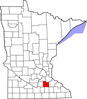 Map of Minnesota highlighting Rice County | |
| Townships | ||
| CDP | ||
| Unincorporated communities | ||
| Ghost towns/Neighborhoods | ||
| Footnotes | ‡This populated place also has portions in an adjacent county or counties | |
| ||
This article is issued from Wikipedia. The text is licensed under Creative Commons - Attribution - Sharealike. Additional terms may apply for the media files.