Wooroonden
Wooroonden is a rural locality in the South Burnett Region, Queensland, Australia.[2] In the 2016 census Wooroonden had a population of 59 people.[1]
| Wooroonden Queensland | |||||||||||||||
|---|---|---|---|---|---|---|---|---|---|---|---|---|---|---|---|
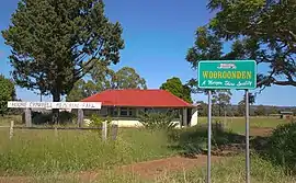 Wooroonden State School, 2011 | |||||||||||||||
 Wooroonden | |||||||||||||||
| Coordinates | 26.1130°S 151.7597°E | ||||||||||||||
| Population | 59 (2016 census)[1] | ||||||||||||||
| • Density | 1.973/km2 (5.11/sq mi) | ||||||||||||||
| Postcode(s) | 4605 | ||||||||||||||
| Area | 29.9 km2 (11.5 sq mi) | ||||||||||||||
| Time zone | AEST (UTC+10:00) | ||||||||||||||
| LGA(s) | South Burnett Region | ||||||||||||||
| State electorate(s) | Nanango | ||||||||||||||
| Federal Division(s) | Wide Bay | ||||||||||||||
| |||||||||||||||
History
Wooroon State School opened in 1917. In 1919 the spelling was changed to Woroon State School. In 1925 it was renamed Woroonden State School. It closed in 1963.[3]
The school was originally known as Woroonden School, but on advice from the Murgon Shire Council on 24 January 2002, the locality was to be known as Wooroonden.[2]
In the 2016 census Wooroonden had a population of 59 people.[1]
References
| Wikimedia Commons has media related to Wooroonden. |
- Australian Bureau of Statistics (27 June 2017). "Wooroonden (SSC)". 2016 Census QuickStats. Retrieved 20 October 2018.

- "Wooroonden – locality in South Burnett Region (entry 46284)". Queensland Place Names. Queensland Government. Retrieved 29 December 2020.
- Queensland Family History Society (2010), Queensland schools past and present (Version 1.01 ed.), Queensland Family History Society, ISBN 978-1-921171-26-0
This article is issued from Wikipedia. The text is licensed under Creative Commons - Attribution - Sharealike. Additional terms may apply for the media files.