Wyoming Highway 132
Wyoming Highway 132 (WYO 132) is a 17.43-mile-long (28.05 km) north–south Wyoming State Road in Fremont County that travels from U.S. Route 287 (US 287) near Lander, north to Kinnear by way of Ethete.
| ||||
|---|---|---|---|---|
| Blue Sky Highway | ||||
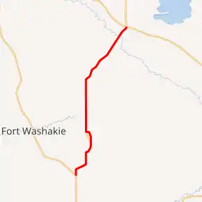
WYO 132 highlighted in red | ||||
| Route information | ||||
| Maintained by WYDOT | ||||
| Length | 17.43 mi[1] (28.05 km) | |||
| Major junctions | ||||
| South end | ||||
| North end | ||||
| Location | ||||
| Counties | Fremont | |||
| Highway system | ||||
State highways in Wyoming
| ||||

Route description
Wyoming Highway 132 begins its southern end north of Lander at US 287. Highway 132 proceeds northward toward Ethete. Before reaching Ethete, 17 mile Road is intersected which turns into Wyoming Highway 137 east of here. Ethete is reached at approximately 7 miles into the route.[2] WYO 132 heads north finally reaching its northern terminus at U.S. Route 26 and the southern end of Wyoming Highway 133 at 17.43 miles.[3] Highway 132 lies entirely within the Wind River Indian Reservation.
Major intersections
The entire route is in Fremont County. [4]
| Location[4] | mi | km | Destinations | Notes | |
|---|---|---|---|---|---|
| | 0.00 | 0.00 | |||
| Ethete | 4.70 | 7.56 | 17 mile Road | To WYO 137 | |
| Johnstown | 17.43 | 28.05 | |||
| Continuation beyond northern terminus; southern terminus WYO 133 | |||||
| 1.000 mi = 1.609 km; 1.000 km = 0.621 mi | |||||
References
- Wyoming Department of Transportation Reference Marker Book - November 2004 (PDF) (Map). WYDOT. Archived from the original (PDF) on July 17, 2011. Retrieved 2011-10-19.
- Google (19 October 2011). "Overview Map of Wyoming Highway 132" (Map). Google Maps. Google. Retrieved 19 October 2011.
- Wyoming @ AARoads.com - Wyoming Routes 100-199
- Geography Division (2016). "Wyoming Governmental Unit Reference Map". United States Census Bureau. Retrieved January 23, 2017.