Wyoming Highway 137
Wyoming Highway 137 (WYO 137) was a 8.79-mile-long (14.15 km) east–west Wyoming State Road in central Fremont County.
| ||||
|---|---|---|---|---|
| 17 Mile Road | ||||
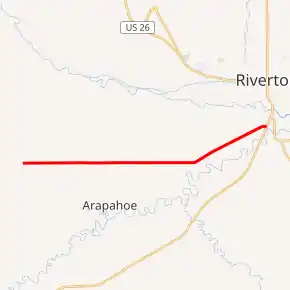
WYO 137 highlighted in red | ||||
| Route information | ||||
| Maintained by Wind River Indian Reservation | ||||
| Length | 8.79 mi[1] (14.15 km) | |||
| Existed | ?–c. 2015 | |||
| Major junctions | ||||
| West end | 17 Mile Road east of Ethete | |||
| East end | ||||
| Location | ||||
| Counties | Fremont | |||
| Highway system | ||||
State highways in Wyoming
| ||||

Route description
Wyoming Highway 137 began its western end at 17 mile Road, east of Ethete, and northwest of Arapahoe, a census-designated place (CDP). 17 Mile Road continues west from here to Wyoming Highway 132 near Ethete.[2][3] Highway 137 traveled eastward and intersected the northern terminus of Wyoming Highway 138 in the unincorporated community of St. Stephens at just over five miles. WYO 137 turned east-northeast for the remainder of its route and ended 3 miles later at Wyoming Highway 789 south of Riverton. The entire route was located within the Wind River Indian Reservation.[3]
History
Upon completion of various roadway improvement projects along the route circa 2013, the Wyoming Department of Transportation turned control of WYO 137 over to tribal control by 2015. The road remains open to the public, with maintenance and law enforcement duties residing with the Northern Arapaho and Eastern Shoshone tribes.[4]
Major intersections
The entire route was in Fremont County. [5]
| Location[5] | mi | km | Destinations | Notes | |
|---|---|---|---|---|---|
| | 0.00 | 0.00 | 17 Mile Road | ||
| Arapahoe | 5.76 | 9.27 | Northern terminus of WYO 138 | ||
| 8.79 | 14.15 | ||||
| 1.000 mi = 1.609 km; 1.000 km = 0.621 mi | |||||
References
- Wyoming Department of Transportation Reference Marker Book - November 2004 (PDF) (Map). WYDOT. Archived from the original (PDF) on July 17, 2011. Retrieved 2011-10-20.
- Google (10 November 2011). "Overview Map of Wyoming Highway 137" (Map). Google Maps. Google. Retrieved 10 November 2011.
- Wyoming @ AARoads.com - Wyoming Routes 100-199
- "East end of 17 Mile Road is now a Wind River Reservation roadway". County 10. 16 September 2015. Retrieved 12 June 2016.
- Geography Division (2016). "Wyoming Governmental Unit Reference Map". United States Census Bureau. Retrieved January 23, 2017.