Wyoming Highway 338
Wyoming Highway 338 (WYO 338) is a 15.03-mile-long (24.19 km) north-south Wyoming State Road located in north-central Sheridan County.
| ||||
|---|---|---|---|---|
| Decker Road | ||||
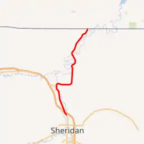
WYO 338 highlighted in red | ||||
| Route information | ||||
| Maintained by WYDOT | ||||
| Length | 15.03 mi[1] (24.19 km) | |||
| Major junctions | ||||
| South end | ||||
| North end | ||||
| Location | ||||
| Counties | Sheridan | |||
| Highway system | ||||
State highways in Wyoming
| ||||

Route description
Wyoming Highway 338 begins its southern end in Sheridan at I-90 BUS/US 14 BUS/US 87 BUS (N. Main Street) and exit 20 of Interstate 90, which also carries US 14 and US 87 at this point. Named Decker Road for the Montana community it reaches, WYO 338 travels north, passing under I-90, and paralleling it to the east.[2] At approximately 4.2 miles, WYO 338 intersects the eastern terminus of WYO 339 (Jensick Connector) which links Highway 338 with exit 16 of I-90.[3] Past 339, WYO 338 curves due east before turning back north on which it will stay to complete its routing. At 15.03 miles, Wyoming Highway 338 reaches its northern terminus at Montana Secondary Highway 314 at the Montana State Line.[2][3]
History
The length of Wyoming Highway 338 between its southern terminus and Wyoming Highway 339 is the original routing of US 14/US 87 prior to the construction of Interstate 90.[3]
Major intersections
The entire route is in Sheridan County. [4]
| Location[4] | mi | km | Destinations | Notes | |
|---|---|---|---|---|---|
| Sheridan | 0.00 | 0.00 | Exit 20 on I-90 | ||
| | 4.16 | 6.69 | Eastern terminus of WYO 339; to Exit 16 on I-90 | ||
| | 15.03 | 24.19 | Continuation beyond Montana state line | ||
| 1.000 mi = 1.609 km; 1.000 km = 0.621 mi | |||||
References
- Wyoming Department of Transportation Reference Marker Book - November 2004 (PDF) (Map). WYDOT. Archived from the original (PDF) on July 17, 2011. Retrieved 2010-02-24.
- Google (26 December 2016). "Wyoming Highway 338" (Map). Google Maps. Google. Retrieved 26 December 2016.
- aaroads.com - Wyoming Highway 338
- Geography Division (2016). "Wyoming Governmental Unit Reference Map". United States Census Bureau. Retrieved January 24, 2017.