Wyoming Highway 451
Wyoming Highway 451 (WYO 451) is a 5.026-mile-long (8.089 km) east-west Wyoming State Road in Weston County that acts as a spur from U.S. Route 16 at Osage west to Weston County Routes 22 and 36B.
| ||||
|---|---|---|---|---|
| Oil City Road | ||||
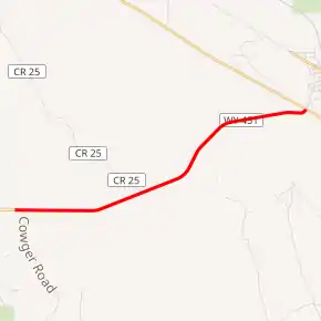
WYO 451 highlighted in red | ||||
| Route information | ||||
| Maintained by WYDOT | ||||
| Length | 5.026 mi[1] (8.089 km) | |||
| Major junctions | ||||
| West end | ||||
| East end | ||||
| Location | ||||
| Counties | Weston | |||
| Highway system | ||||
State highways in Wyoming
| ||||

Route description
Wyoming Highway 451 begins its western end west of Osage at Weston County Route 22 and County Route 36B just west of Beaver Creek in the Thunder Basin National Grassland. County Route 22 (Oil City Road) is the continuation of the roadway westward. WYO 451 heads west and ends at US 16 in the census-designated place (CDP) of Osage.[2]
Major intersections
The entire route is in Weston County. [3]
| Location[3] | mi | km | Destinations | Notes | |
|---|---|---|---|---|---|
| | 0.000 | 0.000 | |||
| Osage | 5.026 | 8.089 | |||
| 1.000 mi = 1.609 km; 1.000 km = 0.621 mi | |||||
References
- Wyoming Department of Transportation Reference Marker Book (PDF) (Map). WYDOT. March 2012. Retrieved December 22, 2012.
- Google (December 22, 2012). "Wyoming Highway 451" (Map). Google Maps. Google. Retrieved December 22, 2012.
- Geography Division (2016). "Wyoming Governmental Unit Reference Map". United States Census Bureau. Retrieved January 24, 2017.
External links
| Wikimedia Commons has media related to Wyoming Highway 451. |
This article is issued from Wikipedia. The text is licensed under Creative Commons - Attribution - Sharealike. Additional terms may apply for the media files.