Wyoming Highway 76
Wyoming Highway 76 (WYO 76) is a 6.54-mile (10.53 km) long east-west Wyoming state highway in Carbon County that travels from Rawlins to Sinclair.
| ||||||||||
|---|---|---|---|---|---|---|---|---|---|---|
WYO 76 highlighted in red | ||||||||||
| Route information | ||||||||||
| Maintained by WYDOT | ||||||||||
| Length | 6.54 mi[1] (10.53 km) | |||||||||
| Major junctions | ||||||||||
| West end | ||||||||||
| East end | ||||||||||
| Location | ||||||||||
| Counties | Carbon | |||||||||
| Highway system | ||||||||||
State highways in Wyoming
| ||||||||||

Route description
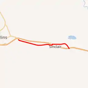
Highway 76 is the former routing of U.S. Routes 30 and 287 and still closely parallels their new route on Interstate 80. Highway 76 begins its west end at exit 215 of I-80 / US 30 / US 287 and the eastern terminus of I-80 Business / US 30 Business. Highway 76 heads east, running south of the interstate, but closely paralleling it until the town of Sinclair where I-80 / US 30 / US 287 pass over Highway 76 as it turns north and heads into town as S. 9th Street.[2] At just over 4 miles, WYO 76 turns east on Lincoln Avenue (Exit 219 can be reached by heading west on Lincoln Avenue). Highway 76 continues east through the town of Sinclair as Lincoln Avenue, but now is on the north side of I-80. Shortly after leaving the town center, WYO 76 nears exit 221 of I-80/US 30/US 287 where it ends at 6.54 miles[2]
Exit 215 of Interstate 80 does not mention Highway 76, but there are trailblazer signs along its routing.[1]
History
In 1938, Highway 76 started out as the designation for Battle Mountain Road, which is the present-day routing of Highway 70 between Baggs and Riverside. At that time, the Highway 70 designation was applied to the current routing of Highway from Walcott Junction south into Saratoga, then south through Riverside into Colorado, then northeast into Laramie via Woods Landing.[1]
Today's current routing of Highway 76 is the former alignment of US 30 / US 287 between I-80 (Exit 215) at Rawlins east to the East Sinclair interchange of I-80 (Exit 221).[1]
Major intersections
The entire route is in Carbon County.
| Location | mi[2] | km | Destinations | Notes | |
|---|---|---|---|---|---|
| Rawlins | 0.00 | 0.00 | Continuation beyond I-80; eastern terminus of I-80 Bus. and US 30 Bus. | ||
| Western terminus; I-80 exit 215 | |||||
| Sinclair | 4.20 | 6.76 | |||
| 6.54 | 10.53 | Eastern terminus; I-80 exit 221 | |||
| 1.000 mi = 1.609 km; 1.000 km = 0.621 mi | |||||
References
- Wyoming @ AARoads.com - Wyoming Routes 000-099
- Google (14 August 2016). "Wyoming Highway 76" (Map). Google Maps. Google. Retrieved 14 August 2016.
- Official 2003 State Highway Map of Wyoming