Zigoitia
Zigoitia (Spanish: Cigoitia) is a municipality of the province of Álava, Basque Country, Spain.
Zigoitia | |
|---|---|
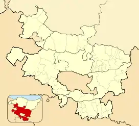 Zigoitia Location in Spain 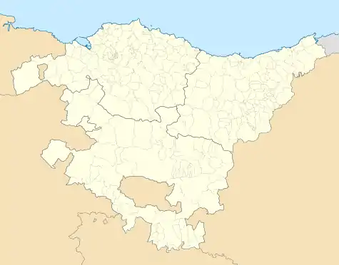 Zigoitia Zigoitia (Basque Country) 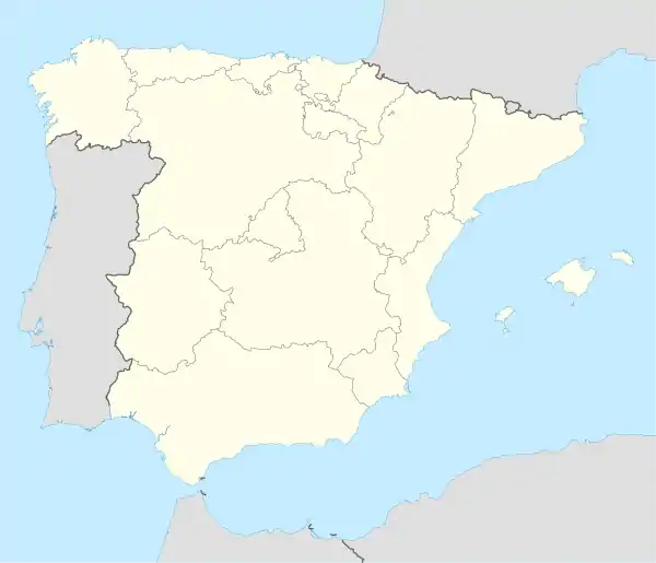 Zigoitia Zigoitia (Spain) | |
| Coordinates: 42°58′6″N 2°43′41″W | |
| Country | |
| Autonomous community | |
| Province | Álava |
| Comarca | Zigoitia |
| Government | |
| • Alcalde | Ioseba Mikel Las Heras Martinez de Lapera (Bildu) |
| Area | |
| • Total | 10,207 km2 (3,941 sq mi) |
| Elevation | 600 m (2,000 ft) |
| Population (2018)[1] | |
| • Total | 1,753 |
| • Density | 0.17/km2 (0.44/sq mi) |
| Postal code | 01138 |
Place name
The city's name Zigoitia is believed to derive from the Basque expression Zuya goitia (upper Zuya) because it borders with the municipality and valley of Zuya at the west.
The fact that Zigoitia is higher than Zuya could be an explanation for the name Zuya goitia. The existence of resilient historical links between both valleys also has to be validated; since Zigoitia historically belonged to Cuadrilla de Zuya.
Zigoitia is the normalized form of the town name in the Basque language, according to the actual pronunciation in that language and the modern Basque orthography. In 1995 it was adopted by the Town Council as the official municipal name. It was published by the Boletín Oficial del Estado on 13 September 1996.
In 2013 the largest common grave of the Basque Country from the Spanish Civil War was excavated in the locality.
Demography
According to the nomenclátor in 2011, the population registered in the municipality and in its localities was:
- Cigoitia: 1 729 inhabitants
- Acosta (officially Acosta/Okoizta): 68 inhabitants
- Apodaca (officially Apodaka): 163 inhabitants
- Berrícano (officially Berrikano): 111 inhabitants
- Buruaga: 50 inhabitants
- Cestafe (officially Zestafe): 44 inhabitants
- Echágüen (officially Etxaguen): 82 inhabitants
- Echávarri-Viña (officially Etxabarri-Ibiña): 321 inhabitants
- Eribe: 71 inhabitants
- Gopegui (officially Gopegi): 243 inhabitants
- Larrinoa: 13 inhabitants
- Letona: 44 inhabitants
- Manurga: 76 inhabitants
- Mendarózqueta (officially Mendarozketa): 53 inhabitants
- Murua: 146 inhabitants
- Olano: 23 inhabitants
- Ondátegui (officially Ondategi): 159 inhabitants
- Záitegui (officially Zaitegi): 42 inhabitants
- Dispersed citizens in Cigoitia: 22 inhabitants
Local administration
The capital status is in Ondategi and it has 16 councils:
- Acosta
- Apodaca
- Berrícano
- Buruaga
- Cestafe
- Echávarri-Viña
- Eribe
- Echágüen
- Gopegui
- Letona
- Manurga
- Mendarózqueta
- Murua
- Olano
- Ondátegui
- Záitegui
See also
Área funcional de Vitoria - Álava Central
References
- Municipal Register of Spain 2018. National Statistics Institute.
External links
| Wikimedia Commons has media related to Zigoitia. |
| Authority control |
|
|---|
