1930 Atlantic hurricane season
The 1930 Atlantic hurricane season was the second least active Atlantic hurricane season on record – behind only 1914 – with only three systems reaching tropical storm intensity. Of those three, two reached hurricane status, both of which also became major hurricanes, Category 3 or higher storms on the Saffir–Simpson hurricane wind scale.[1] The first system developed in the central Atlantic Ocean on August 21. Later that month, a second storm, the Dominican Republic hurricane, formed on August 29. It peaked as a Category 4 hurricane with winds of 155 mph (250 km/h). The third and final storm dissipated on October 21.
| 1930 Atlantic hurricane season | |
|---|---|
 Season summary map | |
| Seasonal boundaries | |
| First system formed | June 14, 1930 |
| Last system dissipated | October 21, 1930 |
| Strongest storm | |
| Name | "Dominican Republic" |
| • Maximum winds | 155 mph (250 km/h) (1-minute sustained) |
| • Lowest pressure | 933 mbar (hPa; 27.55 inHg) |
| Seasonal statistics | |
| Total storms | 3 |
| Hurricanes | 2 |
| Major hurricanes (Cat. 3+) | 2 |
| Total fatalities | 2,000 – 8,000 total |
| Total damage | $50 million (1930 USD) |
| Related article | |
Due to the lack of systems that developed, only one tropical cyclone, the second hurricane, managed to make landfall during the season.[2] It severely impacted areas of the Greater Antilles, particularly the Dominican Republic, before making subsequent landfalls on Cuba and the U.S. states of Florida and North Carolina, with less severe effects. The estimated 2,000 to 8,000 deaths caused by the storm in the Dominican Republic alone ranked it as one of the deadliest Atlantic hurricanes in recorded history. No other storms affected any landmasses during the year, although the first storm damaged a cruise ship in open waters.
The season's inactivity was reflected in its low accumulated cyclone energy (ACE) rating of 50.[1] ACE is, broadly speaking, a measure of the power of the hurricane multiplied by the length of time it existed, so storms that last a long time, as well as particularly strong hurricanes, have high ACEs. It is only calculated for full advisories on tropical systems at or exceeding 39 mph (63 km/h), which is tropical storm strength.[3]
Timeline

Systems
Hurricane One
| Category 3 hurricane (SSHWS) | |
  | |
| Duration | August 21 – August 28 |
|---|---|
| Peak intensity | 125 mph (205 km/h) (1-min) 960 mbar (hPa) |
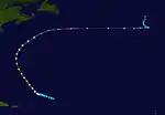
The first hurricane of the season was first noted in the central Atlantic Ocean on August 21. Slowly intensifying, the system initially moved towards the west.[2] On August 22, a steamship in the vicinity sustained some structural damage.[4] After attaining hurricane strength on August 24, the system turned northwestward, and reached Category 3 intensity on August 25 with maximum sustained winds of 125 mph (205 km/h) as it grazed Bermuda.[2] Recurving to the northeast, a French cruise liner encountered the hurricane while it was a Category 2 hurricane. A large wave struck the ship, shattering glass on the vessel and injuring 40 passengers.[4] Although still a Category 2 hurricane, the system became extratropical shortly after on August 28.[2] The extratropical storm was tracked due east towards the Azores for a few days while gradually weakening before abruptly turning to the north and dissipating.[4]
Hurricane Two
| Category 4 hurricane (SSHWS) | |
  | |
| Duration | August 29 – September 17 |
|---|---|
| Peak intensity | 155 mph (250 km/h) (1-min) 933 mbar (hPa) |
The Dominican Republic Hurricane of 1930
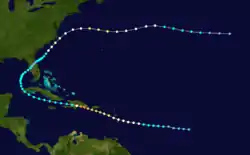
A tropical depression developed well east of the Lesser Antilles on August 29. Initially drifting westward, the storm gradually intensified and became a tropical storm early the next day. By August 31, the system strengthened into a Category 1 hurricane.[2] The next day, the hurricane entered the Caribbean Sea, passing the island of Dominica as a Category 2 hurricane. Continuing to intensify, the storm further intensified into a Category 3 hurricane on September 2 and then to a Category 4 the following day. Around 18:00 UTC on September 3, the hurricane peaked with winds of 155 mph (250 km/h),[2] observed by a ship.[5] Simultaneously, the storm made landfall near Santo Domingo, Dominican Republic.[2]
The mountainous terrain of Hispaniola rapidly weakened the system to a tropical storm early on September 4. Moving westward over the Caribbean Sea, the storm failed to re-strengthen before making landfall in western Cuba with winds of 40 mph (65 km/h) around midday on September 6. Thereafter, the system entered the Gulf of Mexico and curved northeastward. At 09:00 UTC on September 9, the storm again made landfall near Bradenton, Florida with winds of 45 mph (75 km/h). Later that day, the storm weakened to a tropical depression while crossing Florida. Upon emerging into the Atlantic Ocean on the next day, the system re-intensified into a tropical storm. While located offshore South Carolina, the storm re-attained hurricane status early on September 12. The hurricane then brushed the Outer Banks of North Carolina before heading out to sea. The storm further strengthened to Category 2 intensity, heading eastward, but weakened to a tropical storm early on September 16. The following day, the storm deteriorated further to a tropical depression, and late on September 17, the depression dissipated southwest of the Azores.[2]
While crossing the Lesser Antilles, the hurricane brought powerful winds and heavy rainfall to the islands.[5] On Dominica, crops suffered severe damage. All vessels at the harbor sank, killing two people.[6] Winds on Puerto Rico left mostly minor damage to plantations, and rainfall was generally "beneficial".[5] In the Dominican Republic, three districts of Santo Domingo were destroyed, with half of the city leveled by the hurricane.[7] Damages in the city were an estimated $50 million (1930 USD). The Red Cross estimated 2,000 people perished in the city, with an additional 8,000 injured.[5] However, the actual death toll may never be known, and historians estimate the hurricane left between 2,000 and 8,000 fatalities.[8] Haiti experienced crop damage due to the storm.[4] In Florida, "damaging" rainfall was observed over southeastern Hillsborough County, with 8 to 9 in (200 to 230 mm) measured. Press reports indicated damage to highways and bridges, and crops were inundated. Damage reached approximately $75,000. After passing the Outer Banks of North Carolina as re-intensifying hurricane, power outages occurred across the region. Buildings at Cape Lookout were severely damaged.[9]
Tropical Storm Three
| Tropical storm (SSHWS) | |
  | |
| Duration | October 18 – October 21 |
|---|---|
| Peak intensity | 70 mph (110 km/h) (1-min) 992 mbar (hPa) |
The final storm of the season developed in the Bay of Campeche on October 18 at the tail end of a frontal boundary. Although cool-air advection was occurring off the United States coast, warm air around the system allowed the tropical storm to intensify. Moving to the northeast, the system reached peak intensity as a high-end tropical storm with winds of 70 mph (110 km/h). Ultimately, the cool-air advection eventually took a toll on the storm, causing it to quickly weaken. By 06:00 UTC on October 21, the storm dissipated.[9]
References
- Atlantic basin Comparison of Original and Revised HURDAT. Hurricane Research Division; Atlantic Oceanographic and Meteorological Laboratory (Report). Miami, Florida: National Oceanic and Atmospheric Administration. March 2011. Retrieved March 27, 2014.
- "Atlantic hurricane best track (HURDAT version 2)" (Database). United States National Hurricane Center. May 25, 2020.
- David Levinson (August 20, 2008). 2005 Atlantic Ocean Tropical Cyclones. National Climatic Data Center (Report). Asheville, North Carolina: National Oceanic and Atmospheric Administration. Retrieved July 1, 2013.
- F.A. Young. Weather of the Atlantic and Pacific Oceans (PDF) (Report). Retrieved July 1, 2014.
- F. Eugene Hartwell (1930). The Santo Domingo Hurricane of September 1 to 5, 1930 (PDF) (Report). San Juan, Puerto Rico: Weather Bureau. Retrieved July 1, 2014.
- "Two Dead in Dominica". The Milwaukee Journal. Pointe-à-Pitre, Guadeloupe. Associated Press. September 6, 1930. Retrieved July 1, 2014.
- "Santo Domingo Destroyed". Associated Press. September 4, 1930.
- Edward N. Rappaport and Jose Fernandez-Partagas (April 22, 1997). The Deadliest Atlantic Tropical Cyclones, 1492–1996. National Hurricane Center (Report). Miami, Florida: National Oceanic and Atmospheric Administration. Retrieved July 1, 2014.
- Christopher W. Landsea; et al. (December 2012). Documentation of Atlantic Tropical Cyclones Changes in HURDAT. Atlantic Oceanographic and Meteorological Laboratory (Report). Miami, Florida: National Oceanic and Atmospheric Administration. Retrieved July 1, 2014.
External links
| Wikimedia Commons has media related to 1930 Atlantic hurricane season. |