1946 Chatkal earthquake
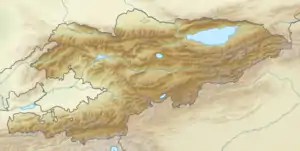
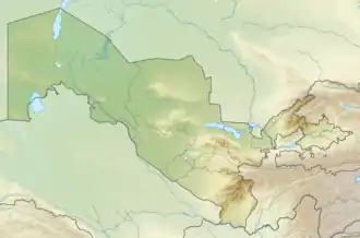
On November 2 of 1946, west Kyrgyzstan (then the Kirghiz Soviet Socialist Republic in the Soviet Union) was struck by a magnitude 7.5-7.6 earthquake, the largest in the republic since 1911.[1] The earthquake's hypocenter is probably located beneath the Tien Shan Mountains, near the border with Uzbekistan and north of Namangan.
   | |
| UTC time | 1946-11-02 18:28:35 |
|---|---|
| ISC event | 898647 |
| USGS-ANSS | ComCat |
| Local date | 3 November 1946 |
| Local time | 00:28 KGT |
| Magnitude | 7.5-7.6 Mw |
| Depth | 25.0 km |
| Epicenter | 41.757°N 71.854°E |
| Fault | Talas-Fergana Fault |
| Type | Thrust |
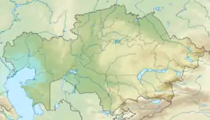
| Areas affected | Kyrgyzstan, Kazakhstan and Uzbekistan |
| Max. intensity | X (Extreme) |
| Landslides | Yes |
| Aftershocks | Yes |
| Casualties | Unknown |
The earthquake had a maximum intensity of X (Extreme) on the Mercalli intensity scale, and IX on the MSK scale. This shock rocked the entire country and Tian Shan Range. Severe property damage was reported in its aftermath but the number of deaths and injuries remains unknown. It has been considered one of the most devastating earthquakes in Central Asia.
Two days later, a magnitude 6.9 earthquake struck nearby Turkmenistan, killing 400 people.[2]
Earthquake
Geology
The Talas-Fergana Fault is a massive 800 km long intracontinental strike-slip fault running through the Tien Shan Mountains, the largest in Central Asia.[3][4] It has produced several significant earthquakes with magnitude 7.0 or greater in the past 6000 years with recurrence intervals on segments of the fault between 145 and 850 years, and an average of 375 years.[3] The earthquake of 1946 may have occurred on a branch of this fault known as the Atoinok Thrust Fault.[5][6]
Effects
.png.webp)
Man-made structures within a 1,500 km2 area around the epicenter were completely destroyed. Shuduger, Kichitovar, Chontovar villages were severely damaged or totally destroyed. Intensity X to VIII was evaluated to occupy an area perpendicular to the Chatkal Range, and parallel to the fault.[7][8]
Landslides, loams and rockfalls dammed rivers. A rockfall dammed the Naryn River, forming a quake lake. This threatened the small community of Toktogul with a possibility the rockfall dam breaching, causing a surge.
Surface ruptures up to 300 meters long and 50 meters wide fissured the landscape.
The earthquake's strength was also felt in Osh and Tashkent, Uzbekistan where the shaking intensity was VI (Strong) to IV (Light), causing substantial damage to buildings.
Aftershocks
Numerous aftershocks continued throughout the region. The largest included a magnitude 5.5 and 5.4 in 1955 and 1959.[9][10] Another magnitude 5.6 struck near Toktogul Reservoir on October 28 1971.[11]
References
- "Significant Earthquake Information KYRGYZSTAN". NGDC. Retrieved 27 December 2020.
- "Significant Earthquake TURKMENISTAN". NGDC. Retrieved 27 December 2020.
- A.M. Korzhenkov, E.A. Rogozhin, Shen Xuhui, Tian Qinjian, Xu Yueren (2014). "Strong paleoearthquakes along the Talas-Fergana Fault, Kyrgyzstan". Geodesy and Geodynamics. 5: 11–19. doi:10.3724/SP.J.1246.2014.01011 – via Elsevier Science Direct.CS1 maint: multiple names: authors list (link)
- Lauterbach, S., Mingram, J., Schettler, G., Orunbaev, S. (2019). "Two twentieth-century MLH = 7.5 earthquakes recorded in annually laminated lake sediments from Sary Chelek, western Tian Shan, Kyrgyzstan" (PDF). Quaternary Research. 92 (2): 288–303. Bibcode:2019QuRes..92..288L. doi:10.1017/qua.2019.21.CS1 maint: multiple names: authors list (link)
- Ulomov, V.I., Polyakova, T.P., Medvedeva, N.S. (2002). "On the Long-Term Prediction of Strong Earthquakes in Central Asia and the Black Sea–Caspian Region". Izvestiya, Physics of the Solid Earth. 38: 276–290.CS1 maint: multiple names: authors list (link)
- A. Tibaldi, C. Corazzato, D. Rust, F.L. Bonali, F.A. Pasquar`e Mariotto, A.M. Korzhenkov, P. Oppizzi, L. Bonzanig (2015). "Tectonic and gravity-induced deformation along the active Talas-Fergana Fault, Tien Shan, Kyrgyzstan" (PDF). Tectonophysics. 657: 38–62. Bibcode:2015Tectp.657...38T. doi:10.1016/j.tecto.2015.06.020.CS1 maint: multiple names: authors list (link)
- Kalmetieva, Z.A., Mikolaichuk, A.V., Moldobekov, B.D., Meleshko, A.V., Jantaev, M.M., Zubovich, A.V., Havenith, H.B. (2009). "The Atlas of Earthquakes in Kyrgyzstan". United Nations International Strategy for Disaster Reduction Secretariat Office in Central Asia.CS1 maint: multiple names: authors list (link)
- D. W. Simpson M. W. Hamburger V. D. Pavlov I. L. Nersesov (1981). "Tectonics and seismicity of the Toktogul Reservoir Region, Kirgizia, USSR". Journal of Geophysical Research. 86 (B1): 345–358. Bibcode:1981JGR....86..345S. doi:10.1029/JB086iB01p00345 – via Wiley Online Library.
- "M 5.5 - eastern Uzbekistan". USGS-ANSS. Retrieved 27 December 2020.
- "M 5.4 - Kyrgyzstan". USGS-ANSS. Retrieved 27 December 2020.
- "Event 779728 Kyrgyzstan". International Seismological Centre ISC: On-Line Bulletin. Retrieved 27 December 2020.