1969 Portugal earthquake
The 1969 Portugal earthquake struck western Portugal and Morocco on February 28 at 02:40 UTC. Originating west of the Strait of Gibraltar, the earthquake registered a magnitude of 7.8 and the maximum felt intensity was VII (Very strong) on the Mercalli intensity scale. In total, thirteen people died. Far more people sustained minor injuries.
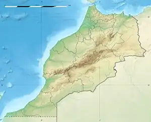 Location off the coast of Morocco and Portugal 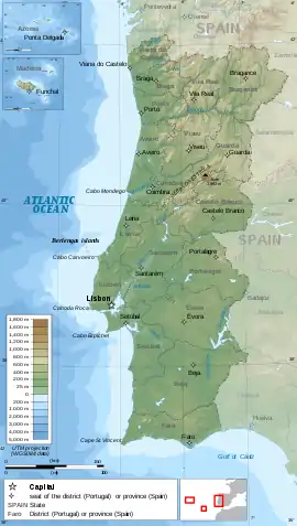 1969 Portugal earthquake (Portugal) | |
| UTC time | 1969-02-28 02:40:32 |
|---|---|
| ISC event | 812637 |
| USGS-ANSS | ComCat |
| Local date | February 28, 1969 |
| Local time | 02:40:32 |
| Magnitude | 7.8 Mw[1] |
| Depth | 22 km |
| Epicenter | 36.017°N 10.950°W |
| Areas affected | Portugal, Morocco |
| Tsunami | 1.14 m (3 ft 9 in)[2] 3 runups[2] |
| Aftershocks | 6.3 Mw Feb 28 at 04:25:35 UTC[3] |
| Casualties | 13 killed[2] 80 injured[2] |
Tectonic setting
The epicenter of the earthquake lies within a diffuse zone of seismicity known as the Azores–Gibraltar seismic belt,[4] which marks the boundary between the African Plate and the Eurasian Plate. The deformation at this plate boundary is transpressional in style, with dextral (right lateral) strike-slip accompanied by slow convergence (4 mm/yr).[5] Linear bathymetric features within this zone, such as the SW–NE trending Gorringe Bank, are thought to be a result of reverse faulting.[4] Investigations using multibeam swathe bathymetry have revealed additional SW–NE trending reverse faults and fold axes and a set of WNW–ESE trending lineaments, interpreted as strike-slip faults. The earthquake was located within the Horseshoe Abyssal Plain, where active reverse faulting has been imaged on seismic reflection data.[6]
Damage and casualties
At magnitude 7.8, the earthquake was considered very powerful. The resulting damage killed thirteen people (11 in Morocco and 2 in Portugal). Damage to local buildings was "moderate", according to the United States Geological Survey. Overall, structures were prepared for the earthquake and responded well, sustaining slight, if any, damage.[7]
Characteristics
The earthquake is interpreted to have resulted from movement on a southeast-dipping reverse fault.[4]
References
- NGDC. "Comments for the Significant Earthquake". Retrieved August 27, 2010.
- USGS (September 4, 2009), PAGER-CAT Earthquake Catalog, Version 2008_06.1, United States Geological Survey
- ISC (2014), ISC-GEM Global Instrumental Earthquake Catalogue (1900–2009), Version 1.05, International Seismological Centre
- Fukao, Y. (1973). "Thrust faulting at a lithospheric plate boundary the Portugal earthquake of 1969". Earth and Planetary Science Letters. 18 (2): 205–216. Bibcode:1973E&PSL..18..205F. doi:10.1016/0012-821X(73)90058-7.
- Grandin, R.; Borges, J.F.; Bezzeghoud, M.; Caldeira, B. & Carrilho, F. (2007). "Simulations of strong ground motion in SW Iberia for the 1969 February 28 (Ms = 8.0) and the 1755 November 1 (M ∼ 8.5) earthquakes – II. Strong ground motion simulations" (PDF). Geophysical Journal International. 171 (2): 807–822. Bibcode:2007GeoJI.171..807G. doi:10.1111/j.1365-246X.2007.03571.x. Retrieved February 13, 2011.
- Zitellini, N.; Grácia E.; Matias L.; Terrinha P.; Abreu M.A.; DeAlteris G.; Henriet J.P.; Dañobeitia J.J.; Masson D.G.; Mulder T.; Ramella R.; Somoza L. & Diez S. (2009). "The quest for the Africa–Eurasia plate boundary west of the Strait of Gibraltar" (PDF). Earth and Planetary Science Letters. 280 (1–4): 13–50. Bibcode:2009E&PSL.280...13Z. doi:10.1016/j.epsl.2008.12.005.
- "Earthquake History for February 28th". United States Geological Survey. December 18, 2009. Retrieved February 28, 2010.
External links
- The International Seismological Centre has a bibliography and/or authoritative data for this event.