1761 Lisbon earthquake
The 1761 Lisbon earthquake and North Atlantic tsunami of Portugal occurred in the Atlantic Ocean, south of the Iberian Peninsula. This violent shock which struck just after noon on March 31, 1761, was felt across many parts of Western Europe. Its direct effects were even observed far north in Scotland and Amsterdam, and to the south in the Canary Islands of Spain. The estimated surface-wave magnitude 8.5 event was the largest in the region, and the most significant earthquake in Europe since the Great Lisbon earthquake of 1755.
 1761 Lisbon earthquake (North Atlantic) | |
| Local date | March 31, 1761 |
|---|---|
| Local time | 12:01 pm WET |
| Duration | 8 minutes |
| Magnitude | 8.5 Ms |
| Epicenter | 34.5°N 13.0°W |
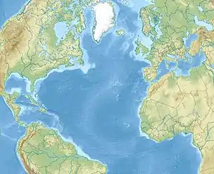
| Areas affected | Atlantic Ocean |
| Max. intensity | IX (Violent) |
| Tsunami | 2.4 meters (Transatlantic) |
| Aftershocks | Yes |
Records of this disaster are sparse as the Portuguese Government censored much information in order to avoid panic in the already ruined city.
Tectonic setting
The Azores-Gibraltar Fault form part of the complex and poorly defined plate boundary between the African and Eurasian plates that converge at a rate of 3.8 mm/yr. Here, a collection of strike-slip and thrust faults accommodate motion between the two plates, including the Horseshoe Fault, Marques Pombal Fault, Gorringe Bank Fault and Cádiz Subduction Zone.[1]
The earthquake is thought to have been sourced from a thrust fault located beneath the Coral Patch Seamount with an estimated rupture dimension of 200 km by 50 km.[2] The Coral Patch Thrust Fault is a component in the Africa-Eurasia plate boundary.[3] From an analysis of the reported duration of shaking, the rupture was suggested to propagate northwards, from the northern end of the 1755 rupture. This earthquake is likely to be a result of stress transfer from the 1755 event.[4] Based on measuring the tsunami run-up height, the estimated tsunami magnitude for this earthquake is 8.5, and is unlikely to be larger than the 1755 event.[5]
Earthquake
At noon on March 31, the Portuguese city Lisbon was rocked by an earthquake that lasted up to three minutes. Ruins in the city left by the 1755 earthquake collapsed while frightened residents ran outside. Shipping vessels offshore felt jolts during the earthquake. It was felt in many Spanish cities including Madrid and Aranjuez. Other European locations that felt the earthquake include Bayonne, Bordeaux and Roussillon in France, Amsterdam in The Netherlands, Cork, Ireland, and the Azores Islands.[6]
Much of the damage in Lisbon were towards old houses, and buildings already compromised by the 1755 earthquake. The city shook for at least five minutes. Piles of debris from the previous quake collapsed. The nearby mountain ranges were affected by rockslides. Shaking damaged a prison, and some 300 inmates managed to escape.[7] Surprisingly, no lives were lost in Lisbon but the damage was greater than 20,000 moidores. On the Modified Mercalli intensity scale, the earthquake reached an estimated VI (Strong) to VII (Very strong). The greatest destruction was in Setúbal and Vila Franca. In Porto, the city suffered heavy damage worse than those sustained in 1755, resulting in several people being killed. In Madeira, rockfalls were triggered, tumbling into the sea and destroying a church. Four people died as a result, with two being crushed while fishing when boulders tumbled on them.[7]
In Madrid, ground motions went on for five to 23 minutes. Some houses shook violently causing furniture to topple. Frightened residents ran out of their houses for fear of them collapsing. This prompted an inquiry from the Council of Castile and Diocese of Cartagena to obtain more information about the earthquake.[7]
In Fort Augustus, Scotland, the water level at Loch Ness rose some two feet (0.6 m) and then subsided. The unusual lake behavior continued for forty-five minutes to an hour. In Amsterdam, the chandelier of a church started vibrating in the afternoon, possibly caused by the earthquake.[6]
Cork, Ireland saw strong shaking, more violent than the 1755 quake.[7]
Tsunami
One hour and 25 minutes after the earthquake was felt in Lisbon, waves measuring up to eight feet (2.4 m) was observed approaching the coast and damaging ships. The sea retreated and advanced repeatedly even 13 hours after the earthquake, continuing into the night.[8]
Along the coasts of Spain, changes to the sea were witnessed but there were no records of the tsunami arriving, nor their heights.
In Barbados, waves between 18 inches (0.45 m) and four feet (1.2 m) that swept along the coast were attributed to the earthquake.[7][8]
On Terceira Island in the Azores, the tsunami picked up boats and smashed them against the rocky coastline.
At Mount's Bay in Cornwall, a tsunami of up six feet (1.8 m) advanced five times at 5 p.m. for an hour. In the Isles of Scilly, the sea rose up to four feet (1.2 m) at the time waves were seen in Cornwall. Penzance saw waves up to six feet (1.8 m) arriving in the early evenings five times. At Newlyn, the sea rose nearly six feet. Along the Irish coasts, the same phenomena were observed. At Kinsale, at about 6 p.m., the sea rose suddenly 2 feet (0.6 m) and retreated rapidly in 4 minutes, this being repeated, though to a less extent, several times. At Carrick, at 4 pm, the surface of the River Suir rose one foot (0.3 m). in five minutes. At Dungarvan, the sea ebbed and flowed five times between 4 and 9 pm. At Waterford, the sea advanced 30 feet (9 m) along the shore, while at Ross, County Wexford, a violent agitation of the river occurred at 7 p.m.[8][9]
References
- Wronna, Martin; Baptista, Maria Ana; Miranda, Jorge Miguel (2019). "Reanalysis of the 1761 transatlantic tsunami". Natural Hazards and Earth System Sciences. 19 (2): 337–352. doi:10.5194/nhess-2018-30.CS1 maint: multiple names: authors list (link)
- M. A. Baptista (2019). "Tsunamis Along the Azores Gibraltar Plate Boundary". Pure and Applied Geophysics. 117: 1713–1724. doi:10.1007/s00024-019-02344-8.
- Roy Barkan, Uri S. ten Brink, Jian Lin (2009). "Far field tsunami simulations of the 1755 Lisbon earthquake: Implications for tsunami hazard to the U.S. East Coast and the Caribbean" (PDF). Marine Geology. 264: 109–122. doi:10.1016/j.margeo.2008.10.010.CS1 maint: multiple names: authors list (link)
- Robert Muir-WoodArnaud Mignan (2009). "A Phenomenological Reconstruction of the Mw9 November 1st 1755 Earthquake Source. In: The 1755 Lisbon Earthquake: Revisited". Geotechnical, Geological, and Earthquake Engineering. 7: 121–146. doi:10.1007/978-1-4020-8609-0_8.
- Baptista, M. & Miranda, Jym & Luis, Joaquim (2006). "In Search of the 31 March 1761 Earthquake and Tsunami Source". Bulletin of the Seismological Society of America. 96: 713–721. doi:10.1785/0120050111.CS1 maint: multiple names: authors list (link)
- National Geophysical Data Center / World Data Service (NGDC/WDS): NCEI/WDS Global Significant Earthquake Database. NOAA National Centers for Environmental Information. "Significant Earthquake Information PORTUGAL: LISBON". doi:10.7289/V5TD9V7K. Retrieved 2021-02-01.
- Borlase, William (1 January 1761). LXV. Some account of the extraordinary agitation of the waters in Mount's-bay, and other places, on the 31st of March 1761: In a letter to the Reverend Dr. Charles Lyttelton, Dean of Exeter, from the Reverend William Borlase, M. A. F. R. S. The Royal Society.
- NCEI Global Historical Hazard Database. "Tsunami Event Information SW PORTUGAL". www.ngdc.noaa.gov. Retrieved 2021-02-01.
- M. A. Baptista and J. M. Miranda (2009). "Revision of the Portuguese catalog of tsunamis" (PDF). Natural Hazards and Earth System Sciences. 9 (1).
.png.webp)