A' Chràlaig
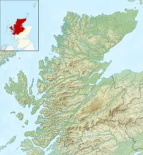
A' Chràlaig is a mountain in the Scottish Highlands, north of Loch Cluanie and south of Glen Affric. It is the highest peak along Glen Shiel and can be easily climbed from the Cluanie Inn on the A87.[3] The eastern slopes of the mountain, are owned by the Forestry Commission and are part of the Kintail National Scenic Area.
| A' Chràlaig | |
|---|---|
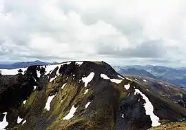
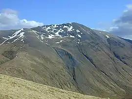 A' Chralaig from the northwest | |
| Highest point | |
| Elevation | 1,120 m (3,670 ft) [1] |
| Prominence | 786 m (2,579 ft) Ranked 38th in British Isles |
| Parent peak | Carn Eige |
| Listing | Munro, Marilyn |
| Coordinates | 57°11′5″N 05°09′16″W |
| Naming | |
| English translation | the basket [2] |
| Language of name | Gaelic |
| Pronunciation | Scottish Gaelic: [əˈxɾaːl̪ˠɛkʲ] English approximation: ə-KHRAH-lek |
| Geography | |
| Parent range | Northwest Highlands |
| OS grid | NH094148 |
| Topo map | OS Landranger 33 / 34 |
| Geology | |
| Mountain type | mountain |
Despite being the highest peak on the ridge, it is considered less interesting than the route over Stob Coire na Cràlaig to the nearby Mullach Fraoch-choire.[4] These two peaks may be combined with the neighbouring peaks of Sgurr nan Conbhairean and Sail Chaorainn to make the so-called "Cluanie Horseshoe", although no path connects A' Chràlaig with the peaks to the east.[5]

Cluanie Horseshoe
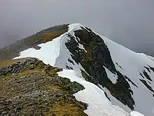
Summit from south ridge
References
- "walkhighlands A' Chralaig". walkhighlands.co.uk. 2014. Retrieved 9 January 2014.
- "A' Chralaig". MunroMagic.com.
- David Jarman (Autumn 2006). "On Diurnal Variations in the Remoteness and Tranquillity of the Highlands". Wild Land News. 67. Archived from the original on 11 October 2008.
- "Scotland's Munros: A' Chralaig". Walking Scotland.
- Anthony Dyer. "The Cluanie Horseshoe". Archived from the original on 30 April 2016.
 |
|  | |
List of Munros | |||
| Northern Highlands (20) |    | |
|---|---|---|
| Western Highlands (20) | ||
| Central and Eastern Highlands (13) | ||
| Southern Highlands (15) | ||
| Islands (13) | ||
| Scottish Lowlands, England and Wales (13) | ||
| Republic of Ireland, Northern Ireland (25) | ||
This article is issued from Wikipedia. The text is licensed under Creative Commons - Attribution - Sharealike. Additional terms may apply for the media files.