Ab-i Istada
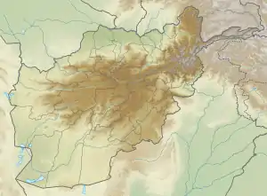
Ab-i Istada ("standing water"[1]) is an endorheic salt lake in Nawa District, Ghazni Province, Afghanistan. It lies in a large depression created by the Chaman Fault system in the southern foothills of the Hindu Kush, 125 kilometres (78 mi) south-southwest of Ghazni.[1]
| Ab-e Istada | |
|---|---|
| Āb-e Istāda, Ab-e Estada, Āb-e Īstādeh-e Moqor, Lake Istada | |
 Ab-e Istada in November 1996. The Kabul–Kandahar Highway is visible in the top left corner. | |
 Ab-e Istada | |
| Location | Nawa District, Ghazni Province, Afghanistan |
| Coordinates | 32.5°N 67.9°E |
| Type | Salt lake |
| Native name | آب ایستاده (Persian) |
| Primary inflows | Ghazni River, Sardeh River, Nahara River |
| Catchment area | 17,252 km2 (6,661 sq mi) |
| Basin countries | Afghanistan |
| Surface area | 130 km2 (50 sq mi) |
| Max. depth | 3.7 m (12 ft) |
| Surface elevation | 2,070 m (6,790 ft) |
| Islands | Loya ghundai, Kuchney ghundai |
In modern times the lake has been reported to have a surface area of 130 square kilometres (50 sq mi),[2] although it dries out periodically.[1][3] It is very shallow, not exceeding 3.7 m (12 ft) in depth.[4] There are two small islands near the lake's southeastern shore, Loya ghundai (2,500 m2 (27,000 sq ft)) and Kuchney ghundai (500 m2 (5,400 sq ft)).[2] The water is highly alkaline and mass die-offs of freshwater fish from the Ghazni River sometimes occur.[1]
The main inflows into Ab-i Istada are the Ghazni, Sardeh and Nahara Rivers, which drain into it from the northeast.[3] The watershed draining into the lake covers 17,252 square kilometres (6,661 sq mi) and was home to over 1.8 million people in 2003.[5] Three sets of raised beaches surrounding the lake have been noted at 2–3 m (6 ft 7 in–9 ft 10 in), 6–7 m (20–23 ft) and 9–10 m (30–33 ft) above the normal lake level.[1] At high water levels, the lake is known to overflow into the Lora River, a tributary of the Arghistan River,[5] through two channels on the south side of the lake, Akasi Mandeh and Sekva Mandeh. A groundwater connection between the lake and the Lora drainage has been suggested.[1]
Historically the area around the lake was unpopulated, although nomads from Kandahar visited it in the summer. More recently, the Tarakai have settled near the lake: in 2003 there were eight villages within 10 kilometres (6.2 mi) with a total population of approximately 5000.[3] Economic activities around the lake include trapping of saker and peregrine falcons,[3] grazing and collection of fuel wood.[2]
The wetlands around Ab-i Istada attract a variety of migratory birds, over 120 species having previously been recorded.[2] Babur observed enormous flocks of greater flamingoes at the lake;[6] their numbers in recent years have varied between 0 and 9000.[3] The wetlands were once a critical stopover for the central migratory population of Siberian cranes, but these have not been sighted at the lake since 1986.[3] In 1974, the Afghani government proclaimed a Waterfowl and Flamingo Sanctuary around the lake,[2] causing considerable resentment among the locals;[3] conservation efforts ended with the Soviet invasion in 1979 and have not been restarted since.[2]
References
- Shroder, John F. (2014). Natural Resources in Afghanistan. Elsevier. pp. 159–161. ISBN 0128005459. Retrieved 26 April 2017.
- Khan, Ahmad (2006). "A review of the wetlands of Afghanistan" (PDF). Waterbirds around the world. Edinburgh: The Stationery Office. pp. 287–291. Retrieved 26 April 2017.
- Post-Conflict Environmental Assessment: Afghanistan (PDF) (Report). UNEP. 2003. pp. 81–83. Retrieved 26 April 2017.
- "Ab-i-Istāda". Imperial Gazetteer of India. 1908. p. 2. Retrieved 23 February 2017.
- Part IV: Description of Watersheds (PDF). Watershed Atlas of Afghanistan. 1. AIZON. 2004. pp. 100–103, 142–144. Retrieved 26 April 2017.
- Johnson, Alan; Cézilly, Frank (2010). The Greater Flamingo. Bloomsbury. p. 34. ISBN 1408132990. Retrieved 26 April 2017.
| Districts | 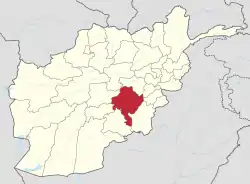 | |
|---|---|---|
| Populated places |
| |
| Landforms | ||
| Other | ||
