Acmar, Alabama
Acmar is a former unincorporated community and neighborhood within the city of Moody in St. Clair County, in the U.S. state of Alabama.
Acmar, Alabama | |
|---|---|
 Acmar, Alabama  Acmar, Alabama | |
| Coordinates: 33°37′17″N 86°29′46″W | |
| Country | United States |
| State | Alabama |
| County | St. Clair |
| Elevation | 804 ft (245 m) |
| Time zone | UTC-6 (Central (CST)) |
| • Summer (DST) | UTC-5 (CDT) |
| Area codes | 205, 659 |
| GNIS feature ID | 164535[1] |
History
Henry F. DeBardeleben, founder of the Alabama Fuel & Iron Company (AFICO), opened two coal mines at Acmar.[2] The mines were serviced by the Central of Georgia Railway, with coal production peaking in 1926.[2] In October 1935, one miner was killed and six were injured when strikers belonging to the United Mine Workers of America attempted to drive into the mines.[3] The mines at Acmar closed in 1951. The community was later annexed into the city of Moody.
A post office was established at Acmar in 1911, and remained in operation until it was discontinued in 1987.[4] Acmar is a conjoin of the names Acton and Margaret[5] AFICO also operated mines at both of these locations.[2]
The Cahaba River originates near Acmar.[6]
Demographics
Acmar Precinct (1930-50)
| Historical population | |||
|---|---|---|---|
| Census | Pop. | %± | |
| 1930 | 1,965 | — | |
| 1940 | 1,850 | −5.9% | |
| 1950 | 1,616 | −12.6% | |
| U.S. Decennial Census[7] | |||
Acmar village has never reported a population figure separately on the U.S. Census as an unincorporated community. However, the 26th precinct within St. Clair County bore its name from 1930–1950.[8] In the 1930 and 1940[9] returns, when the census recorded racial statistics for the precincts, both times reported a White majority for the precinct. In 1960, the precincts were merged and/or reorganized into census divisions (as part of a general reorganization of counties) and it was consolidated into the census division of Moody.[10] The village itself was later annexed into the city of Moody.
References
- "Acmar". Geographic Names Information System. United States Geological Survey.
- James Sanders Day (24 June 2013). Diamonds in the Rough: A History of Alabama's Cahaba Coal Field. University of Alabama Press. pp. 64–86. ISBN 978-0-8173-1794-2.
- Robert H. Woodrum (2007). "Everybody was Black Down There": Race and Industrial Change in the Alabama Coalfields. University of Georgia Press. p. 59. ISBN 978-0-8203-2739-6.
- "St. Clair County". Jim Forte Postal History. Retrieved 9 February 2015.
- Foscue, Virginia O. (1989). Place Names in Alabama. University of Alabama Press. p. 6. ISBN 978-0-8173-0410-2.
- Eddie Wayne Shell (2013). Evolution of the Alabama Agroecosystem: Always Keeping Up, but Never Catching Up. NewSouth Books. p. 38. ISBN 978-1-60306-203-9.
- "U.S. Decennial Census". Census.gov. Retrieved June 6, 2013.
- http://www2.census.gov/prod2/decennial/documents/10612963v3p1ch02.pdf
- http://www2.census.gov/prod2/decennial/documents/33973538v2p1ch4.pdf
- http://www2.census.gov/prod2/decennial/documents/37721510v1p2ch2.pdf
Municipalities and communities of St. Clair County, Alabama, United States | ||
|---|---|---|
| Cities | 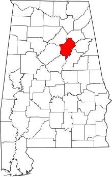 Map of Alabama highlighting St. Clair County | |
| Towns | ||
| Unincorporated communities | ||
| Former towns | ||
| Footnotes | ‡This populated place also has portions in an adjacent county or counties | |
| ||