Springville, Alabama
Springville is a city in St. Clair County, Alabama, United States. It incorporated in December 1880.[3] At the 2010 census the population was 4,080, up from 2,521 in 2000.
Springville, Alabama | |
|---|---|
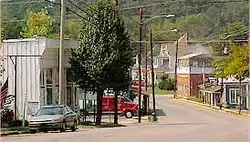 Downtown Springville | |
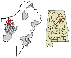 Location of Springville in St. Clair County, Alabama. | |
| Coordinates: 33°46′8″N 86°28′16″W | |
| Country | United States |
| State | Alabama |
| County | St. Clair |
| Area | |
| • Total | 9.44 sq mi (24.44 km2) |
| • Land | 9.40 sq mi (24.34 km2) |
| • Water | 0.04 sq mi (0.10 km2) |
| Elevation | 725 ft (221 m) |
| Population (2010) | |
| • Total | 4,080 |
| • Estimate (2019)[2] | 4,304 |
| • Density | 458.07/sq mi (176.86/km2) |
| Time zone | UTC-6 (Central (CST)) |
| • Summer (DST) | UTC-5 (CDT) |
| ZIP code | 35146 |
| Area code(s) | 205, 659 Exchange: 467 |
| FIPS code | 01-72600 |
| GNIS feature ID | 0164863 |
| Website | www.springvillealabama.org |
Geography
Springville is located at 33°46′8″N 86°28′16″W (33.768950, −86.471037).[4]
According to the U.S. Census Bureau, the town has a total area of 6.4 square miles (17 km2), of which 6.4 square miles (17 km2) is land and 0.04 square miles (0.10 km2) (0.31%) is water.
Demographics
| Historical population | |||
|---|---|---|---|
| Census | Pop. | %± | |
| 1880 | 185 | — | |
| 1900 | 496 | — | |
| 1910 | 350 | −29.4% | |
| 1920 | 450 | 28.6% | |
| 1930 | 437 | −2.9% | |
| 1940 | 460 | 5.3% | |
| 1950 | 553 | 20.2% | |
| 1960 | 822 | 48.6% | |
| 1970 | 1,153 | 40.3% | |
| 1980 | 1,476 | 28.0% | |
| 1990 | 1,910 | 29.4% | |
| 2000 | 2,521 | 32.0% | |
| 2010 | 4,080 | 61.8% | |
| 2019 (est.) | 4,304 | [2] | 5.5% |
| U.S. Decennial Census[5] 2013 Estimate[6] | |||
At the 2000 census there were 2,521 people, 990 households, and 767 families living in the town. The population density was 393.8 people per square mile (152.1/km2). There were 1,049 housing units at an average density of 163.8 per square mile (63.3/km2). The racial makeup of the town was 90.56% White, 7.74% Black or African American, 0.16% Native American, 0.28% Asian, 0.16% Pacific Islander, and 1.11% from two or more races. 0.24% of the population were Hispanic or Latino of any race.[7] Of the 990 households 34.4% had children under the age of 18 living with them, 62.8% were married couples living together, 11.5% had a female householder with no husband present, and 22.5% were non-families. 20.5% of households were one person and 8.3% were one person aged 65 or older. The average household size was 2.55 and the average family size was 2.93.
The age distribution was 24.9% under the age of 18, 6.9% from 18 to 24, 30.1% from 25 to 44, 26.2% from 45 to 64, and 11.9% 65 or older. The median age was 38 years. For every 100 females, there were 97.4 males. For every 100 females age 18 and over, there were 88.5 males.
The median household income was $43,397 and the median family income was $53,859. Males had a median income of $35,977 versus $25,542 for females. The per capita income for the town was $20,518. About 8.0% of families and 10.8% of the population were below the poverty line, including 11.1% of those under age 45–55 and 23.4% of those age 65 or over.
2010 census
At the 2010 census there were 4,080 people, 1,561 households, and 1,223 families living in the town. The population density was 637.5 people per square mile (245.8/km2). There were 1,652 housing units at an average density of 258.1 per square mile (99.5/km2). The racial makeup of the town was 93.6% White, 4.7% Black or African American, 0.3% Native American, 0.4% Asian, 0.1% Pacific Islander, and .9% from two or more races. 0.7% of the population were Hispanic or Latino of any race.[8] Of the 1,561 households 31.5% had children under the age of 18 living with them, 66.0% were married couples living together, 9.5% had a female householder with no husband present, and 21.7% were non-families. 19.3% of households were one person and 8.1% were one person aged 65 or older. The average household size was 2.61 and the average family size was 2.98.
The age distribution was 23.8% under the age of 18, 6.7% from 18 to 24, 22.9% from 25 to 44, 32.3% from 45 to 64, and 14.3% 65 or older. The median age was 42.6 years. For every 100 females, there were 95.3 males. For every 100 females age 18 and over, there were 95.7 males.
The median household income was $66,667 and the median family income was $75,679. Males had a median income of $60,893 versus $31,782 for females. The per capita income for the town was $27,526. About 7.9% of families and 9.2% of the population were below the poverty line, including 11.6% of those under age 18 and 9.9% of those age 65 or over.
Movies
Although a small Alabama town, Springville has been the site of filming for two movies:
- 1987 – a gangster film called The Verne Miller Story (released on video entitled Gangland) starring Scott Glenn
- 2001 – Rustin (starring Meat Loaf and Zachary Ty Bryan)
Notable people
- Howard Cruse, alternative cartoonist
- Casey Mize, MLB pitcher for the Detroit Tigers.
- Hank Patterson, who played Mr. Fred Ziffel, on Green Acres.
- Aubrey Willis Williams, head of the National Youth Administration during the New Deal.
- Artie Wilson, former Major League Baseball player.
References
- "2019 U.S. Gazetteer Files". United States Census Bureau. Retrieved June 29, 2020.
- "Population and Housing Unit Estimates". United States Census Bureau. May 24, 2020. Retrieved May 27, 2020.
- http://www.encyclopediaofalabama.org/article/h-3215
- "US Gazetteer files: 2010, 2000, and 1990". United States Census Bureau. 2011-02-12. Retrieved 2011-04-23.
- "U.S. Decennial Census". Census.gov. Retrieved June 6, 2013.
- "Annual Estimates of the Resident Population: April 1, 2010 to July 1, 2013". Retrieved June 3, 2014.
- "U.S. Census website". United States Census Bureau. Retrieved 2008-01-31.
- "U.S. Census website". United States Census Bureau. Retrieved 2015-08-09.
External links
 Media related to Springville, Alabama at Wikimedia Commons
Municipalities and communities of St. Clair County, Alabama, United States | ||
|---|---|---|
| Cities | 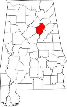 Map of Alabama highlighting St. Clair County | |
| Towns | ||
| Unincorporated communities | ||
| Former towns | ||
| Footnotes | ‡This populated place also has portions in an adjacent county or counties | |
| ||