Ahal Region
Ahal Region (Turkmen: Ahal welaýaty; from Persian آخال Axāl) is one of the regions of Turkmenistan. It is in the south-center of the country, bordering Iran and Afghanistan along the Kopet Dag Range. Its area is 97,160 km2 (37,510 sq mi) and population 939,700 (2005 est.).[1]
Ahal | |
|---|---|
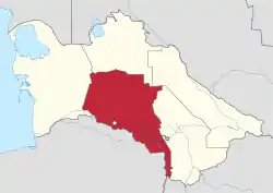 Ahal region in Turkmenistan | |
| Country | |
| Capital | Anau |
| Area | |
| • Total | 97,160 km2 (37,510 sq mi) |
| Population (2005) | |
| • Total | 939,700 |
| • Density | 9.7/km2 (25/sq mi) |
Overview
In 2000, Ahal Region accounted for 14% of Turkmenistan's population, 11% of the total number of employed, 23% of agricultural production (by value), and 31% of the country's total industrial production.[2]
Ahal's agriculture is irrigated by the Karakum Canal, which stretches all the way across the province from east to west, tracking Turkmenistan's southern border. Another water source is Tejen River, which flows north from Afghanistan in the south-east corner of the province, passing through two large reservoirs south of the city of Tejen.
Ahal is known for the Geok Tepe battle of 1881, today the site of an imposing new mosque, and for the Baherden underground warm lake (in the Kov Ata karst cave),[3][4] both west of Ashgabat.
The capital of Ahal Province is Änew (or Annau), a town on the south-eastern outskirts of Ashgabat. One other notable town is Tejen in the south-east near the border with Mary Province. Turkmenistan's largest city, Ashgabat, is surrounded by Ahal Province, but it has the status of a special capital district outside the provincial jurisdiction.
Districts
Effective January 5, 2018, Ahal Province (Ahal welaýaty) is subdivided into 7 districts (etrap, plural etraplar):[5][6][7]
- Ak Bugdaý
- Babadaýhan
- Bäherden (previously Baharly)
- Gökdepe
- Kaka
- Sarahs
- Tejen
As of January 1, 2017, the province included 8 cities (города or şäherler), 9 towns (посёлки or şäherçeler), 89 rural or village councils (сельские советы or geňeşlikler), and 235 villages (села, сельские населенные пункты or obalar).[7] However, as of January 5, 2018, the master list of provinces, districts, and municipalities listed only 7 cities.[7][5]
- Cities include:
- Änew
- Babadaýhan
- Bäherden
- Gökdepe
- Kaka
- Sarahs
- Tejen
As of May 2013 Ruhabat District and the city of Abadan (today called Büzmeýin), until then in Ahal Province, were incorporated into the city of Ashgabat. In January 2018, Babadaýhan District of Ahal Province was established, and the Kaka, Tejen, Sarahs Provinces were reaffirmed. In the same decree, Baharly's former name, Bäherden, was restored, and the Altyn Asyr District was abolished.
See also
- Darvaza gas crater, a persistent natural gas fire
- OpenStreetMap Wiki: Ahal Province
- OpenStreetMap Wiki: Districts in Turkmenistan
References
- Statistical Yearbook of Turkmenistan 2000-2004, National Institute of State Statistics and Information of Turkmenistan, Ashgabat, 2005.
- Social-economic situation of Turkmenistan in 2000, National Institute of State Statistics and Information of Turkmenistan, Ashgabat, 2001, pp. 129-130 (in Russian).
- Baharden warm lake Archived November 21, 2008, at the Wayback Machine in Kov Ata cave.
- Turkmenistan: an official guide Archived October 6, 2011, at the Wayback Machine (downloadable Word file).
- Türkmenistanyň Mejlisi (2010–2018). "Türkmenistanyň dolandyryş-çäk birlikleriniň Sanawy". Türkmenistanyş Mejlisiniň Karary. Ashgabat. This document is reproduced online at https://wiki.openstreetmap.org/wiki/Districts_in_Turkmenistan.
- "Парламент Туркменистана внёс изменения в административно-территориальное деление Ахалского велаята". 5 January 2018.
- "Административно-территориальное деление Туркменистана по регионам по состоянию на 1 января 2017 года". Archived from the original on 2018-07-08. Retrieved 2018-07-08.
External links
| Wikivoyage has a travel guide for Ahal Province. |
![]() Media related to Ahal Province at Wikimedia Commons
Media related to Ahal Province at Wikimedia Commons
Places adjacent to Ahal Region | |
|---|---|
Region (capital) | |
|
| Authority control |
|---|