Razavi Khorasan Province
Razavi Khorasan Province (Persian: استان خراسان رضوی, Ostâne Xorâsâne Razavi) is a province located in northeastern Iran. Mashhad is the center and capital of the province. Other cities are Quchan, Dargaz, Chenaran, Sarakhs, Fariman, Torbat-e Heydarieh, Torbat-e Jam, Salehabad, Taybad, Khaf, Roshtkhar, Kashmar, Rivash, Bardaskan, Nishapur, Sabzevar, Gonabad, Kalat. Razavi Khorasan is one of the three provinces that were created after the division of Khorasan Province in 2004. In 2014 it was placed in Region 5[4] with Mashhad as the location of the region's secretariat.
Razavi Khorasan Province
استان خراسان رضوی | |
|---|---|
.JPG.webp) | |
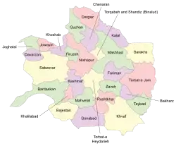 Razavi Khorasan counties | |
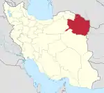
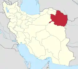 Location of Khorasan-e Razavi Province in Iran | |
| Coordinates: 36.2980°N 59.6057°E | |
| Country | |
| Region | Region 5 |
| Capital | Mashhad |
| Counties | 32 |
| Government | |
| • Governor | Mohammad Sadegh Motamedian |
| Area | |
| • Total | 118,884 km2 (45,901 sq mi) |
| Population (2016)[1] | |
| • Total | 6,434,501 |
| • Estimate (2020) | 6,871,000[2] |
| • Density | 54/km2 (140/sq mi) |
| Time zone | UTC+03:30 (IRST) |
| • Summer (DST) | UTC+04:30 (IRST) |
| Main language(s) | Persian |
| HDI (2017) | 0.781[3] high · 19th |
| Website | http://ostandari.khorasan.ir/ |
History
The Greater Khorasan has witnessed the rise and fall of many dynasties and governments in its territory throughout history. Various tribes of the Arabs, Turks, Kurds,[5] Turkmens, and Mongols brought changes to the region time and time again.
Ancient geographers of Iran divided Iran ("Ērānshahr") into eight segments of which the most flourishing and largest was the territory of Greater Khorasan. Esfarayen, among other cities of the province, was one of the focal points for residence of the Aryan tribes after entering Iran.
The Parthian Empire was based near Merv in Khorasan for many years. During the Sassanid dynasty the province was governed by a Spahbod (Lieutenant General) called "Padgošban" and four margraves, each commander of one of the four parts of the province.
Khorasan was divided into four parts during the Muslim conquest of Persia, each section being named after the four largest cities, Nishapur, Merv, Herat, and Balkh.
In the year 651, the army of the Rashidun Caliphate conquered Khorasan. The territory remained under the rule of the Abbasid Caliphate until 820, followed by the rule of the Iranian Tahirid dynasty until 873, and the Samanid dynasty in 900.
Mahmud of Ghazni conquered Khorasan in 994, and Tuğrul in the year 1037.
In 1507, Khorasan was occupied by Uzbek tribes. After the death of Nader Shah in 1747, it was occupied by the Afghan Durrani Empire centered in Qandahar.
In 1824, Herat became independent for several years when the Afghan Empire was split between the Durranis and Barakzais. The Persians sieged the city in 1837, but the British assisted the Afghans in repelling them. In 1856, the Persians launched another invasion, and briefly managed to recapture the city; it led directly to the Anglo-Persian War. In 1857 hostilities between the Persians and the British ended after the Treaty of Paris was signed, and the Persian troops withdrew from Herat.[6] Afghanistan reconquered Herat in 1863 under Dost Muhammad Khan, two weeks before his death.[7]
Khorasan was the largest province of Iran until it was divided into three provinces on September 29, 2004. The provinces approved by the parliament of Iran (on May 18, 2004) and the Council of Guardians (on May 29, 2004) were Khorasan-e Razavi, North Khorasan, and South Khorasan.
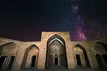
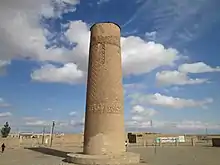
Archaeological sites
Among the archeological sites discovered in this province:
Kohandezh hills
Excavations conducted by an American team between 1935 and 1940 in Nishapur discovered museum-worthy objects, which were shared with the government of the Shah. The Metropolitan Museum of Art's publications document its own Nishapur ceramics from those excavations. For half a century after 1945 the site of Nishapur was ransacked to feed the international market demand for early Islamic works of art. Nowadays, the Kohandezh hills reveal the remains from those excavations.
Shadiyakh
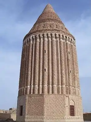
Shadiyakh was an important palace in old Nishapur up to the 7th century, and became more important and populated after that. The palace was completely ruined in the 13th century. It was the home of notables such as Farid al-Din Attar, whose tomb is found in Shadiyakh.
Administrative divisions
The counties of Khorasan-e Razavi Province are Khalilabad County, Mahvelat County, Chenaran County, Dargaz County, Kalat County, Quchan County, Mashhad County, Sarakhs County, Nishapur County, Firuzeh County, Khoshab County, Jowayin County, Joghatai County, Davarzan County, Sabzevar County, Salehabad County, Bardaskan County, Bajestan County, Kashmar County, Gonabad County, Khaf County, Kuhsorkh County, Roshtkhar County, Taybad County, Bakharz County, Zaveh County, Fariman County, Torbat-e Jam County, Torbat-e Heydarieh County and Torqabeh and Shandiz County.
Demographics
The absolute major ethnic group in this region are Persians, there are other small sizeable communities such as Kurds, Khorasani Turks. and Turkmens.[8]
Culture
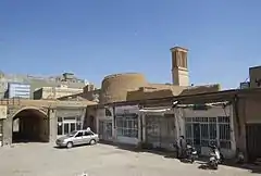
Attractions
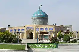
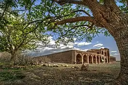
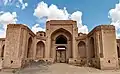
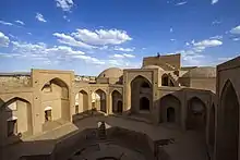
This province contains many historical and natural attractions, such as mineral water springs, small lakes, recreational areas, caves and protected regions, and various hiking areas.
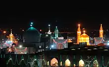
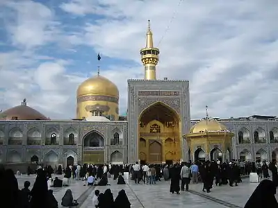
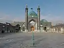
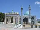
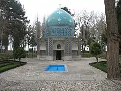
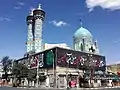
Besides these, Khorasan encompasses numerous religious buildings and places of pilgrimage, including the shrine of Imam Reza, Goharshad mosque and many other mausoleums and Imamzadehs which attract visitors to this province.
The Cultural Heritage of Iran lists 1179 sites of historical and cultural significance in all three provinces of Khorasan.
Some of the popular attractions of Khorasan-e Razavi are:
Mashhad
Nishabur
Sabzevar
Kashmar
Torbat-e Jam
Gonabad
- Qanats of Gonabad
- Kūh-e Tīr Māhī
Sarakhs
Bajestan
Taybad
Colleges and universities
- Asrar Institute of Higher Education[9]
- Bahar Institute of Higher Education[10]
- Comprehensive University of Applied and Practical Sciences, Khorasan[11]
- Ferdowsi University of Mashhad[12]
- Gonabad University of Medical Sciences[13]
- Hakim-e Sabzevari University of Sabzevar[14]
- Imam Reza University[15]
- Islamic Azad University of Bardaskan
- Islamic Azad University of Ghoochan
- Islamic Azad University of Gonabad[16]
- Islamic Azad University of Mashhad
- Islamic Azad University of Neishabur
- Islamic Azad University of Sabzevar[17]
- Islamic Azad University of Torbat e Jam
- Islamic Azad University of Torbat Heidariyeh
- Mashhad University of Medical Sciences
- Payame Noor University of Bardaskan
- Payame Noor University of Mashhad
- Sabzevar University of Medical Sciences[18]
- Sadjad University of Technology[19]
- Sport Sciences Research Institute of Iran
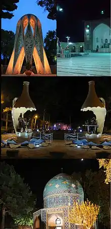
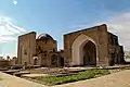
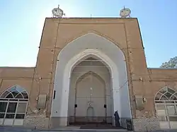
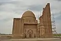
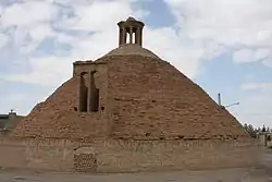
Gallery
.jpg.webp)
References
- "Census of the Islamic Republic of Iran, 1395 (2016)" (Excel). Islamic Republic of Iran.
- "جمعیت". amar.org.ir.
- "Sub-national HDI - Area Database - Global Data Lab". hdi.globaldatalab.org. Retrieved 2018-09-13.
- "همشهری آنلاین-استانهای کشور به ۵ منطقه تقسیم شدند (Provinces were divided into 5 regions)". Hamshahri Online (in Persian). 22 June 2014. Archived from the original on 23 June 2014.
- "CSKK - Kurds in Khorasan". cskk.org.
- Avery, Peter; Hambly, Gavin; Melville, Charles, eds. (1991). The Cambridge History of Iran (Vol. 7): From Nadir Shah to the Islamic Republic. Cambridge University Press. pp. 183, 394–395. ISBN 978-0521200950.
- Ewans (2002). Afghanistan: A short History of its People and Politics. Perennial. pp. 77. ISBN 006-050508-7.
- "Ethnicities and Religions in Iran".
- http://www.asrar.ac.ir
- "مؤسسه آموزش عالی غیرانتفاعی بهار مشهد – مؤسسه آموزش عالی غیرانتفاعی بهار مشهد – دانشگاه بهار مشهد".
- "Welcome to ISATC 1". February 11, 2005. Archived from the original on February 11, 2005.
- "دانشگاه فردوسی مشهد - دانشگاه فردوسی مشهد". www.um.ac.ir.
- "دانشگاه علوم پزشکی و خدمات بهداشتی درمانی گناباد". www.gmu.ac.ir.
- "دانشگاه حکیم سبزواری – دانشگاه حکیم سبزواری پویا در عرصه ملی پیشرو در مسیر توسعه".
- "دانشگاه بین المللی امام رضا (علیه السلام)". دانشگاه بین المللی امام رضا (علیه السلام).
- "دانشگاه آزاد اسلامی گناباد". iau-gonabad.ac.ir.
- "دانشگاه آزاد اسلامی سبزوار". www.iaus.ac.ir.
- "دانشگاه علوم پزشكي سبزوار - صفحه اصلی". www.medsab.ac.ir.
- "دانشگاه صنعتی سجاد". www.sadjad.ac.ir.
External links
![]() Media related to Razavi Khorasan Province at Wikimedia Commons
Media related to Razavi Khorasan Province at Wikimedia Commons
- The text of the law for division of Khorasan into three provinces (in Persian)
- Cultural Heritage Foundation of Khorasan
- Khorasan-e Razavi Province cooprative office
- Khorasan-e Razavi Province cooprative office (in Persian)
- Khorasan-e Razavi Province Department of Education (in Persian)
- Imam Reza Shrine Official website
- Mashad Mayor's Office
- Central Library of Astan Quds Razavi Official website
Places adjacent to Razavi Khorasan Province | ||||||||||
|---|---|---|---|---|---|---|---|---|---|---|
| ||||||||||
| ||
| Authority control |
|---|