Balkanabat
Balkanabat (Балканабат), formerly Nebit-Dag and Neftedag, is a city in western Turkmenistan and the capital of Balkan Province, the largest province in the country. It is located at 39°31′0″N 54°22′0″E, at an altitude of 17 metres.
Balkanabat | |
|---|---|
.jpg.webp) Street scene in Balkanabat | |
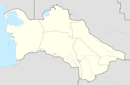 Balkanabat Location in Turkmenistan | |
| Coordinates: 39°31′00″N 54°22′00″E | |
| Country | |
| Province | Balkan Province |
| Government | |
| • Mayor | Balkan Gulmamedov |
| Elevation | 17 m (56 ft) |
| Population (2011) | |
| • Total | 120,800 |
| Time zone | +5 GMT |
| ru:Почтовые индексы в Туркмении | 745100 |
| Area code(s) | (00993) 222 X XX XX |
Balkanabat lies at the foot of the Balkan Daglary mountain range. Balkanabat is about 450 km west of Ashgabat and 160 km east of the port city of Turkmenbashi. The city has an airport with scheduled daily flights to Ashgabat.
Name and history
.jpg.webp)
The town was founded in 1933 as "Neftedag", meaning "Oil Mountain" (from Russian neft, "oil", and Turkmen dag, "mountain"), as a settlement along one of the stations of Trans-Caspian Railway. In 1946, when it was transformed into a city, it was renamed "Nebit-Dag", also meaning "Oil Mountain" but this time using the Turkmen word nebit.[1]
A large monument in the far eastern end "Monument to the Desert Explorers" depicts a camel, Ivan Gubkin and peers, struggling to walk through the windy desert of Karakum while exploring petroleum.[2] Nebit Dag was renamed to Balkanabat (Balkan from the name of the Balkan mountains, abat – meaning “peaceful” in Turkmen and/or “city” in Persian) in 2001 by the decree of former President of Turkmenistan Saparmurat Niyazov.[3]
The city adjoins a "Health Path", a concrete circuit hike path to give a moderate hike along the mountainside. It was opened in 2004 in the template of that of Ashgabat. The city has five bazaars (markets) Gök, Jennet, Gündogar, Bereket and bazaar on 5th microregion. There is the large hotel "Nebitçi", a theatre, museums, restaurants and parks. The north side of town has the large park Saparmyrat Türkmenbaşy Seýilgähi. This features trees, tennis courts, a life-size chess board and many benches.
The Yomud tribe was historic to the Balkan region and the Yomud carpet göl (pattern) is one of the five patterns represented on the Turkmen flag.
In the 2000s, the city underwent street improvement, construction of large housing facilities and amenities. Overseen by Presidential-level long-term planning massive housing construction continues. The buildings of the State Drama Theater, the Museum of History and Local Lore, a diagnostic center, a wedding palace, a Balkanabat Railway Station building, a Balkan Regional Library, a stadium for 10,000 seats, a multi-profile market and other social and cultural facilities were built in the city.[4]
Demographics
Most of the residents are Turkmens; other ethnicities include Russians, Kazakhs, Lezgins, Azeris, Armenians, Uzbeks, Tatars and Karakalpaks. Tajiks are also found.
Climate
Balkanabat has a cold desert climate (BWk) according to the Köppen climate classification.
| Climate data for Balkanabat | |||||||||||||
|---|---|---|---|---|---|---|---|---|---|---|---|---|---|
| Month | Jan | Feb | Mar | Apr | May | Jun | Jul | Aug | Sep | Oct | Nov | Dec | Year |
| Average high °C (°F) | 7.9 (46.2) |
10.0 (50.0) |
15.8 (60.4) |
23.7 (74.7) |
30.3 (86.5) |
35.4 (95.7) |
38.1 (100.6) |
37.2 (99.0) |
31.9 (89.4) |
23.2 (73.8) |
16.4 (61.5) |
9.9 (49.8) |
23.3 (73.9) |
| Daily mean °C (°F) | 3.2 (37.8) |
4.6 (40.3) |
10.0 (50.0) |
17.3 (63.1) |
23.6 (74.5) |
28.8 (83.8) |
31.5 (88.7) |
31.1 (88.0) |
25.9 (78.6) |
17.5 (63.5) |
11.1 (52.0) |
5.5 (41.9) |
17.5 (63.5) |
| Average low °C (°F) | −0.6 (30.9) |
0.4 (32.7) |
5.4 (41.7) |
11.9 (53.4) |
17.8 (64.0) |
22.5 (72.5) |
25.7 (78.3) |
25.5 (77.9) |
19.7 (67.5) |
12.2 (54.0) |
6.8 (44.2) |
1.9 (35.4) |
12.4 (54.3) |
| Average precipitation mm (inches) | 11 (0.4) |
14 (0.6) |
21 (0.8) |
19 (0.7) |
17 (0.7) |
5 (0.2) |
8 (0.3) |
2 (0.1) |
4 (0.2) |
12 (0.5) |
14 (0.6) |
16 (0.6) |
143 (5.6) |
| Average precipitation days (≥ 1.0 mm) | 6 | 5 | 7 | 6 | 4 | 2 | 2 | 1 | 2 | 4 | 5 | 7 | 51 |
| Average relative humidity (%) | 68 | 63 | 56 | 50 | 43 | 38 | 41 | 34 | 34 | 46 | 58 | 70 | 50 |
| Source: NOAA[5] | |||||||||||||
Industry, economy and transport
.jpg.webp)
It is an industrial centre for petroleum and natural gas production. Animal breeding and wheat and cotton cultivation are another areas of economy in Balkanabat.
There are range of national banks, Turkmenpostal services in the centre by Magtymguly Shayoly, near 197 kvartal.
Transport
The city is connected to Turkmenistan cities by Turkmenistan Airlines, as by air, train and bus. Buses route is from east to the west of Magtymguly shayoly (highway) and makes stops at bus station. While there is no official cab company, private citizens operate shared cabs. Almost any vehicle will pick up passengers. If the driver has already passengers in the car, then he will agree to take you if headed in the similar direction of their other available passengers. The city layout is a grid of apartment blocks called kvartal (quarters). There are main streets called Magtymguly, Pervomayskiy and Gurbansoltan eje shayoly.
Air
The Balkanabat Airport is well served with connections only to domestic destinations (Ashgabat, Mary, Dashoguz and Turkmenabat). The airport's terminal was opened in October 2004. Carrying capacity up to 200 passengers per hour.[6]
Rail
Balkanabat sits on one of the Turkmenistan primary rail lines running east–west connecting the capital, Ashgabat, with the Balkan Region. The Trans-Caspian railway railway runs along the line through the city. The railway provides both human transportation and transport of goods and commodities such as oil and gravel. Balkanabat Railway Station is the terminus for national and international rail links to the city.
Education
Balkanabat was the home to the Polytechnic Institute, which was an extension of the Gubkin Russian State University of Oil and Gas in Moscow during the Soviet days.
The city has a Faculty of oil and gas industry of the branch of the International Oil and Gas University. The faculty conducts preparatory work in such specialties as geology, drilling of oil and gas wells, development and operation of oil and gas fields, chemical technology of oil and gas processing, construction, operation of oil and gas storages, oil and gas pipelines and others.[7]
Also in Balkanabat school alumnus can get a secondary-specialized education in the following vocational schools: Balkanabat Medical School, Special School of Arts, Financial and Economic Secondary Vocational School and Oil Secondary Vocational School of the State Concern Turkmennebit.[8][9][10][11]
Twin towns and sister cities
Monuments
In memory of the pioneer geologists of the oil region, an architectural and memorial ensemble was installed "Pioneers".
Sports
Nebitçi is an soccer team based in Balkanabat, playing in the Ýokary Liga.[13][14]
See also
References
- Zonn, Igor S.; Kosarev, Aleksey N.; Glantz, Michael H.; Kostianoy, Andrey G. (2010-05-26). The Caspian Sea Encyclopedia. Springer Science & Business Media. p. 70. ISBN 9783642115240.
- Mayhew, Bradley; Bloom, Greg (2007). Central Asia. Lonely Planet Publications. p. 420.
Heading west, on the road to Turkmenbashi (Krasnovodsk), is the Monument to the Desert Explorers, a handsome concrete statue of caravan men urging forward their obstinate camel in the midst of a fierce sandstorm.
- Landau, Jacob M.; Kellner-Heinkele, Barbara (2011-12-18). Language Politics in Contemporary Central Asia: National and Ethnic Identity and the Soviet Legacy. I.B.Tauris. p. 158. ISBN 9780857720856.
- Балканабат расширяет границы
- "Nebitdag (Balkanabat) Climate Normals 1961–1990". National Oceanic and Atmospheric Administration. Retrieved 9 March 2017.
- В БАЛКАНАБАТЕ ОТКРЫТ НОВЫЙ АЭРОПОРТ
- [http://almetievsk-ru.ru/news/gorod/u-almetevska-poyavilsya-gorod-pobratim У Альметьевска появился город-побратим Подробнее: http://almetievsk-ru.ru/news/gorod/u-almetevska-poyavilsya-gorod-pobratim]
| Wikivoyage has a travel guide for Balkanabat. |