Ak-Buura
The Ak-Buura (Kyrgyz: Ак-Буура) is a river in Kyrgyzstan and Uzbekistan. It flows through the city Osh, and discharges into the Shahrixonsoy, one of the canals of the Fergana Valley. The river is formed at the north slopes of Alai Mountains. The river is 148 kilometres (92 mi) long, and the watershed covers 2,530 square kilometres (980 sq mi).[1] The long-term average discharge of the river at Tuleyken gauging post (southern boundary of Osh) is 21.4 cubic metres per second (760 cu ft/s), high-water discharge (June–July) ranging from 50 cubic metres per second (1,800 cu ft/s) to 67 cubic metres per second (2,400 cu ft/s) and low-water discharge (January) from 5 cubic metres per second (180 cu ft/s) to 6 cubic metres per second (210 cu ft/s).[2]
| Ak-Buura | |
|---|---|
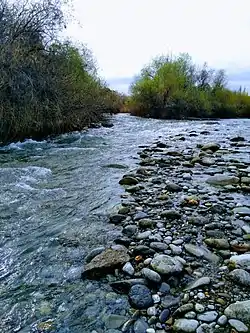 The Ak-Buura during spring 2018. | |
| Location | |
| Country | Kyrgyzstan, Uzbekistan |
| Physical characteristics | |
| Source | Alai Mountains |
| Mouth | Shahrixonsoy |
• coordinates | 40.6717°N 72.6137°E |
| Length | approx. 148 km (92 mi) |
| Basin size | 2,530 km2 (980 sq mi) |
| Discharge | |
| • average | Annual average::21.4 m3/s (760 cu ft/s) |
References
- Ошская область:Энциклопедия [Encyclopedia of Osh Oblast] (in Russian). Bishkek: Chief Editorial Board of Kyrgyz Soviet Encyclopedia. 1987. p. 445.
- Материалы к изучению проблем экологии, питьевого водоснабжения, мелиорации, энергоснабжения и машинного орошения в зоне пилотных каналов. (Materials on investigating of issues of ecology, drinking water, amelioration, energy supply, and pump irrigation in pilot canal's area) (PDF) (Report). Scientific-Information Center of the Interstate Coordination Water Commission of the Central Asia. 2006.
