Akia Island
Akia Island (Danish: Langø) is an uninhabited island in the Qaasuitsup municipality in northwestern Greenland. The name of the island means "turned on its side" in the Greenlandic language.
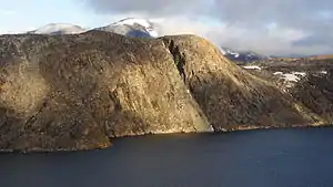 Akia Island seen from the north | |
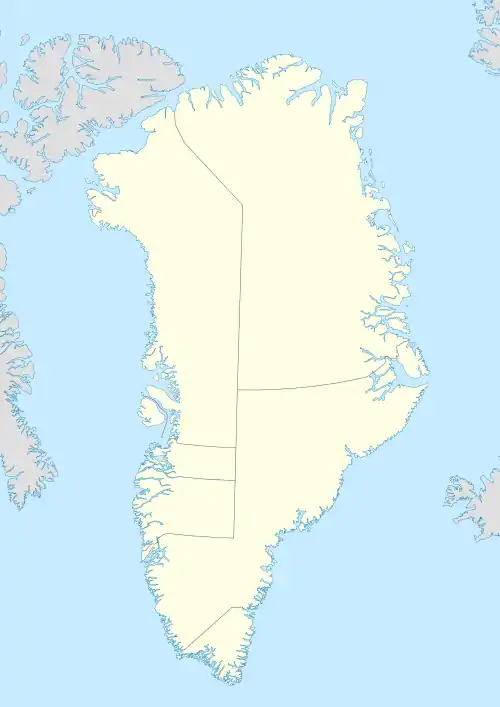 Akia Location off the west coast of Greenland | |
| Geography | |
|---|---|
| Location | Greenland |
| Coordinates | 72°45′10″N 56°07′00″W |
| Archipelago | Upernavik Archipelago |
| Length | 5.8 km (3.6 mi) |
| Width | 5.8 km (3.6 mi) |
| Administration | |
Greenland | |
| Municipality | Qaasuitsup |
Geography
Akia Island is located in the outer belt of islands in the Upernavik Archipelago, in the group between the Upernavik Icefjord in the north, and Nunavik Peninsula in the south, approximately 500 m (1,600 ft) to the southeast of Upernavik Island, on the other side of a small waterway separating the islands.[1]
In the east and south, another small waterway separates Akia from a larger Qaarsorsuaq Island. In the west, several small skerries such as Avannarleq (Danish: Nordø), Qeqertasussuk (Danish: Bruuns ø), and Aorrussaq (Danish: Hvalø) buffer the western coast from the open waters of Baffin Bay.[1]
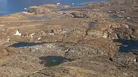
Pear-shaped and hilly, the island culminates in an unnamed 220 m (720 ft) peak in the central-northern part of the island.[1] There are many small ponds and lakes in the interior of the island.
Promontories
| Name | Direction | Latitude N | Longitude W |
|---|---|---|---|
| Pamiua (Danish: Søndre Næs) | Western Cape | 72°45′41″ | 56°12′52″ |
| (none) | Northern Cape | 72°47′22″ | 56°03′17″ |
| Sarpinat | Eastern Cape (not the easternmost point) | 72°45′58″ | 56°02′36″ |
| Umiartorfik | Southern Cape | 72°44′06″ | 56°06′56″ |
References
| Wikimedia Commons has media related to Akia Island. |
- Upernavik, Saga Map, Tage Schjøtt, 1992