Qullikorsuit Island
Qullikorsuit Island (old spelling: Qutdlikorssuit) is an uninhabited[1] island in the Qaasuitsup municipality in northwestern Greenland. It is located in the northern part of Upernavik Archipelago.
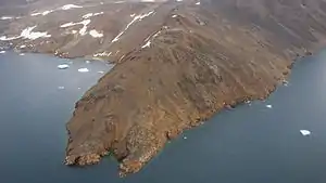 Aerial view of the southwestern shore of Qullikorsuit Island | |
 Qullikorsuit | |
| Geography | |
|---|---|
| Location | Greenland |
| Coordinates | 73°52′N 56°20′W |
| Archipelago | Upernavik Archipelago |
| Area | 204 km2 (79 sq mi)[1] |
| Coastline | 89.3 km (55.49 mi)[2] |
| Administration | |
Greenland | |
| Municipality | Qaasuitsup |
History
Qullikorsuit Island was inhabited between 1916, when the Appaalissiorfik settlement was founded, and 1923, when it was abandoned.[3] Appaalissiorfik was perched on the southwestern cape of the island, on the shores of the Appaalissiorfiup Ikerasaa strait.[4]
Geography
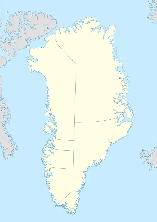
Location within the archipelago
Qullikorsuit Island is located in the north-central part of Upernavik Archipelago, in the group between Kangerlussuaq Icefjord in the south, and Nuussuaq Peninsula in the north.[4] The island defines the southern boundary of the Sugar Loaf Bay.
The island is the largest within the group, and is separated from the mainland of Greenland and smaller islands by narrow straits: from the unnamed nunataq on the mainland in the east by the narrow Ikerasassuaq strait, from the smaller, U-shaped Paornivik Island in the southeast by Paarniviup Tunua strait, from Mernoq Island in the south by the Mernup Tunua strait, and from Apparsuit Island by the Appaalissiorfiup Ikerasaa strait.[4] The latter is an important waterway trail followed by the boats between Upernavik, the only town in the region, and smaller settlements in the north: Nuussuaq and Kullorsuaq. The neighboring Kittorsaq Island to the northwest is sometimes used as a stopover on the marine route from Nuussuaq to Tasiusaq, and further south to Upernavik.[4]
Topography
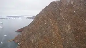
The island is mountainous throughout. At 822 m (2,697 ft), the Sullaussartooq mountain is the highest point on the island, with the top of the ridge permanently glaciated.[4]
Coastline
The coastline of the island is generally undeveloped, despite two distinct peninsulas and shallow, unnamed bays in the south.[4]
Promontories
| Name | Direction | Latitude N | Longitude W |
|---|---|---|---|
| Ujarassuit | Northern Cape | 73°55′34″ | 56°35′45″ |
| (none) | Southern Cape | 73°46′50″ | 56°16′20″ |
| Appaalissiorfik | Southwestern Cape | 73°48′30″ | 56°35′00″ |
| Saffioorsuaq | Western Cape | 73°52′47″ | 56°44′12″ |

References
| Wikimedia Commons has media related to Qullikorsuit Island. |
- "TIL OPPLYSNING". Norwegian University of Science and Technology. Archived from the original on 15 June 2011. Retrieved 17 August 2010.
- "Island Directory". United Nations Environment Programme. Retrieved 17 August 2010.
- Petersen, Robert (2003). Settlements, kinship and hunting grounds in traditional Greenland: A comparative study of local experiences from Upernavik and Ammassalik. Danish Polar Center. p. 107. ISBN 978-87-635-1261-9.
- Upernavik Avannarleq, Saga Map, Tage Schjøtt, 1992