Umiasussuk
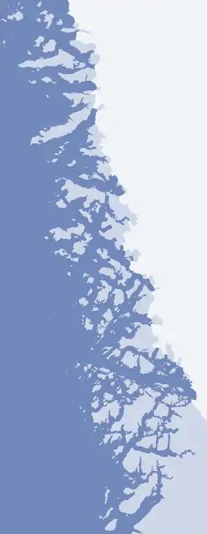
Umiasussuk (old spelling: Umiasugssuk) is a 620 m (2,030 ft)[1] mountain in the Qaasuitsup municipality in northwestern Greenland, located in the northern part of Qaarsorsuaq Island in the Upernavik Archipelago. The name of the mountain means "a boat-shaped mountain" in the Greenlandic language.
| Umiasussuk | |
|---|---|
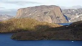 Umiasussuk seen from the northwest, from Upernavik Island | |
| Highest point | |
| Elevation | 620 m (2,030 ft) [1] |
| Prominence | 620 m (2,030 ft) |
| Coordinates | 72°45′39″N 55°56′25″W |
| Geography | |
 Umiasussuk | |
| Location | Qaarsorsuaq Island, Upernavik Archipelago, Greenland |
Geography
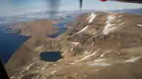
Umiasussuk is a standalone mountain, a flooded peak, whose trapezoid shape is the landmark of Upernavik town, visible from the Upernavik Airport 7 km (23,000 ft) away, and from the entire eastern and northern coast of Upernavik Island.
Via a small isthmus in the east, the mountain is connected with the remainder of the large Qaarsorsuaq Island.[1] To the north, the Torsuut strait separates the mountain from Atilissuaq Island. To the west, the low Akia Island separates the mountain from Upernavik Island.
References
| Wikimedia Commons has media related to Umiasussuk. |
- Upernavik, Saga Map, Tage Schjøtt, 1992
