Al-Tawani
Al-Tawani (Arabic: التواني) is a village in southern Syria, administratively part of the Rif Dimashq Governorate, located northeast of Damascus in the Qalamoun Mountains. Nearby localities include Ma'loula to the northeast, Hosh Arab and Assal al-Ward to the north, Hala to the south, and al-Qutayfah to the southeast. According to the Syria Central Bureau of Statistics, al-Tawani had a population of 2,446 in the 2004 census.[1] Its inhabitants are predominantly Sunni Muslims.[2]
Al-Tawani
التواني | |
|---|---|
Village | |
 Al-Tawani | |
| Coordinates: 33°46′43″N 36°30′3″E | |
| Country | |
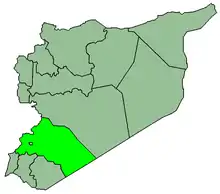
| Governorate | Rif Dimashq Governorate |
| District | Al-Qutayfah District |
| Nahiyah | Ma'loula |
| Population (2004 census)[1] | |
| • Total | 2,446 |
| Time zone | UTC+2 (EET) |
| • Summer (DST) | UTC+3 (EEST) |
| Area code(s) | 11 |
References
- General Census of Population and Housing 2004. Syria Central Bureau of Statistics (CBS). Rif Dimashq Governorate. (in Arabic)
- Smith, in Robinson and Smith, 1841, vol 3, 2nd appendix, p. 172
Bibliography
This article is issued from Wikipedia. The text is licensed under Creative Commons - Attribution - Sharealike. Additional terms may apply for the media files.
