Assal al-Ward
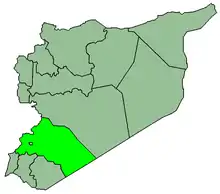
Assal al-Ward (Arabic: عسال الورد; also spelled Asal el-Ward) is a town in southern Syria, administratively part of the Rif Dimashq Governorate, located northeast of Damascus along the Syrian–Lebanese borders. Nearby localities include Hala, Hosh Arab and al-Qutayfah to the southeast, Rankous, Saidnaya, Douma and al-Tawani to the south. According to the Syria Central Bureau of Statistics, Assal al-Ward had a population of 5,812 in the 2004 census.[1] The town is also the administrative center of the Assal al-Ward nahiyah which consists of three towns with a combined population of 8,766.[1] Its inhabitants are predominantly Sunni Muslims.[2]
Assal al-Ward
عسال الورد | |
|---|---|
Town | |
 Assal al-Ward | |
| Coordinates: 33°51′57″N 36°24′48″E | |
| Country | |
| Governorate | Rif Dimashq |
| District | Yabroud |
| Subdistrict | Assal al-Ward |
| Elevation | 1,850 m (6,070 ft) |
| Population (2004 census)[1] | |
| • Total | 5,812 |
| Time zone | UTC+2 (EET) |
| • Summer (DST) | UTC+3 (EEST) |
| Area code(s) | 11 |
History
Assal al-Ward ("the rose makers") was long famous for its flower produce. The flowers produced in the town were supplied to the attar makers of Damascus.[3] But unrestricted grazing reduced the town's once burgeoning yearly harvest of sixty to seventy Kantars (hundredweights) to one or one and a half by the end of the 19th century.[3] During the early 1870s, the village was described as a "well-to-do place" with an entirely Shafi'i Muslim population. Armed men from the village possessed about 250 guns and were led by a local chief, Shaykh Salih. The inhabitants were noted for their hospitality, intelligence and willingness to fight.[4] In 1874, the town was visited by British geographer, Sir Richard Francis Burton, and he noted that the town was affluent, with cool fresh air and healthy inhabitants.[3] In its Quarterly Statement of 1892, the Palestine Exploration Fund described Assal al-Ward as a "village of a few hundred people" with a cool water spring.[5]
Geography
Assal al-Ward lies on a high plateau that starts at 1,600 metres (5,200 ft) between the Qalamoun and Anti-Lebanon Mountains.[6] The large Tertiary-Quaternary basin[7] of Assal al-Ward is watered by several springs, and drains northwards towards the towns of Jayroud and an-Nabek.[6] The area's forest vegetation is dominated by Juniperus excelsa (Greek Juniper) which is observed between 1,880 to 2,200 metres (6,170 to 7,220 ft).[8]
References
- General Census of Population and Housing 2004. Syria Central Bureau of Statistics (CBS). Rif Dimashq Governorate. (in Arabic)
- Robinson and Smith, 1841, vol 3, 2nd appendix, p. 172
- Burton; Drake, 1872, p. 45.
- Royal Geographical Society, 1872, p. 415.
- Palestine Exploration Fund, 1892, p. 167.
- Hastings, 2004, p. 92.
- Beck, 1989, p. 18.
- Merlo; Croitory, ed., 2005, p. 183.
Bibliography
- Burton, R. F.; Tyrwhitt-Drake, C. F. (1872). Unexplored Syria: Visits to the Libanus, the Tulúl el Safá, the Anti-Libanus, the northern Libanus, and the 'Aláh. 2. Tinsley Brothers.
- Hastings, James (2004). A Dictionary of the Bible: Volume III: (Part I: Kir – Nympha). The Minerva Group, Inc. ISBN 9781410217264.
- Beck, Barry F. (1989). Engineering and Environmental Impacts of Sinkholes and Karts: Proceedings of the third multidisciplinary conference, St. Petersburg-Beach, Florida, 2–4 October 1989. Taylor & Francis. ISBN 9789061919872.
- Merlo, Maurizio; Croitory, Lelia, eds. (2005). Valuing Mediterranean Forests: Towards Total Economic Value. CABI. ISBN 9780851999975.
- Palestine Exploration Fund (1892). Quarterly statement. 23–24. Palestine Exploration Fund.
- Robinson, E.; Smith, E. (1841). Biblical Researches in Palestine, Mount Sinai and Arabia Petraea: A Journal of Travels in the year 1838. 3. Boston: Crocker & Brewster.
- Royal Geographical Society (1872). The journal of the Royal Geographical Society of London. 42. J. Murray.