Talfita
Talfita (Arabic: تلفيتا) is a Syrian village in the Al-Tall District of the Rif Dimashq Governorate. According to the Syria Central Bureau of Statistics (CBS), Talfita had a population of 4,082 in the 2004 census.[1] Its inhabitants are predominantly Sunni Muslims.[2]
Talfita
تلفيتا | |
|---|---|
Village | |
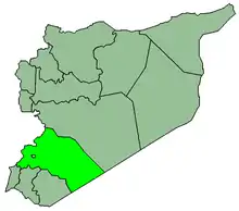
 Talfita Location in Syria | |
| Coordinates: 33°41′53″N 36°19′16″E | |
| Country | |
| Governorate | Rif Dimashq |
| District | al-Tall |
| Subdistrict | al-Tall |
| Population (2004 census)[1] | |
| • Total | 4,082 |
| Time zone | UTC+2 (EET) |
| • Summer (DST) | UTC+3 (EEST) |
Climate
In Talfita, there is a Mediterranean climate. Rainfall is higher in winter than in summer. The Köppen-Geiger climate classification is Csc. The average annual temperature in Talfita is 11.3 °C (52.3 °F). About 425 mm (16.73 in) of precipitation falls annually.
| Climate data for Talfita | |||||||||||||
|---|---|---|---|---|---|---|---|---|---|---|---|---|---|
| Month | Jan | Feb | Mar | Apr | May | Jun | Jul | Aug | Sep | Oct | Nov | Dec | Year |
| Average high °C (°F) | 6.6 (43.9) |
7.2 (45.0) |
10.9 (51.6) |
15.0 (59.0) |
20.2 (68.4) |
24.1 (75.4) |
26.4 (79.5) |
26.6 (79.9) |
24.9 (76.8) |
20.1 (68.2) |
13.3 (55.9) |
7.3 (45.1) |
16.9 (62.4) |
| Average low °C (°F) | −1.9 (28.6) |
−1.5 (29.3) |
0.9 (33.6) |
4.3 (39.7) |
7.5 (45.5) |
11.3 (52.3) |
12.8 (55.0) |
13.4 (56.1) |
10.8 (51.4) |
7.5 (45.5) |
3.7 (38.7) |
−0.4 (31.3) |
5.7 (42.3) |
| Average precipitation mm (inches) | 93 (3.7) |
75 (3.0) |
56 (2.2) |
28 (1.1) |
18 (0.7) |
0 (0) |
0 (0) |
0 (0) |
2 (0.1) |
21 (0.8) |
47 (1.9) |
85 (3.3) |
425 (16.7) |
| Source: Climate-Data.org,Climate data | |||||||||||||
References
- General Census of Population and Housing 2004. Syria Central Bureau of Statistics (CBS). Rif Dimashq Governorate. (in Arabic)
- Smith, in Robinson and Smith, 1841, vol 3, 2nd appendix, p. 172
Bibliography
This article is issued from Wikipedia. The text is licensed under Creative Commons - Attribution - Sharealike. Additional terms may apply for the media files.
