Yalda, Syria
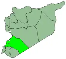
Yalda (Arabic: يلدا, also spelled Yelda) is a town in southern Syria, administratively part of the Rif Dimashq Governorate, located on the southern outskirts of Damascus to the west of the Yarmouk Camp. Nearby localities include al-Hajar al-Aswad, Jaramana, Sayyidah Zaynab, al-Sabinah and Babbila. According to the Syria Central Bureau of Statistics, Yalda had a population of 28,384 in the 2004 census.[1] The town is also in the Babbila nahiyah consisting of 13 towns and villages with a combined population of 341,625.[1]
Yalda
يلدا | |
|---|---|
Village | |
 Yalda | |
| Coordinates: 33°27′46″N 36°19′18″E | |
| Country | |
| Governorate | Rif Dimashq Governorate |
| District | Markaz Rif Dimashq |
| Nahiyah | Babbila |
| Population (2004 census)[1] | |
| • Total | 28,384 |
| Time zone | UTC+2 (EET) |
| • Summer (DST) | UTC+3 (EEST) |
History
The town has ancient ruins including foundations of hewn stone and Corinthian columns of basalt.[2]
Yalda was visited by Syrian geographer Yaqut al-Hamawi in the early 13th-century, during Ayyubid rule. He noted that it was "a village lying some 3 miles from Damascus. The final n is sometimes left out, and the name pronounced Yalda."[3]
References
- General Census of Population and Housing 2004. Syria Central Bureau of Statistics (CBS). Rif Dimashq Governorate. (in Arabic)
- Porter, 1855, vol 2, p. 10
- le Strange, 1890, p. 552
Bibliography
- Porter, Josias Leslie (1855). Five years in Damascus: including an account of the history, topography, and antiquities of that city : with travels and researches in Palmyra, Lebanon, and the Hauran. 2. John Murray.
- Strange, le, Guy (1890). Palestine Under the Moslems: A Description of Syria and the Holy Land from A.D. 650 to 1500. Committee of the Palestine Exploration Fund.