Ambala
Ambala (/əmˈbɑːlə/), is a city and a municipal corporation in Ambala district in the state of Haryana, India, located on the border with the Indian state of Punjab and in proximity to both states capital Chandigarh. Politically, Ambala has two sub-areas: Ambala Cantonment (also known as Ambala Cantt) and Ambala City, eight kilometres apart, therefore it is also known as "Twin City". It has a large Indian Army and Indian Air Force presence within its cantonment area.
Ambala | |
|---|---|
City | |
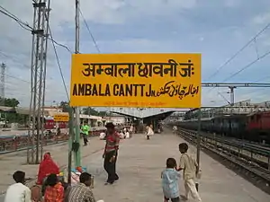 Ambala Cantonment Railway Station | |
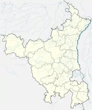 Ambala Location in Haryana, India  Ambala Ambala (India) | |
| Coordinates: 30.38°N 76.78°E | |
| Country | |
| State | Haryana |
| District | Ambala |
| Established | 14th century CE |
| Founded by | Amba Rajput |
| Named for | Amba Rajput or Bhawani Amba (Goddess) |
| Elevation | 264 m (866 ft) |
| Population (2011) | |
| • Total | 207,934 (UA)[1] |
| Languages[2][3] | |
| • Official | Hindi |
| • Additional official | English, Punjabi |
| Time zone | UTC+5:30 (IST) |
| PIN | 1330xx,1340xx |
| Telephone code | 0171 |
| ISO 3166 code | IN-HR |
| Vehicle registration | HR 01 (city), HR 04 (Naraingarh), HR 54 (Barara), HR 85 (Ambala Cantonment), HR37 (commercial) |
| Website | ambala |
Ambala separates the Ganges river network from the Indus river network and is surrounded by two rivers – Ghaggar and Tangri – to the north and to the south. Due to its geographical location, the Ambala district plays an important role in local tourism, being located 47 km (28 miles) south of Chandigarh, 50 km (30 miles) north of Kurukshetra, 148 km (93 miles) southwest of Shimla, 198 km (121 miles) north of New Delhi and 260 km (155 miles) southeast of Amritsar.
History
Etymology
The town is said to derive its name from Amba Rajput who supposedly founded it during the 14th century CE. According to another version, it is named after the goddess "Bhawani Amba" whose Temple still exists in Ambala city. The third version mentions that the name is a corruption of Amba Wala meaning the mango-village, from mango groves which existed in its immediate neighbourhood.[4][5]
Classical era
Archaeological Surveyor C.J Rodgers found Indo-Parthian Kingdom coins as well as coins of Hunas, Mihirakula and Toramana which indicated that after the disintegration of the Mauryan empire, the area was taken over by Indo-Parthians and later was incorporated in the domain of the Hunas.[4]
The Ambala Cantonment
Ambala Army Base
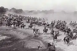
Ambala Army Cantonment was established in 1843 after the British were forced to leave its Karnal Cantonment following the malaria epidemic of 1841–42 in as there were not any known effective means to control malaria epidemic in those days. The cantonment houses the '2 Corps', one of the three Strike Corps of the Indian Army.
Ambala Air Force Base
Ambala Air Force Base is one of the oldest and largest airbases that were inherited from the British by the IAF. It was from this airbase that Spitfires and Harvards flown by Instructors of the Advanced Flying Training School took part in the Indo-Pakistani War of 1947–1948. Subsequently, Ambala was the front line airfield for many years. It was home to various aircraft that were inducted into the Indian Air Force. Vampires, Ouragans, Hunters, etc. all flew from this base. The airbase was briefly attacked in 1965 by B-57 bombers of the Pakistan Air Force. Today, the Airbase houses the '7 Wing' with squadrons of Jaguars and MiG-21 Bisons. A unit of the French-made Dassault Rafale will also be based at Ambala airbase.[7]
European Cemetery
Ambala Cantonment is the location of historic European Cemetery.
Formation of Ambala district
Ambala was given the status of a district in 1847, formed by the merging of the jagir estates of hitherto independent chieftains whose territories had lapsed or had been confiscated by the British Indian Government. In its 160 years of existence as a district, Ambala has witnessed many changes in its boundaries. Previously, it extended across tehsils of Ambala, Saphera, Jagadhri, Pipli, Kharar, Ropar and Nalagarh. Kalka-cum-Kurari State, Pinjore, Mani Majra, Kasauli & Sanawar were also merged later into the district at different times.
1857 rebellion
For their participation in first war of independence, the Chaudharys and Lambardars of villages who participated in rebellion were also deprived of their land and property, including 368 people of Hisar and Gurugram were hanged or transported for life, and fine was imposed on the people of Thanesar (Rs 235,000), Ambala (Rs. 253,541) and Rohtak (Rs. 63,000 mostly on Ranghars, Shaikhs and Muslim Kasai).[8]
Hanging of Mahatma Gandhi's assassin Nathuram Godse
In November 1949, Mahatma Gandhi's assassin Nathuram Godse was hanged at Ambala Central Jail[9] along with Narayan Apte, a co-conspirator. Ambala Cantt is also mentioned in Kim (novel) by Rudyard Kipling.
Climate
| Climate data for Ambala (1981–2010, extremes 1901–2012) | |||||||||||||
|---|---|---|---|---|---|---|---|---|---|---|---|---|---|
| Month | Jan | Feb | Mar | Apr | May | Jun | Jul | Aug | Sep | Oct | Nov | Dec | Year |
| Record high °C (°F) | 29.1 (84.4) |
33.9 (93.0) |
41.7 (107.1) |
45.0 (113.0) |
47.8 (118.0) |
47.8 (118.0) |
46.7 (116.1) |
43.9 (111.0) |
40.6 (105.1) |
39.4 (102.9) |
35.6 (96.1) |
29.4 (84.9) |
47.8 (118.0) |
| Average high °C (°F) | 18.9 (66.0) |
22.4 (72.3) |
27.8 (82.0) |
34.9 (94.8) |
38.1 (100.6) |
38.1 (100.6) |
34.4 (93.9) |
33.3 (91.9) |
33.1 (91.6) |
31.7 (89.1) |
27.1 (80.8) |
21.7 (71.1) |
30.1 (86.2) |
| Average low °C (°F) | 6.4 (43.5) |
9.1 (48.4) |
13.8 (56.8) |
19.1 (66.4) |
23.4 (74.1) |
25.4 (77.7) |
25.5 (77.9) |
25.0 (77.0) |
23.0 (73.4) |
17.1 (62.8) |
11.1 (52.0) |
7.1 (44.8) |
17.2 (63.0) |
| Record low °C (°F) | −1.3 (29.7) |
−0.6 (30.9) |
3.7 (38.7) |
9.4 (48.9) |
13.9 (57.0) |
17.8 (64.0) |
19.4 (66.9) |
20.0 (68.0) |
15.6 (60.1) |
8.3 (46.9) |
1.8 (35.2) |
−0.6 (30.9) |
−1.3 (29.7) |
| Average rainfall mm (inches) | 27.3 (1.07) |
35.1 (1.38) |
27.2 (1.07) |
12.3 (0.48) |
31.5 (1.24) |
86.6 (3.41) |
264.7 (10.42) |
239.2 (9.42) |
134.8 (5.31) |
15.1 (0.59) |
4.5 (0.18) |
19.7 (0.78) |
898.2 (35.36) |
| Average rainy days | 1.9 | 2.2 | 1.8 | 1.2 | 2.7 | 4.5 | 9.1 | 9.0 | 4.8 | 0.8 | 0.6 | 1.0 | 39.6 |
| Average relative humidity (%) (at 17:30 IST) | 63 | 54 | 45 | 28 | 31 | 42 | 67 | 72 | 64 | 51 | 53 | 60 | 52 |
| Source: India Meteorological Department[10][11] | |||||||||||||
Demographics
As of 2011 India census, Ambala UA had a population of 207,934 consisting of 112,840 males and 95,094 females, a ratio of 843. there were 20,687 children 0–6 and Ambala had an average literacy rate of 89.31%, with 91.76% of males and 86.41% of females literate.[1]
Cloth Market
The Cloth Market is considered to be the largest textile market in the region. It is located in sector 7, the central part of the city of Ambala. The market is known for catering to wedding related shopping. The most commonly bought items are sarees and silk clothing.[13]
Education
Ambala has a large number of schools and colleges. Notable colleges include:-
- Convent of Jesus and Mary, Ambala
- E-Max School of Engineering and Applied Research
- Government Polytechnic College, Ambala
- Maharishi Markandeshwar University, Mullana
- Sanatan Dharma College (S.D. College)
- Shri Atmanand Jain Institute of Management and Technology
- Philadelphia Hospital & School of Nursing, Ambala
Transport
Ambala is connected to all of the other major cities of north India. It is a big interchange for various commuters for all neighbouring states. The Ambala Cantt bus stand witnesses roughly 50,000 commuters daily.
National Highway NH 44 popularly known as GT road earlier known as NH 1 passes through Ambala and connects it to National capital Delhi, Panipat, Ludhiana and Amritsar. NH 152 connects it to state capital Chandigarh, Kaithal. Apart from the Interstate service, Ambala also houses one of the oldest local bus services in Haryana, which is run by both Haryana roadways and private companies. Other means of local transportation include auto rickshaws and cycle rickshaws.
Roadways
Bus service is the major means of public transport in this district. Ambala depot came into being on 1 August 1950. The office of the General Manager has situated on the premises of the depot workshop at Ambala City. Ambala depot has a sub depot at Naraingarh.
Presently, Haryana Roadways, Ambala has 209 buses, which carry about 34.88 Lac's passengers daily and cover a distance of about 19.79 Lacs Km daily. Out of these, total distance covered on interstate routes is 24,711 km and 41,439 km are operated within Haryana every day. The total staff of the depot (including that of sub depot Naraingarh) is 1085.
New Bus Stand at Ambala Cantt was inaugurated on 12 July 1999 and the total land of bus stand is 6.7 acre. Bus stands in this district exist at Ambala City, Naraingarh and Barara as well. A sub-depot-level workshop has also been provided at Naraingarh. 'Yatri Niwas' exists on the campus of Ambala Cantt. bus stand for the convenience of the commuters who wish to stay for the night.
Besides, the Haryana Roadways buses, the government has issued permits to private operators on local routes. Presently 51 such buses are plying in Ambala district. The bus stand is very near to Ambala Cantt Jn. (Railway station). Most of the buses plying on GT road (NH1) stop in front of the Railway station.
Railways
Ambala is a divisional headquarters of the Northern Railway Zone and is an important railway junction. Ambala Cantt station is among the top 100 booking stations in India. The city is served by three railway stations:
- Ambala Cantt [UMB] (Junction on Delhi-Kalka line and Moradabad-Ambala line/Ambala-Attari line)
- Ambala City [UBC] (On Ambala-Attari line)
- Dhulkot [DKT] (on Delhi-Kalka line)
The Ambala Cantonment railway station was founded on the junction of the Delhi-Kalka and Ludhiana-Saharanpur lines. The historic Delhi-Panipat-Ambala-Kalka railway line dates back to 1889 while the Ludhiana-Saharanpur line was built in 1870. Situated 200 km north of Delhi, this town is well connected by the rail and road network.
Ambala cantt railway station is main station of the city and is well connected with major cities of India. Kalka-Shimla Railway, which is a UNESCO World Heritage site, also comes under Ambala division.
Ambala Cantonment railway station serves maximum Shatabdi Express after New Delhi. Ambala railway station was mentioned in the famous story 'The Woman on Platform 8' by Ruskin Bond, although in reality there is no platform 8 in Ambala Cantt.
Notable people

References
- "Urban Agglomerations/Cities having population 1 lakh and above" (PDF). Census India. Retrieved 29 December 2015.
- "Report of the Commissioner for linguistic minorities: 52nd report (July 2014 to June 2015)" (PDF). Commissioner for Linguistic Minorities, Ministry of Minority Affairs, Government of India. p. 24. Archived from the original (PDF) on 15 November 2016. Retrieved 4 February 2019.
- IANS (28 January 2010). "Haryana grants second language status to Punjabi". Hindustan Times. Retrieved 2 January 2019.
- Haryana Gazateer, Revenue Dept of Haryana, Capter-V.
- Bajwa, J.S.; Kaur, R. (2007). Tourism Management. APH Publishing Corporation. ISBN 9788131300473.
- Sagoo, Harbans (2001). Banda Singh Bahadur and Sikh Sovereignty. Deep & Deep Publications.
- ANI (4 January 2019). "Indian Air Force To Deploy Rafale Jets in Ambala, Hashimara". NDTV. Retrieved 10 March 2019.
- Satish Chandra Mittal, 1986, Haryana, a Historical Perspective, p58.
- The Times (London), page 3, 16 November 1949
- "Station: Ambala Climatological Table 1981–2010" (PDF). Climatological Normals 1981–2010. India Meteorological Department. January 2015. pp. 35–36. Archived from the original (PDF) on 5 February 2020. Retrieved 1 March 2020.
- "Extremes of Temperature & Rainfall for Indian Stations (Up to 2012)" (PDF). India Meteorological Department. December 2016. p. M63. Archived from the original (PDF) on 5 February 2020. Retrieved 1 March 2020.
- "Ambala City Population Census 2011 – Haryana". www.census2011.co.in.
- "About Cloth Market". Yatra.com. Retrieved 22 June 2019.
External links
 Media related to Ambala at Wikimedia Commons
 Ambala travel guide from Wikivoyage
- Ambala at the Encyclopædia Britannica
Ambala district topics | ||
|---|---|---|
| Cities and towns | 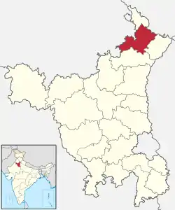 | |
| Transport | ||
| Lok Sabha constituencies | ||