Ghaggar-Hakra River
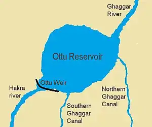
The Ghaggar-Hakra River is an intermittent river in India and Pakistan that flows only during the monsoon season. The river is known as Ghaggar before the Ottu barrage and as the Hakra downstream of the barrage.[2] The Hakra river is hydraulically connected to the Nara River provided it has adequate flow to maintain surface flow.[3] After the construction of the Otu Barrage, the downstream Hakra river dried up fully but subsurface flow is maintained to the Nara river which becomes later the delta channel of the Indus River before joining the sea via Kori Creek in Gujarat state. The basin is classified in two parts, Khadir and Bangar, the higher area that is not flooded in rainy season is called Bangar and the lower flood-prone area is called Khadar.[4]
| Ghaggar-Hakra River | |
|---|---|
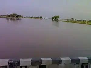
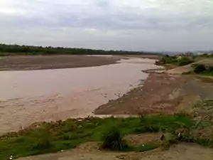 Ghaggar river in Panchkula | |
| Location | |
| Country | India, Pakistan |
| Physical characteristics | |
| Source | |
| • location | Shivalik Hills, Himachal Pradesh, India |
| Mouth | |
• location | Ottu, Haryana, India |
| Discharge | |
| • location | [1] |
| Basin features | |
| Tributaries | |
| • left | Kaushalya river |
| • right | Markanda river, Sarsuti, Tangri river, Chautang |
| Waterbodies | Kaushalya Dam, Ottu barrage |
Most sites ascribed to the Mature Indus Valley Civilisation (2600-1900 BCE) are found along the middle course of the Indus and the (dried-up) Ghaggar-Hakkar. The Late Harappan Civilisation was centered on the upper Ghaggar-Hakkar and the lower Indus. Recent geophysical research shows that before the onset of the Harappan Civilisation, the Ghaggar-Hakra system may have been glacier-fed, but about 8,000 years ago, it became a system of monsoon-fed rivers, after the Sutlej river changed its course.[5][note 1] The Indus Valley Civilisation declined when the monsoons that fed the rivers diminished around 4,000 years ago.[6][note 2][7] Subatlantic aridification subsequently reduced the Ghaggar-Hakra to the seasonal river it is today.
Nineteenth and early 20th century scholars, but also some more recent authors, have suggested that the Ghaggar-Hakra might be the defunct remains of the Sarasvati River mentioned in the Rig Veda, fed by Himalayan-fed rivers. Politically motivated claims[8] are made by Indian arcaeologists that most sites ascribed to the Mature Indus Valley Civilisation (2600-1900 BCE) are found along the (dried-out) bed of the Ghaggar-Hakkar,[note 3] though many of those sites in India may actually belong to local cultures,[9] mistakingly calling the Indus Valley Civiliation the "Indus-Sarasvati Civiliastion" or "Sarasvati Civilisation."[8]
River course
Ghaggar River
The Ghaggar is an intermittent river in India, flowing during the monsoon rains. It originates in the village of Dagshai in the Shivalik Hills of Himachal Pradesh at an elevation of 1,927 metres (6,322 ft) above mean sea level[10] and flows through Punjab and Haryana states into Rajasthan;[11] just southwest of Sirsa, Haryana and by the side of Talwara Lake in Rajasthan.
Dammed at Ottu barrage near Sirsa, Ghaggar feeds two irrigation canals that extend into Rajasthan.
Tributaries of the Ghaggar
The main tributaries of the Ghaggar are the Kaushalya river, Markanda, Sarsuti, Tangri and Chautang.[10]
The Kaushalya river is a tributary of Ghaggar river on the left side of Ghahhar-Hakra, it flows in the Panchkula district of Haryana state of India and confluences with Ghaggar river near Pinjore just downstream of Kaushalya Dam.[12]
Hakra River
The Hakra is the dried-out channel of a river near Fort Abbas City in Pakistan that is the continuation of the Ghaggar River in India. Several times, but not continuously, it carried the water of the Sutlej and Ghaggar during the Bronze Age period.[13] Many early settlements of the Indus Valley Civilisation have been found in this area. Hakra Ware culture is believed to be the earliest pre-Harappan culture of India. Many early settlements are found along the river beds in this area.
Hakra or Hakro Darya streamed through Sindh and its sign can be found in Sindh areas such as Khairpur, Nawabshah, Sanghar and Tharparkar.
Along the course of the Ghaggar-Hakra river, there are many early archaeological sites attributed to the Indus Valley Civilization.[note 3] However, according to archaeologist Shereen Ratnagar, many Ghaggar-Hakra sites in India are actually those of local cultures; some sites display contact with Harappan civilization, but only a few are fully developed Harappan ones.[9] Hetalben Sidhav notes that claims of a large number of Ghaggar-Hakra sites are politically motivated and exaggerated. While the Indus remained an active river, the Ghaggar-Hakra dried up, leaving many sites undisturbed.[8]
Ghaggar-Hakra sites have not been found further south than the middle of Bahawalpur district. It has been assumed that the Sarasvati ended there in a series of terminal lakes, and some think that its water only reached the Indus or the sea in very wet rainy seasons. However, satellite images seem to contradict this: they do not show subterranean water in reservoirs in the dunes between the Indus and the end of the Hakra west of Fort Derawar/Marot.[14]
Palaeogeography
Post-Ice Age
The wide river bed (paleo-channel) of the Ghaggar river suggests that the river once flowed full of water during the great meltdown of the Himalayan Ice Age glaciers at the end of the Ice Age, some 10,000 years ago, and that it then continued through the entire region, in the presently dry channel of the Hakra River, possibly emptying into the Rann of Kutch.[15]
According to Mugal the Sutlej may have flowed periodically into the Ghaggar-Hakra river bed.[13] Mista suggested the same possibility for the Yamuna.[16]
Analysis of sand grains using optically stimulated luminescence by Ajit Singh and others in 2017 indicated that the paleochannel of the Ghaggar-Hakra is a former course of the Sutlej, which diverted to its present course before the development of the Harappan Civilisation. The abandonment of this older course by the Sutlej started 15,000 years ago, and was complete by 8,000 years ago.[17][5] Ajit Singh et al. conclude that the urban populations settled not along a perennial river, but a monsoon-fed seasonal river that was not subject to devastating floods.[17][5]
According to Chatterjee (2019) the Ghaggar-Hakra channel was perennial receiving sediments from Higher and Lesser Himalayas from 80-20K years ago and 9-4.5K years ago, and ceased to exist during the last Glacial Maximum. It was perennial after the last Ice Age due to reactivation from Satluj, during the pre, early and middle Harappan period, from 7000BCE to 2500BCE. The river became seasonal after that and completely dried up by 1900 BCE. [18] In response, Sinha et al. (2020) state that "most workers have documented the cessation of large scale fluvial activity in NW India in early Holocene, thereby refuting the sustenance of the Harappan civilization by a large river."[19]
Drying-up of the Hakra
Mughal, summing up the evidence, concludes that during the Bronze Age the Ghaggar-Hakra sometimes carried more, sometimes less water.[13] Satellite photography has shown that the Ghaggar-Hakra was a large river that dried up several times.[13] The latter point agrees with a recent isotope study.[20][21]
According to M. R. Mughal, the Hakkra dried-up at the latest in 1900 BCE, but other scholars conclude that it took place much earlier.[22][23] Henri-Paul Francfort, utilizing images from the French satellite SPOT two decades ago, found that the large river Sarasvati is pre-Harappan altogether, and started drying up already in the middle of the 4th millennium BCE; during Harappan times only a complex irrigation-canal network was being used. The date should therefore be pushed back to c. 3800 BCE.
Paleobotanical information documents the aridity that developed after the drying up of the river.[24] Mature Harappan sites are located in the middle Ghaggar-Hakra river valley and on the Indus and in Kutch-Saurashtra. Just as in other contemporary cultures, such as the BMAC, settlements moved up-river due to climate changes around 2000 BCE. In the late Harappan period the number of late Harappan sites in the middle Ghaggar-Hakra channel and in the Indus valley diminished, while it expanded in the upper Ghaggar-Sutlej channels and in Saurashtra.[25]
Painted Grey Ware sites (c. 1000–600 BCE) have been found at former IVC-sites at the middle and upper Ghaggar-Hakra channel,[25] and have also been found in the bed and not on the banks of the Ghaggar-Hakra river, which suggests that river was certainly dried up by this period.[26][27] The sparse distribution of the Painted Gray Ware sites in the Ghaggar river valley indicates that during this period the Ghaggar river had already dried up.
Diminishing of the monsoons
The loss of rainfall in much of its catchment area, due to a change in the monsoons, was the primary cause of the drying-up of the Hakkar, while deforestation and overgrazing may also have contributed to the drying up of the river. A similar phenomenon, caused by climate change, is also seen at about the same period north of the Hindu Kush, in the area of the Bactria-Margiana Archaeological Complex.
Late in the 2nd millennium BCE the Ghaggar-Hakra fluvial system dried up, which affected the Harappan civilisation. Giosan et al., in their study Fluvial landscapes of the Harappan civilisation,[28] make clear that the Ghaggar-Hakra fluvial system was not a large glacier-fed Himalayan river, but a monsoonal-fed river.[note 4][note 5] They concluded that the Indus Valley Civilisation died out because the monsoons, which fed the rivers that supported the civilisation, diminished. With the rivers drying out as a result, the civilisation diminished some 4000 years ago.[28] This particular effected the Ghaggar-Hakra system, which became ephemeral and was largely abandoned.[29] The Indus Valley Civilisation had the option to migrate east toward the more humid regions of the Indo-Gangetic Plain, where the decentralized late Harappan phase took place.[29]
Most of the Harappan sites along the Ghaggar-Hakkra are found in desert country, and have remained undisturbed since the end of the Indus Civilization. This contrasts with the heavy alluvium of the Indus and other large Panjab rivers that have obscured Harappan sites, including part of Mohenjo Daro. About 80 percent of the Ghaggar-Hakkra sites are datable to the fourth or third millennium BCE, suggesting that the river was flowing during (part of) this period, which is also indicated by the fact that some Indus sites are found inside the bed of the Ghaggar-Hakra.
Identification with the Rigvedic Sarasvati River
Since the 19th century, proposals have been made to identify the mythological Sarasvati River with the Ghaggar-Hakra River. The Sarasvati is often mentioned in the Rig Veda, which describes it as a mighty river located between the Indus and the Ganges, while later Vedic texts describe it as disappearing in the desert. Arguments have been made that the Ghaggar-Hakra was such a mighty river, due to tributaries which were supposed to receive snow melt waters from the Himalayas. Yet, more recent research shows that the Ghaggar-Hakra was monsoon-fed during Harappan times, and had already dried-up during Vedic times.
Rig Veda
The Sarasvati River is mentioned in all books of the Rigveda except the fourth. It is the only river with hymns entirely dedicated to it: RV 6.61, RV 7.95 and RV 7.96. It is mentioned as a divine and large river, which flows "from the mountains to the samudra," which some take as the Indian Ocean. The Rig Veda was composed during the latter part of the late Harappan period, and according to Shaffer, the reason for the predominance of the Sarasvati in the Rig Veda is the late Harappan (1900–1300 BCE) population shift eastwards to Haryana.[30]
The identification with the Sarasvati River is based on the mentions in Vedic texts, e.g. in the enumeration of the rivers in Rigveda 10.75.05; the order is Ganga, Yamuna, Sarasvati, Sutudri, Parusni. Later Vedic texts record the river as disappearing at Vinasana (literally, "the disappearing") or Upamajjana, and in post-Vedic texts as joining both the Yamuna and Ganges as an invisible river at Prayaga (Allahabad). Some claim that the sanctity of the modern Ganges is directly related to its assumption of the holy, life-giving waters of the ancient Saraswati River. The Mahabharata says that the Sarasvati River dried up in a desert (at a place named Vinasana or Adarsana).[31]
Identification
Nineteenth and early 20th century scholars, such as orientalist Christian Lassen (1800–1876),[32] philologist and Indologist Max Müller (1823–1900),[33] archaeologist Aurel Stein (1862–1943), and geologist R. D. Oldham (1858–1936),[34] had considered that the Ghaggar-Hakra might be the defunct remains of a river, the Sarasvati, invoked in the orally transmitted collection of ancient Sanskrit hymns, the Rig Veda composed circa 1500 BCE to 1200 BCE.
More recently, but writing before Giosan's 2012 publication, several scholars have identified the old Ghaggar-Hakra River with the Vedic Sarasvati River and the Chautang with the Drishadvati River. Such scholars include Gregory Possehl,[35] J. M. Kenoyer,[36] Bridget and Raymond Allchin,[37] Kenneth Kennedy,[38] Franklin Southworth,[39] and numerous Indian archaeologists. Gregory Possehl and Jane McIntosh refer to the Ghaggar-Hakra River as "Sarasvati" throughout their respective 2002 and 2008 books on the Indus Civilisation,[40][41] and Gregory Possehl states:
"Linguistic, archaeological, and historical data show that the Sarasvati of the Vedas is the modern Ghaggar or Hakra."[41]
Because most of the Indus Valley sites known so far are actually located on the Ghaggar-Hakra river and its tributaries and not on the Indus river, some Indian archaeologists, such as S.P. Gupta, have proposed to use the term "Indus Sarasvati Civilization" to refer to the Harappan culture which is named, as is common in archaeology, after the first place where the culture was discovered.
Tectonics
Some paleo-environmental scientists have proposed that the Hakkra was fed by Himalayan sources, which made it a mighty river,[note 6] but dried-up between 2500 BCE and 1900 BCE, due to tectonic disturbances which caused a tilt in topography of Northwest India, resulting in the migration of rivers. According to this theory, the Sutlej moved westward and became a tributary of the Indus River,[note 7] while the Yamuna moved eastward and became a tributary of the Ganges, supposedly in the early 2nd millennium BCE, while reaching its current bed by 1st millennium BCE.[note 8] The Drishadvati bed retained only a small seasonal flow. The water loss due to these movements caused the Ghaggar-Hakra river to dry up in the Thar Desert.[50][51][note 9]
Anthropologists Gregory Possehl (1942–2011),[35] J. M. Kenoyer,[36] and professional archaeological writer, Jane McIntosh,[40][51] have suggested that many religious and literary invocations to Sarasvati in the Rig Veda were to a real Himalayan river, whose waters, on account of seismic events, were diverted, leaving only a seasonal river, the Ghaggar-Hakra, in the original river bed.[40]
Objections
Romila Thapar terms the identification "controversial" and dismisses it, noticing that the descriptions of Sarasvati flowing through the "high mountains" does not tally with Ghaggar's course and suggests that Sarasvati is Haraxvati of Afghanistan which is also known as the Helmand river.[53] Wilke suggests that the identification is problematic since the Ghaggar-Hakra river was already dried up at the time of the composition of the Vedas,[54] let alone the migration of the Vedic people into northern India.[55][56]
The idea that the Ghaggar-Hakra was fed by Himalayan sources has been contradicted by recent geophysical research, which shows that the Ghaggar-Hakra system, although having greater discharge in Harappan times which was enough to sustain human habitation, was not sourced by the glaciers and snows of the Himalayas, but rather by a system of perennial monsoon-fed rivers. Geologist Liviu Giosan of the Woods Hole Oceanographic Institution and his team showed that in contrast to all Himalayan rivers in the region that dug out wide valleys in their own sediments as the monsoon declined, no such valley exists between the Sutlej and the Yamuna, demonstrating that neither the Ghaggar-Hakra nor any other Sarasvati candidate in that region had a Himalayan source.[57][note 2][7] Late Holocene aridification subsequently reduced the Ghaggar-Hakra to the seasonal river it is today.[58][59][60][note 10] Clift et al. (2012), using dating of zircon sand grains, have shown that subsurface river channels near the Indus Valley Civilisation sites in Cholistan immediately below the dry Ghaggar-Hakra bed show sediment affinity not with the Ghagger-Hakra, but instead with the Beas River in the western sites and the Sutlej and the Yamuna in the eastern ones, further weakening the hypothesis that the Ghaggar-Hakra was once a large river, but suggesting that the Yamuna itself, or a channel of the Yamuna, along with a channel of the Sutlej may have flowed west some time between 47,000 BCE and 10,000 BCE, well before the beginnings of Indus civilization.[64]
Ajit Singh et al. (2017) show that the paleochannel of the Ghaggar-Hakra is a former course of the Sutlej, which diverted to its present course between 15,000 and 8,000 years ago, well before the development of the Harappan civilisation. Ajit Singh et al. conclude that the urban populations settled not along a perennial river, but a monsoon-fed seasonal river that was not subject to devastating floods.[17]
Rajesh Kocchar further notes that, even if the Sutlej and the Yamuna had drained into the Ghaggar during Vedic period, it still would not fit the Rig Vedic descriptions because "the snow-fed Satluj and Yamuna would strengthen [only the] lower Ghaggar. [The] upper Ghaggar would still be as puny as it is today."[65]
Helmand River
Astrophysicist Rajesh Kocchar claims that there are two Sarasvati rivers mentioned in the Rigveda. The older one described in the family books of the Rigveda, which he calls Naditama Sarasvati, drains into a samudra. The newer one described in the tenth book of Rigveda as well as later Vedic texts, which he calls Vinasana Sarasvati, disappears in the sands. The Vinasana Sarasvati has been "accepted by all" to be the same as the Ghaggar-Hakra river. On the other hand, the description of the Naditama Sarasvati in the Rigveda matches the physical features of the Helmand River in Afghanistan, more precisely its tributary the Harut River, whose older name was Haraxvatī in Avestan. Ganga and Yamuna, he takes to be small streams in its vicinity. When the Vedic people moved east into Punjab, they named the new rivers they encountered after the old rivers they knew from Helmand.[66][65]
Notes
- A paper published in Nature journal in 2017 asserts that the Ghaggar-Hakra paleochannel was fed by the Himalayan Sutlej River. The initial abandonment by the river Sutlej started about 15,000 years ago, with complete avulsion to its current course shortly after 8,000 years ago.[5]
- Giosan (2012): "Numerous speculations have advanced the idea that the Ghaggar-Hakra fluvial system, at times identified with the lost mythical river of Sarasvati (e.g., 4, 5, 7, 19), was a large glacier fed Himalayan river. Potential sources for this river include the Yamuna River, the Sutlej River, or both rivers. However, the lack of large-scale incision on the interfluve demonstrates that large, glacier-fed rivers did not flow across the Ghaggar-Hakra region during the Holocene. .... The present Ghaggar-Hakra valley and its tributary rivers are currently dry or have seasonal flows. Yet rivers were undoubtedly active in this region during the Urban Harappan Phase. We recovered sandy fluvial deposits approximately 5;400 y old at Fort Abbas in Pakistan (SI Text), and recent work (33) on the upper Ghaggar-Hakra interfluve in India also documented Holocene channel sands that are approximately 4;300 y old. On the upper interfluve, fine-grained floodplain deposition continued until the end of the Late Harappan Phase, as recent as 2,900 y ago (33) (Fig. 2B). This widespread fluvial redistribution of sediment suggests that reliable monsoon rains were able to sustain perennial rivers earlier during the Holocene and explains why Harappan settlements flourished along the entire Ghaggar-Hakra system without access to a glacier-fed river."[6]
- In a survey conducted by M.R. Mughal between 1974 and 1977, over 400 sites were mapped along 300 miles of the Hakra river.[note 11] The majority of these sites were dated to the fourth or third millennium BCE.[note 12] S.P. Gupta counts over 600 sites of the Indus civilization on the Ghaggar-Hakra river and its tributaries.[note 13][note 14] Only 90–96 Indus Valley sites have been discovered on the Indus and its tributaries (about 36 sites on the Indus river itself.)[note 15][note 16][67]
- Giosan et al. (2012, pp. 1688, 1689):
- "Contrary to earlier assumptions that a large glacier-fed Himalayan river, identified by some with the mythical Sarasvati, watered the Harappan heartland on the interfluve between the Indus and Ganges basins, we show that only monsoonal-fed rivers were active there during the Holocene." (Giosan et al. 2012, p. 1688)
- "Numerous speculations have advanced the idea that the Ghaggar-Hakra fluvial system, at times identified with the lost mythical river of Sarasvati (e.g., 4, 5, 7, 19), was a large glacierfed Himalayan river. Potential sources for this river include the Yamuna River, the Sutlej River, or both rivers. However, the lack of large-scale incision on the interfluve demonstrates that large, glacier-fed rivers did not flow across the Ghaggar-Hakra region during the Holocene." (Giosan et al. 2012, p. 1689)
- Valdiya (2013) dispute this, arguing that it was a large perennial river draining the high mountains as late as 3700–2500 years ago.
- Puri and Verma (1998) argued that the present-day Tons River was the ancient upper-part of the Ghaggar-Hakra river, identified with the Sarasvati River by them. The Ghaggar-Haggar would then had been fed with Himalayan glaciers, which would make it the mighty river described in the Vedas. The terrain of this river contains pebbles of quartzite and metamorphic rocks, while the lower terraces in these valleys do not contain such rocks.[42] However, recent studies show that Bronze Age sediments from the glaciers of the Himalayas are missing along the Ghaggar-Hakra, indicating that the river did not have or no longer has its sources in the high mountains.[43]
- According to Misra, there are several dried out river beds (paleochannels) between the Sutlej and the Yamuna, some of them two to ten kilometres wide. They are not always visible on the ground, because of excessive silting and encroachment by sand of the dried out river channels.[44]
According to Pal, the course of the Sutlej suggests that "the Satluj periodically was the main tributary of the Ghaggar and that subsequently the tectonic movements may have forced the Satluj westward and the Ghaggar dried." At Ropar the Sutlej river suddenly turns sharply away from the Ghaggar. The narrow Ghaggar river bed itself is becoming suddenly wider at the conjunction where the Sutlej should have met the Ghaggar river. There also is a major paleochannel between the turning point of the Sutlej and where the Ghaggar river bed widens.[45][46]
There are no Harappan sites on the Sutlej in its present lower course, only in its upper course near the Siwaliks, and along the dried up channel of the ancient Sutlej,[47] which may suggest that the Sutlej did flow into the Ghaggar-Hakra at that time. - Raikes (1968) and Suraj Bhan (1972, 1973, 1975, 1977) have argued, based on archaeological, geomorphic and sedimentological research, that the Yamuna may have flowed into the Sarasvati during Harappan times.[16] According to Misra, the Yamuna may have flowed into the Sarasvati river through the Chautang or the Drishadvati channel, since many Harappan sites have been discovered on these dried out river beds.[48] There are no Harappan sites on the present Yamuna river, but there are, however, Painted Gray Ware (1000–600 BCE) sites along the Yamuna channel, showing that the river must then have flowed in the present channel.[49]
- According to Lal, who supports the Indigenous Aryans theory, the disappearance of the river may additionally have been caused by earthquakes which may have led to the redirection of its tributaries.[52]
- From Brooke (2015):[60]
“The story in Harappan India was somewhat different (see Figure 111.3). The Bronze Age village and urban societies of the Indus Valley are some-thing of an anomaly, in that archaeologists have found little indication of local defense and regional warfare. It would seem that the bountiful mosoon rainfall of the Early to Mid-Holocene had forged a condition of plenty for all, and that competitive energies were channeled into commerce rather than conflict. Scholars have long argued that these rains shaped the origins of the urban Harappan societies, which emerged from Neolithic villages around 2600 BC. It now appears that this rainfall began to slowly taper off in the third millennium, at just the point that the Harappan cities began to develop. Thus it seems that this "first urbanization" in South Asia was the initial response of the Indus Valley peoples to the beginning of Late Holocene aridification. These cities were maintained for 300 to 400 years and then gradually abandoned as the Harappan peoples resettled in scattered villages in the eastern range of their territories, into the Punjab and the Ganges Valley ... .” — Brooke (2015)[60](p17) (footnotes)
(a) Giosan, Liviu; et al. (2012). "Fluvial landscapes of the Harappan Civilization". Proceedings of the National Academy of Sciences, USA. 102 (26): E1688–E1694. doi:10.1073/pnas.1112743109. PMC 3387054. PMID 22645375;
(b) Ponton, Camilo (2012). "Holocene aridification of India". Geophysical Research Letters. 39 (3): L03704. Bibcode:2012GeoRL..39.3704P. doi:10.1029/2011GL050722. hdl:1912/5100;
(c) Rashid, Harunur; et al. (2011). "Late glacial to Holocene Indian summer monsoon variability based upon sediment records taken from the Bay of Bengal" (PDF). Terrestrial, Atmospheric, and Oceanic Sciences. 22 (2): 215–228. doi:10.3319/TAO.2010.09.17.02(TibXS);
(d) Madella, Marco; Fuller, Dorian Q. (2006). "Palaeoecology and the Harappan civilisation of south Asia: A reconsideration". Quaternary Science Reviews. 25 (11–12): 1283–1301. Bibcode:2006QSRv...25.1283M. doi:10.1016/j.quascirev.2005.10.012.
Compare with the very different interpretations in Possehl (2002),[61] and Staubwasser et al. (2003),[62] Bar-Matthews & Avner Ayalon (2015).[63] - M.R. Mughal, in Gupta (1995)
- Bryant (2001)
- Gupta, S.P. (1999). Pande, G.C.; Chattophadhyaya, D.P. (eds.). The dawn of Indian civilization. History of Science, Philosophy and Culture in Indian Civilization, Part 1. I. New Delhi: Centre for Studies in Civilizations.
- Gupta (1995) p. 183
- Misra, Virendra Nath (1992). Indus civilization, a special number of the eastern anthropologist. pp. 1–19.
- Gupta (1995)
- in Gupta (1995) p. 144
- Joshi; et al. (1984). "The Indus Civilization". In Lal, B.B.; et al. (eds.). Frontiers of the Indus Civilization.
- Sidhav 2016, p. 103.
References
- Political Economy of the Punjab: An Insider's Account. MD Publications, New Delhi. 1997. ISBN 978-81-7533-031-3.
- Britannica, Dale Hoiberg, Indu Ramchandani (2000). Students' Britannica India, Volumes 1-5. Popular Prakashan, 2000. ISBN 978-0-85229-760-5.
... The Ghaggar River rises in the Shiwalik Range, northwestern Himachal Pradesh State, and flows about 320 km southwest through Haryana State, where it receives the Saraswati River. Beyond the Ottu Barrage, the Ghaggar River is known as the Hakra River which loses itself in the Thar Desert. Just southwest of Sirsa it feeds two irrigation canals that extend into Rajasthan. ...
CS1 maint: multiple names: authors list (link) - "Interactive map - Indus system of rivers". The Third Pole. Retrieved 29 October 2018.
- HaryanaOnline - Geography of Haryana Archived 1 February 2016 at the Wayback Machine
- Singh, Ajit; Thomsen, Kristina J.; Sinha, Rajiv; Buylaert, Jan-Pieter; Carter, Andrew; Mark, Darren F.; Mason, Philippa J.; Densmore, Alexander L.; Murray, Andrew S.; Jain, Mayank; Paul, Debajyoti (28 November 2017). "Counter-intuitive influence of Himalayan river morphodynamics on Indus Civilisation urban settlements". Nature Communications. 8 (1): 1617. Bibcode:2017NatCo...8.1617S. doi:10.1038/s41467-017-01643-9. ISSN 2041-1723. PMC 5705636. PMID 29184098.
- Giosan, L.; et al. (2012). "Fluvial landscapes of the Harappan Civilization". Proceedings of the National Academy of Sciences, USA. 109 (26): E1688–E1694. Bibcode:2012PNAS..109E1688G. doi:10.1073/pnas.1112743109. PMC 3387054. PMID 22645375.
- Maemoku, Hideaki; Shitaoka, Yorinao; Nagatomo, Tsuneto; Yagi, Hiroshi (2013), "Geomorphological Constraints on the Ghaggar River Regime During the Mature Harappan Period", in Giosan, Liviu; Fuller, Dorian Q.; Nicoll, Kathleen; Flad, Rowan K.; Clift, Peter D. (eds.), Climates, Landscapes, and Civilizations, American Geophysical Union Monograph Series 198, John Wiley & Sons, ISBN 978-1-118-70443-1
- Sidhav 2016, p. 103.
- Ratnagar, Shereen (2006). Understanding Harappa: Civilization in the Greater Indus Valley. New Delhi: Tulika Books. pp. 7–8. ISBN 978-81-89487-02-7.
If in an ancient mound we find only one pot and two bead necklaces similar to those of Harappa and Mohenjo-daro, with the bulk of pottery, tools and ornaments of a different type altogether, we cannot call that site Harappan. It is instead a site with Harappan contacts. ... Where the Sarasvati valley sites are concerned, we find that many of them are sites of local culture (with distinctive pottery, clay bangles, terracotta beads, and grinding stones), some of them showing Harappan contact, and comparatively few are full-fledged Mature Harappan sites.
- Shanker Sharma, Hari; Kalwar, S. C. (2005). Geomorphology and Environmental Sustainability: Felicitation Volume in Honour of Professor H.S. Sharma. Concept Publishing Company. p. 61. ISBN 978-81-8069-028-0.
- "Sarasvati: Tracing the death of a river". 11 June 2010. Retrieved 12 June 2010.
- Hillsofmorni.com - Kaushalya dam
- Mughal 1997
- Valdiya, K. S. (2002). Saraswati, the River that Disappeared. Hyderabad: Universities Press. Plate 4. ISBN 9788173714030.
- Erdosy 1995, p. 215.
- V. N. Misra in Gupta 1995, p. 149
- Singh 2017.
- Chatterjee, Anirban; Ray, Jyotiranjan S.; Shukla, Anil D.; Pande, Kanchan (2019), "On the existence of a perennial river in the Harappan heartland", Scientific Reports, 9: 17221, Bibcode:2019NatSR...917221C, doi:10.1038/s41598-019-53489-4, S2CID 208171696
- Sinha 2020, p. 240.
- Tripathi et al. (2004)
- "Hakra". Totally Explained. Archived from the original on 12 July 2012. Retrieved 20 August 2009.
- Mughal, M.R. (1997, 2004). Ancient Cholistan. Archaeology and Architecture. Rawalpindi-Lahore-Karachi: Ferozsons
- Tripathi, J.K.; et al. (2004). "Is river Ghaggar, Saraswati? Geochemical constraints". Current Science. 87 (8): 1141.
- Gadgil and Thapar (1990), and references therein
- Giosan 2012, p. 4.
- Bryant (2001) p. 168
- Gaur, R. C. (1983). Excavations at Atranjikhera, Early Civilization of the Upper Ganga Basin. Delhi.
- Giosan et al. 2012.
- Giosan et al. 2012, p. 1693.
- Shaffer, J. (1999). Bronkhorst, J.; Deshpande, M. (eds.). Aryans and Non-Non-Aryans: Evidence, interpretation, and ideology. Harvard Oriental Series, Opera Minora 3. Cambridge University Press.
- Mahabharata 3.80.118, 3.130.3–4, 6.7.47, 9.34.81, 9.36.1–2
- Indische Alterthumskunde Christian Lassen: Geographie und die älteste Geschichte, H. B. Koenig, 1847, p. 91
- Sacred Books of the East, 32, 60
- Oldham 1893 pp.51–52
- Possehl, Gregory L. (December 1997). "The transformation of the Indus Civilization". Journal of World Prehistory. 11 (4): 425–472. doi:10.1007/bf02220556. JSTOR 25801118. S2CID 161129625.
- Kenoyer, J. M. (1997). "Early city-states in south Asia: Comparing the Harappan phase and the Early Historic period". In Nichols, D.L.; Charlton, T.H. (eds.). The Archaeology of City States: Cross-cultural approaches. Washington, DC: Smithsonian Institution. pp. 52–70. ISBN 978-1560987222.
- Allchin, Bridget; Allchin, Raymond (1982), The Rise of Civilization in India and Pakistan, Cambridge University Press, p. 160, ISBN 978-0-521-28550-6
- Erdosy 1995, p. 44.
- Erdosy 1995, p. 266.
- McIntosh, Jane (2008). The Ancient Indus Valley: New Perspectives. ABC-CLIO. ISBN 978-1-57607-907-2.
- Gregory L. Possehl (2002). The Indus Civilization: A Contemporary Perspective. Rowman Altamira. p. 8. ISBN 978-0-7591-0172-2.
- Puri, V.M.K.; Verma, B.C. (1998). "Glaciological and Geological Source of Vedic Saraswati in the Himalayas". Itihas Darpan. IV (2): 7–36.
- Tripathi, J.K.; Bock, Barbara; Rajamani, V.; Eisenhauer, A. (October 2004). "Is river Ghaggar, Saraswati? Geochemical constraints". Current Science. 87 (8): 1141–1145.
- V.N. Misra in Gupta (1995) pp. 149–150
- Pal, Yash; et al. (1984). "Remote sensing of the "lost" Sarasvati River". In Lal, B.B.; et al. (eds.). Frontiers of the Indus Civilization. p. 494.
Our studies thus show that the Satluj periodically was the main tributary of the Ghaggar and that subsequently the tectonic movements may have forced the Satluj westward and the Ghaggar dried.
- V.N. Misra in Gupta (1995) p. 155
- V.N. Misra in Gupta (1995) p. 153
- Jain, Sharad K.; Agarwal, Pushpendra K.; Singh, Vijay P. (16 May 2007). Hydrology and Water Resources of India. ISBN 9781402051807 – via Google Books.
- McIntosh, Jane (2008). The Ancient Indus Valley: New perspectives. ISBN 9781576079072 – via Google Books.
- Lal (2002) p. 24
- Thapar, Romila (2004). Early India: From the origins to AD 1300. University of California Press. p. 42. ISBN 978-0-520-24225-8.
- Wilke 2011.
- Witzel 2001, p. 93.
- Mukherjee 2001, p. 2, 8-9.
- Giosan, L.; et al. (2012). "Fluvial landscapes of the Harappan Civilization". Proceedings of the National Academy of Sciences, USA. 109 (26): E1688–E1694. Bibcode:2012PNAS..109E1688G. doi:10.1073/pnas.1112743109. PMC 3387054. PMID 22645375.
- Madella, Marco; Fuller, Dorian (2006). "Palaeo-ecology and the Harappan civilisation of south Asia: A reconsideration". Quaternary Science Reviews. 25 (11–12): 1283–1301. Bibcode:2006QSRv...25.1283M. doi:10.1016/j.quascirev.2005.10.012.
- MacDonald, Glen (2011). "Potential influence of the Pacific Ocean on the Indian summer monsoon and Harappan decline". Quaternary International. 229 (1–2): 140–148. Bibcode:2011QuInt.229..140M. doi:10.1016/j.quaint.2009.11.012.
- Brooke, John L. (17 March 2014). Climate Change and the Course of Global History: A rough journey. Cambridge University Press. p. 296. ISBN 978-0-521-87164-8.
- Possehl, Gregory L. (2002). The Indus Civilization: A contemporary perspective. Rowman Altamira. pp. 237–245. ISBN 978-0-7591-0172-2 – via Google Books.
- Staubwasser, Michael; et al. (2003). "Climate change at the 4.2 ka BP termination of the Indus Valley civilization and Holocene south Asian monsoon variability". Geophysical Research Letters. 30 (8): 1425. Bibcode:2003GeoRL..30.1425S. doi:10.1029/2002GL016822.
- Bar-Matthews & Avner Ayalon "Mid-Holocene Climate Variations" in Brooke (2015).
- Clift, Peter D.; Carter, Andrew; Giosan, Liviu; Durcan, Julie (2012). "U-Pb zircon dating evidence for a Pleistocene Sarasvati River and capture of the Yamuna River". Geology. 40 (3): 211–214. Bibcode:2012Geo....40..211C. doi:10.1130/g32840.1.
- Rajesh Kocchar, The rivers Sarasvati: Reconciling the sacred texts, blog post based on The Vedic People: Their History and Geography.
- Kochhar, Rajesh (1999), "On the identity and chronology of the Ṛgvedic river Sarasvatī", in Roger Blench; Matthew Spriggs (eds.), Archaeology and Language III; Artefacts, languages and texts, Routledge, ISBN 978-0-415-10054-0
- V.N. Misra (1992) noted that in the Indus Valley and the valleys of its main tributaries 50 early and mature IVC sites were found. And 40 early and 174 mature IVC sites were found at Cholistan (in Pakistan) in the Hakra valley.<ref>Asko, Parpola; et al., eds. (1994). "Indus Civilization and the Rigvedic Sarasvati". South Asian Archaeology 1993. Helsinki. Cited from Lal (2002)
- An earlier survey[note 18] found 137 early and 109 mature sites in the valleys of the GHR and its tributaries.
Sources
- Bryant, Edwin (2001), The Quest for the Origins of Vedic Culture, Oxford University Press, ISBN 978-0-19-513777-4
- Erdosy, George, ed. (1995), The Indo-Aryans of Ancient South Asia: Language, Material Culture and Ethnicity, Walter de Gruyter, ISBN 978-3-11-014447-5
- Gupta, S. P., ed. (1995), The lost Sarasvati and the Indus Civilisation, Jodhpur: Kusumanjali Prakashan
- Giosan; et al. (2012), "Fluvial landscapes of the Harappan civilization", PNAS, 109 (26): E1688–E1694, Bibcode:2012PNAS..109E1688G, doi:10.1073/pnas.1112743109, PMC 3387054, PMID 22645375
- Kalyanaraman, S. (10–12 January 1997), "A project to revive the Sarasvati river: Role of GIS", National Seminar on Geographic Information Systems for Development Planning, Chennai: Renganathan Centre for Information Studies.
- Lal, B. B. (2002), The Sarasvati flows on: the Continuity of Indian Culture, New Delhi: Aryan Books International
- Macdonell, Arthur Anthony; Keith, Arthur Berriedale (1912), Vedic Index of Names and Subjects
- Mughal, Mohammed Rafique (1997), Ancient Cholistan: Archaeology and architecture, Rawalpini
- Mukherjee, Ashoke (2001), "RIGVEDIC SARASVATI: MYTH AND REALITY" (PDF), Breakthrough, Breakthrough Science Society, 9 (1)
- Oldham, R. D. (1893). "The Saraswati and the Lost River of the Indian Desert". Journal of the Royal Asiatic Society: 49–76.
- Shaffer, Jim G. (1995), "Cultural tradition and Palaeoethnicity in South Asian Archaeology", in Erdosy George (ed.), Indo-Aryans of Ancient South Asia, Berlin u.a.: de Gruyter, ISBN 978-3-11-014447-5
- Scharfe, Hartmut (1996). "Bartholomae's Law Revisited". Studien zur Indologie und Iranistik. XX (Festschrift Paul Thieme): 351–377.
- Singh, Ajit; Thomsen, Kristina J.; Sinha, Rajiv; Buylaert, Jan-Pieter; Carter, Andrew; Mark, Darren F.; Mason, Philippa J.; Densmore, Alexander L.; Murray, Andrew S. (28 November 2017). "Counter-intuitive influence of Himalayan river morphodynamics on Indus Civilisation urban settlements". Nature Communications. 8 (1): 1617. Bibcode:2017NatCo...8.1617S. doi:10.1038/s41467-017-01643-9. ISSN 2041-1723. PMC 5705636. PMID 29184098.
- Sinha; Singh; Tandon (25 July 2020), "Fluvial archives of north and northwestern India as recorders of climatic signatures in the late Quaternary: review and assessment", Current Science, 119 (2)CS1 maint: date and year (link)
- Valdiya, K.S. (2013), "The River Saraswati was a Himalayan-born river" (PDF), Current Science, 104 (1): 42
- Wilke, Annette (2011), Sound and Communication: An Aesthetic Cultural History of Sanskrit Hinduism, Walter de Gruyter, ISBN 978-3-11-018159-3
- Witzel, Michael (2001), "Autochthonous Aryans? The Evidence from Old Indian and Iranian Texts" (PDF), Electronic Journal of Vedic Studies, 7 (3): 1–93
External links
| Wikimedia Commons has media related to Ghaggar-Hakra river. |
- OpenStreetMap: Ghaggar River, Hakra canal (partly on the Hakra bed).
- OpenStreetMap: Nara Canal
- Saraswati – the ancient river lost in the desert by A. V. Sankaran
- Map of the ancient Ghaggar and Hakra rivers, mapsofindia.com
- Sarasvati-Sindhu civilization and Sarasvati River
- The Saraswati: Where lies the mystery by Saswati Paik
| Rivers | |
|---|---|
| Lakes |
|
| Dams, Barrages | |
| Related topics/ templates |
|
| Hydrography of surrounding areas |
|