Amby, Queensland
Amby is a rural town and locality in the Maranoa Region, Queensland, Australia.[2][3] In the 2016 census the locality of Amby had a population of 86 people.[1]
| Amby Queensland | |||||||||||||||
|---|---|---|---|---|---|---|---|---|---|---|---|---|---|---|---|
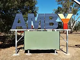 Sign located at the entrance to Amby | |||||||||||||||
 Amby | |||||||||||||||
| Coordinates | 26.5477°S 148.1872°E | ||||||||||||||
| Population | 86 (2016 census locality)[1] | ||||||||||||||
| • Density | 0.4322/km2 (1.119/sq mi) | ||||||||||||||
| Postcode(s) | 4462 | ||||||||||||||
| Elevation | 340 m (1,115 ft) | ||||||||||||||
| Area | 199.0 km2 (76.8 sq mi) | ||||||||||||||
| Time zone | AEST (UTC+10:00) | ||||||||||||||
| Location | |||||||||||||||
| LGA(s) | Maranoa Region | ||||||||||||||
| State electorate(s) | Warrego | ||||||||||||||
| Federal Division(s) | Maranoa | ||||||||||||||
| |||||||||||||||
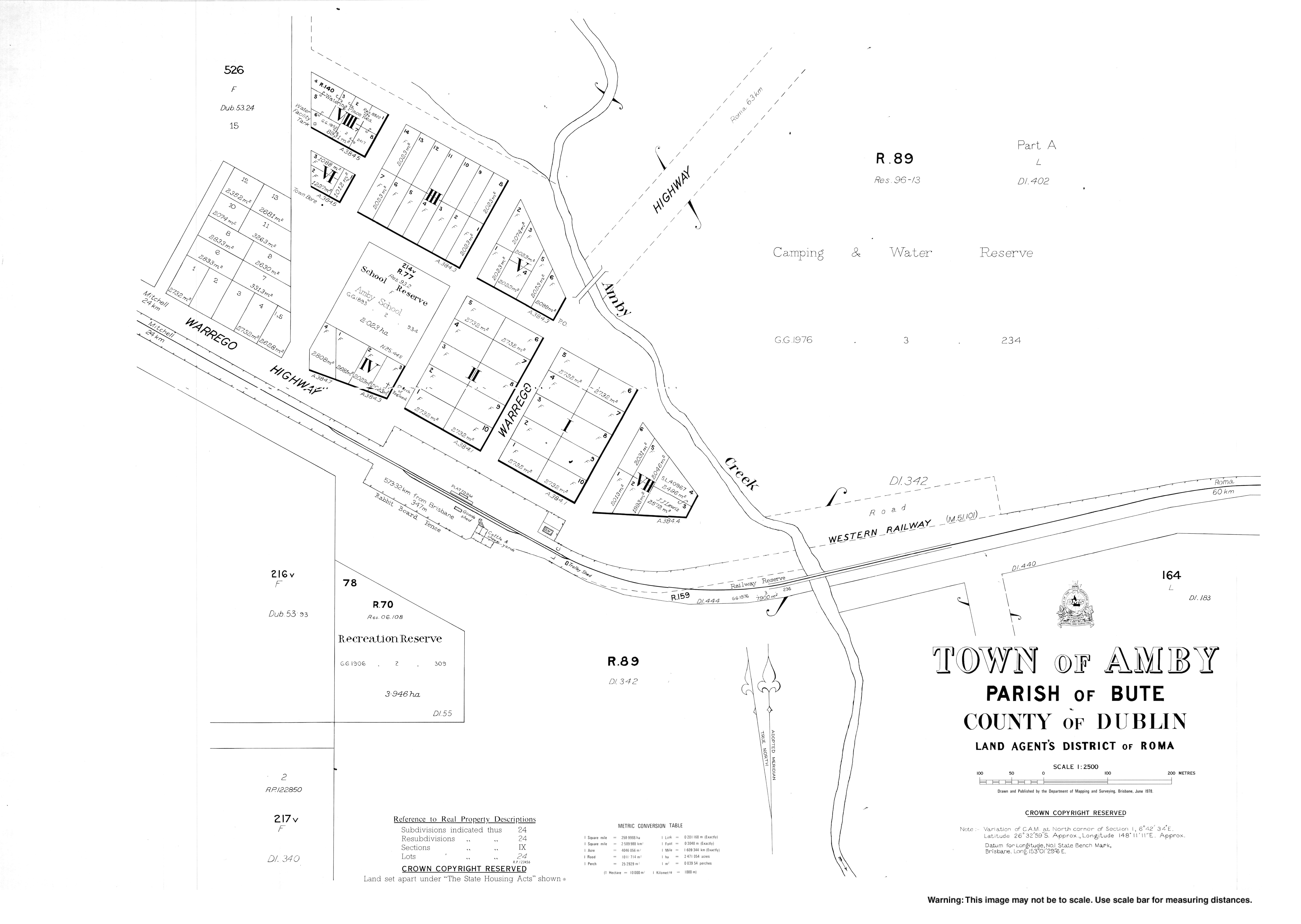
Geography
The town is roughly in the centre of the locality. Amby Creek flows through the location from north to south, passing immediately to the east of the town. Amby Creek is eventually a tributary of the Maranoa River.[4]
The Warrego Highway passes through the locality from east to west, passing through the main street of the town. The Western railway line also passes through the locality from east to west, with two railway stations in the locality:
- Amby railway station serving the town (26.5497°S 148.1866°E)[5]
- Bongo railway station to the north-west of the town (26.5345°S 148.1472°E)[5]
History
Amby takes its name from the Amby Creek; Amby is possibly a word meaning "little girl" in Kogai dialect of Mandandanji language.[6]
The Amby Downs pastoral station is believed to have been established before 1860.[7]
A postal receiving office opened at Amby around 1883, and became a post office around 1900; it continues to operate out of the Amby Store.[8][9]
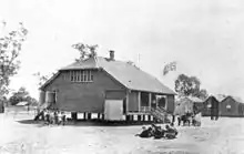
Amby Provisional School opened on 26 February 1894 and became Amby State School in 1901. It closed on 19 September 1997.[10][11]
Freeman's Waterhole Provisional School opened on 8 March 1920. In 1923 it was renamed Hampstead Provisional School. It closed on 30 May 1930.[11]
In the 2011 census, Amby had a population of 139 people.[12]
In the 2016 census the locality of Amby had a population of 86 people.[1]
Economy
There are a number of homesteads in the locality:[13]
- Amby Downs in the north-east of the locality (26.5148°S 148.2302°E)[7]
- Huntington (26.5670°S 148.1820°E)
- Richland Hill (26.5090°S 148.1314°E)
- Spring Hill (26.5532°S 148.1621°E)
- Turtle Grove (26.5125°S 148.1712°E)
Notable residents
- Robert Dunsmure, Member of the Queensland Legislative Assembly for Maranoa
References
- Australian Bureau of Statistics (27 June 2017). "Amby (SSC)". 2016 Census QuickStats. Retrieved 20 October 2018.

- "Amby – town in Maranoa Region (entry 521)". Queensland Place Names. Queensland Government. Retrieved 27 December 2020.
- "Amby – locality in Maranoa Region (entry 47406)". Queensland Place Names. Queensland Government. Retrieved 27 December 2020.
- "Queensland Globe". State of Queensland. Retrieved 29 January 2021.
- "Railway stations and sidings - Queensland". Queensland Open Data. Queensland Government. 2 October 2020. Archived from the original on 5 October 2020. Retrieved 5 October 2020.
- "Amby – town (entry 521)". Queensland Place Names. Queensland Government. Retrieved 4 September 2016.
- "Amby Downs – homestead (entry 526)". Queensland Place Names. Queensland Government. Retrieved 4 September 2016.
- "Amby". Post Office Reference. Premier Postal. Archived from the original on 20 December 2016. Retrieved 4 September 2016.
- "Amby CPA". Australia Post. Archived from the original on 16 September 2016. Retrieved 4 September 2016.
- "Opening and closing dates of Queensland Schools". Queensland Government. Retrieved 4 September 2016.
- Queensland Family History Society (2010), Queensland schools past and present (Version 1.01 ed.), Queensland Family History Society, ISBN 978-1-921171-26-0
- Australian Bureau of Statistics (31 October 2012). "Amby (SSC)". 2011 Census QuickStats. Retrieved 4 September 2016.
- "Homesteads - Queensland". Queensland Open Data. Queensland Government. 18 November 2020. Archived from the original on 24 November 2020. Retrieved 24 November 2020.
Further reading
- Sullivan, Jock; Amby Centenary Committee (1994), Amby State School Centenary 1894-1994 : and district, Amby Centenary Committee, retrieved 4 September 2016
External links
| Wikimedia Commons has media related to Amby, Queensland. |