Injune
Injune /ˈɪndʒuːn/ is a rural town and locality in the Maranoa Region, Queensland, Australia.[3][4] In the 2016 census, Injune had a population of 461 people.[5]
| Injune Queensland | |||||||||
|---|---|---|---|---|---|---|---|---|---|
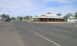 The information centre at Injune | |||||||||
 Injune | |||||||||
| Coordinates | 25°51′0″S 148°34′0″E | ||||||||
| Population | 461 (2016 census)[1] | ||||||||
| Postcode(s) | 4454 | ||||||||
| Elevation | 393 m (1,289 ft)[2] | ||||||||
| Location | |||||||||
| LGA(s) | Maranoa Region | ||||||||
| State electorate(s) | Warrego | ||||||||
| Federal Division(s) | Maranoa | ||||||||
| |||||||||
Geography
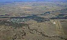
Injune is a small town in South West Queensland. It located on the Carnarvon Highway, 92 kilometres (57 mi) north of the regional centre of Roma. A railway connected Injune with Roma from 1920 until 1966.[6]
It was formerly a hub for cattle and dairy industries, but now serves as a staging point for expeditions to the nearby Carnarvon National Park. More recently, natural gas and timber have served as the major primary industries.
History
Injune Post Office opened on 11 August 1920.[7]
Injune State School opened on 24 October 1921.[8]
At the 2006 census, Injune had a population of 362.[1]
Facilities
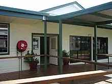
Injune has a public library at Hutton Street operated by the Maranoa Regional Council.[9] It also has an historical railway and steam train precinct, and the Injune art space.
Henricks Park
Residents of Injune district have a lively interest in the arts, strongly supported by Bungil Shire Council's Arts & Cultural Policy.[10]
Injune's local arts group, the Injune Public Space Art Group (IPSAG), is leading the development of Henricks Park opposite the Injune Information Centre.[11]
Education
Injune P-10 State School is a government primary and secondary (Prep-10) school for boys and girls at Cnr Hutton Street & Fourth Avenue (25.8467°S 148.5651°E).[12][13] In 2017, the school had an enrolment of 80 students with 12 teachers and 16 non-teaching staff (7 full-time equivalent).[14]
As Injune State School only provides education to Year 10, for Years 11 and 12 the nearest school is in Roma.[15]
Climate
Injune has a subtropical climate with warm to hot summers and cool winters with rainfall concentrated in the summer months. A record low temperature of −8.0 °C (17.6 °F) is one of the coldest temperatures recorded in Queensland outside of the Darling Downs and Granite Belt along with the record low in nearby Mitchell.[16]
| Climate data for Injune | |||||||||||||
|---|---|---|---|---|---|---|---|---|---|---|---|---|---|
| Month | Jan | Feb | Mar | Apr | May | Jun | Jul | Aug | Sep | Oct | Nov | Dec | Year |
| Record high °C (°F) | 43.8 (110.8) |
42.2 (108.0) |
40.1 (104.2) |
35.9 (96.6) |
33.3 (91.9) |
30.0 (86.0) |
34.2 (93.6) |
36.1 (97.0) |
39.3 (102.7) |
40.5 (104.9) |
42.4 (108.3) |
44.1 (111.4) |
44.1 (111.4) |
| Average high °C (°F) | 33.6 (92.5) |
32.1 (89.8) |
30.8 (87.4) |
27.7 (81.9) |
23.4 (74.1) |
20.3 (68.5) |
20.0 (68.0) |
22.3 (72.1) |
26.1 (79.0) |
29.4 (84.9) |
31.4 (88.5) |
33.1 (91.6) |
27.5 (81.5) |
| Average low °C (°F) | 19.6 (67.3) |
19.1 (66.4) |
16.4 (61.5) |
11.9 (53.4) |
7.7 (45.9) |
4.5 (40.1) |
3.1 (37.6) |
4.4 (39.9) |
8.1 (46.6) |
12.7 (54.9) |
15.9 (60.6) |
18.1 (64.6) |
11.8 (53.2) |
| Record low °C (°F) | 10.6 (51.1) |
9.4 (48.9) |
3.6 (38.5) |
−0.8 (30.6) |
−4.4 (24.1) |
−6.7 (19.9) |
−8.0 (17.6) |
−6.2 (20.8) |
−3.3 (26.1) |
−0.4 (31.3) |
3.1 (37.6) |
6.6 (43.9) |
−8.0 (17.6) |
| Average rainfall mm (inches) | 88.9 (3.50) |
88.8 (3.50) |
62.2 (2.45) |
41.8 (1.65) |
33.3 (1.31) |
30.3 (1.19) |
29.3 (1.15) |
25.2 (0.99) |
26.0 (1.02) |
47.2 (1.86) |
72.4 (2.85) |
89.1 (3.51) |
634.5 (24.98) |
| Average rainy days (≥ 0.2mm) | 7.7 | 7.0 | 5.3 | 3.9 | 3.9 | 3.9 | 3.6 | 3.3 | 3.7 | 5.9 | 7.0 | 8.2 | 63.4 |
| Source: Bureau of Meteorology[17] | |||||||||||||
References
- Australian Bureau of Statistics (25 October 2007). "Injune (L) (Urban Centre/Locality)". 2006 Census QuickStats. Retrieved 4 May 2008.
- Bureau of Meteorology Archived 26 July 2008 at the Wayback Machine Retrieved on 2008-05-04
- "Injune – town in Maranoa Region (entry 16701)". Queensland Place Names. Queensland Government. Retrieved 16 November 2019.
- "Injune – locality in Maranoa Region (entry 47430)". Queensland Place Names. Queensland Government. Retrieved 16 November 2019.
- Australian Bureau of Statistics (27 June 2017). "Injune (SSC)". 2016 Census QuickStats. Retrieved 20 October 2018.

- Australian Railway Historical Society Bulletin, December 1973, pp266-286
- Premier Postal History. "Post Office List". Premier Postal Auctions. Archived from the original on 15 May 2014. Retrieved 10 May 2014.
- Queensland Family History Society (2010), Queensland schools past and present (Version 1.01 ed.), Queensland Family History Society, ISBN 978-1-921171-26-0
- "Injune Library". plconnect.slq.qld.gov.au. State Library of Queensland. Archived from the original on 14 January 2020. Retrieved 22 January 2018.
- Cultural policy Archived 14 July 2004 at the Wayback Machine
- "Henricks Park". Outback Queensland. 17 November 2019. Archived from the original on 18 November 2019. Retrieved 18 November 2019.
- "State and non-state school details". Queensland Government. 9 July 2018. Archived from the original on 21 November 2018. Retrieved 21 November 2018.
- "Injune P-10 State School". Archived from the original on 18 March 2020. Retrieved 21 November 2018.
- "ACARA School Profile 2017". Archived from the original on 22 November 2018. Retrieved 22 November 2018.
- "Queensland Globe". State of Queensland. Retrieved 18 November 2019.
- "Official records for Queensland in July". Daily Extremes. Bureau of Meteorology. 31 July 2013. Archived from the original on 5 September 2020. Retrieved 22 April 2014.
- "Injune Post Office". Climate statistics for Australian locations. Bureau of Meteorology. April 2014. Retrieved 22 April 2014.