Amurian Plate
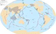
The Amurian Plate (or Amur Plate; also occasionally referred to as the China Plate) is a minor tectonic plate in the northern and eastern hemispheres. It covers Manchuria, the Korean Peninsula, the Sea of Japan, and Primorsky Krai. Once thought to be a part of the Eurasian Plate, the Amurian Plate is now generally considered to be a separate plate moving southeast with respect to the Eurasian Plate.[1] The Amurian Plate is named after the Amur River, that forms the border between the Russian Far East and Northeastern China. It is bounded on the north, west, and southwest by the Eurasian Plate, on the east by the Okhotsk Plate, to the southeast by the Philippine Sea Plate along the Suruga Trough and the Nankai Trough, and the Okinawa Plate, and the Yangtze Plate.[2]
| Amurian Plate | |
|---|---|
 | |
| Type | Minor |
| Movement1 | South |
| Speed1 | 10 mm/year |
| Features | Amur, Korea, Manchuria, Lake Baikal, Sea of Japan, southern Honshu, Shikoku, Kyushu |
| 1Relative to the African Plate | |
The Baikal Rift Zone is considered a boundary between the Amurian Plate and the Eurasian Plate. GPS measurements indicate that the plate is slowly rotating counterclockwise.
The Amurian Plate may have been involved in the 1976 Tangshan earthquake in China.
See also
References
- "Amurian Plate". Eurasiatectonics.weebly.com. Retrieved 2016-01-21.
- Yu. F. Malyshev, et. al. Deep structure of the Amur lithospheric Plate border zone.
Further reading
- Dongping Wei and Tetsuzo Seno. 1998. Determination of the Amurian Plate Motion. Mantle Dynamics and Plate Interactions in East Asia, Geodynamics Series. v.27, edited by M. F. J. Flower et al., 419p, AGU, Washington D.C. (abstract)