Antoigné
Antoigné is a commune in the Maine-et-Loire department in western France.
Antoigné | |
|---|---|
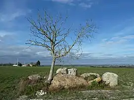 The Dolmen du Griffier in Antoigné | |
Location of Antoigné 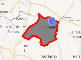
| |
 Antoigné  Antoigné | |
| Coordinates: 47°05′06″N 0°06′41″W | |
| Country | France |
| Region | Pays de la Loire |
| Department | Maine-et-Loire |
| Arrondissement | Saumur |
| Canton | Doué-en-Anjou |
| Intercommunality | CA Saumur Val de Loire |
| Government | |
| • Mayor (2008–2014) | Éric Mousserion |
| Area 1 | 17.87 km2 (6.90 sq mi) |
| Population (2017-01-01)[1] | 465 |
| • Density | 26/km2 (67/sq mi) |
| Time zone | UTC+01:00 (CET) |
| • Summer (DST) | UTC+02:00 (CEST) |
| INSEE/Postal code | 49009 /49260 |
| Elevation | 36–74 m (118–243 ft) (avg. 41 m or 135 ft) |
| 1 French Land Register data, which excludes lakes, ponds, glaciers > 1 km2 (0.386 sq mi or 247 acres) and river estuaries. | |
Population
|
|
References
- "Populations légales 2017". INSEE. Retrieved 6 January 2020.
| Wikimedia Commons has media related to Antoigné. |
| Authority control |
|
|---|
This article is issued from Wikipedia. The text is licensed under Creative Commons - Attribution - Sharealike. Additional terms may apply for the media files.